
Images


March 23, 2015 - Fires in Indochina
 Tweet
Tweet
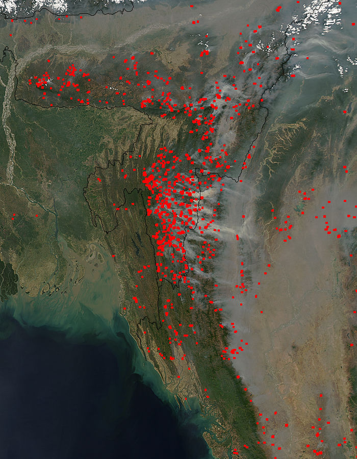
Fires stretched from the foothills of the Himalaya Mountains nearly to the Bay of Bengal in mid-March, 2015. The Moderate Resolution Imaging Spectroradiometer (MODIS) aboard NASA’s Aqua satellite captured this true-color image on March 13.
Red hotpots mark actively burning fires in (from west to east) Bangladesh, India and Burma (Myanmar), with most of them located in India. Thick smoke rises from the fires and blows to the east. Smoke also contributes to the haze south of the Himalayas.
The time of year, location, widespread nature, and number of fires suggest that these fires were deliberately set for agricultural purposes. Farmers often use fire to return nutrients to the soil and to clear the ground of unwanted plants. While fire helps enhance crops and grasses for pasture, the fires also produce smoke that degrades air quality and has a direct, negative impact on the respiratory health of human and animals.
Image Facts
Satellite:
Aqua
Date Acquired: 3/13/2015
Resolutions:
1km (173.2 KB), 500m (580.1 KB), 250m (1.4 MB)
Bands Used: 1,4,3
Image Credit:
Jeff Schmaltz, MODIS Land Rapid Response Team, NASA GSFC
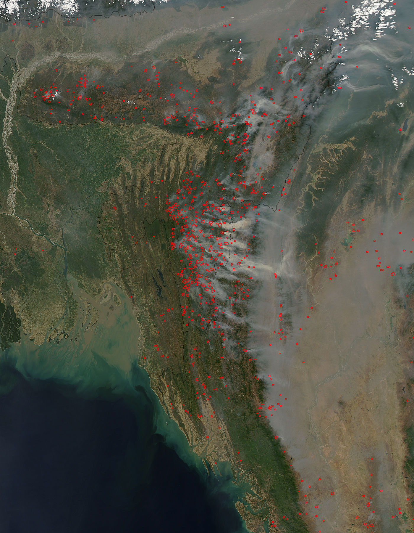
