
Images


April 1, 2015 - Snow over northeastern United States and Canada
 Tweet
Tweet
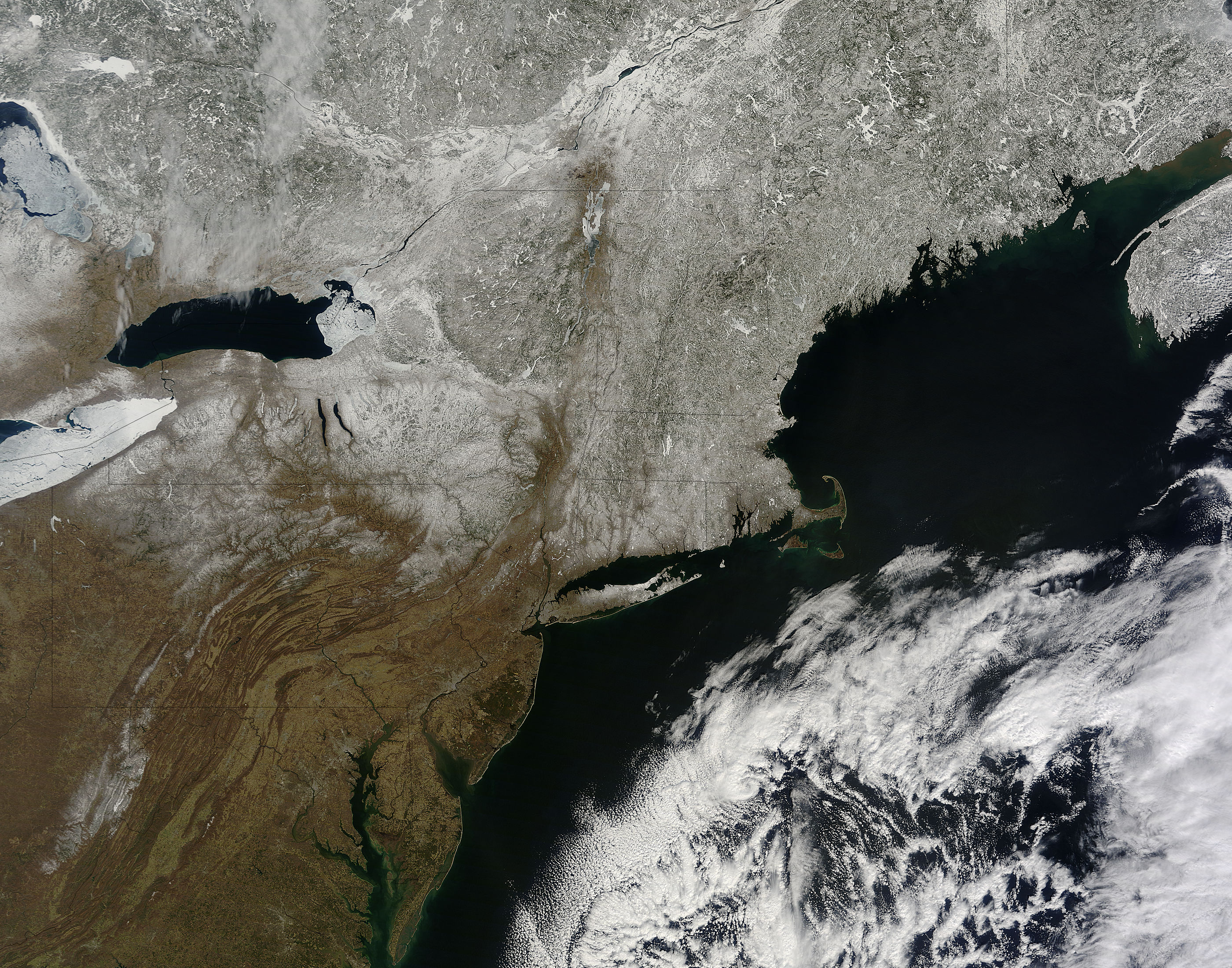
The northeastern United States and Canada remained under a wintery blanket over a week after spring’s official arrival on March 20, 2015. The Moderate Resolution Imaging Spectroradiometer (MODIS) aboard NASA’s Terra satellite captured this true-color image on March 29.
Snow stretches from Ontario and Quebec, Canada and Maine, USA southward to northern Pennsylvania, northern Delaware and New Jersey. The higher elevations in the Appalachian Mountains in Pennsylvania, Maryland and West Virginia are also dusted in white. Both Lake Huron (northwest) and Lake Eire (southwest) remain heavily ice covered, while Lake Ontario’s ice mostly ice free.
Image Facts
Satellite:
Terra
Date Acquired: 3/29/2015
Resolutions:
1km (561 KB), 500m (2 MB), 250m (5 MB)
Bands Used: 1,4,3
Image Credit:
Jeff Schmaltz, MODIS Land Rapid Response Team, NASA GSFC
