
Images


April 11, 2015 - Fires in Indochina
 Tweet
Tweet
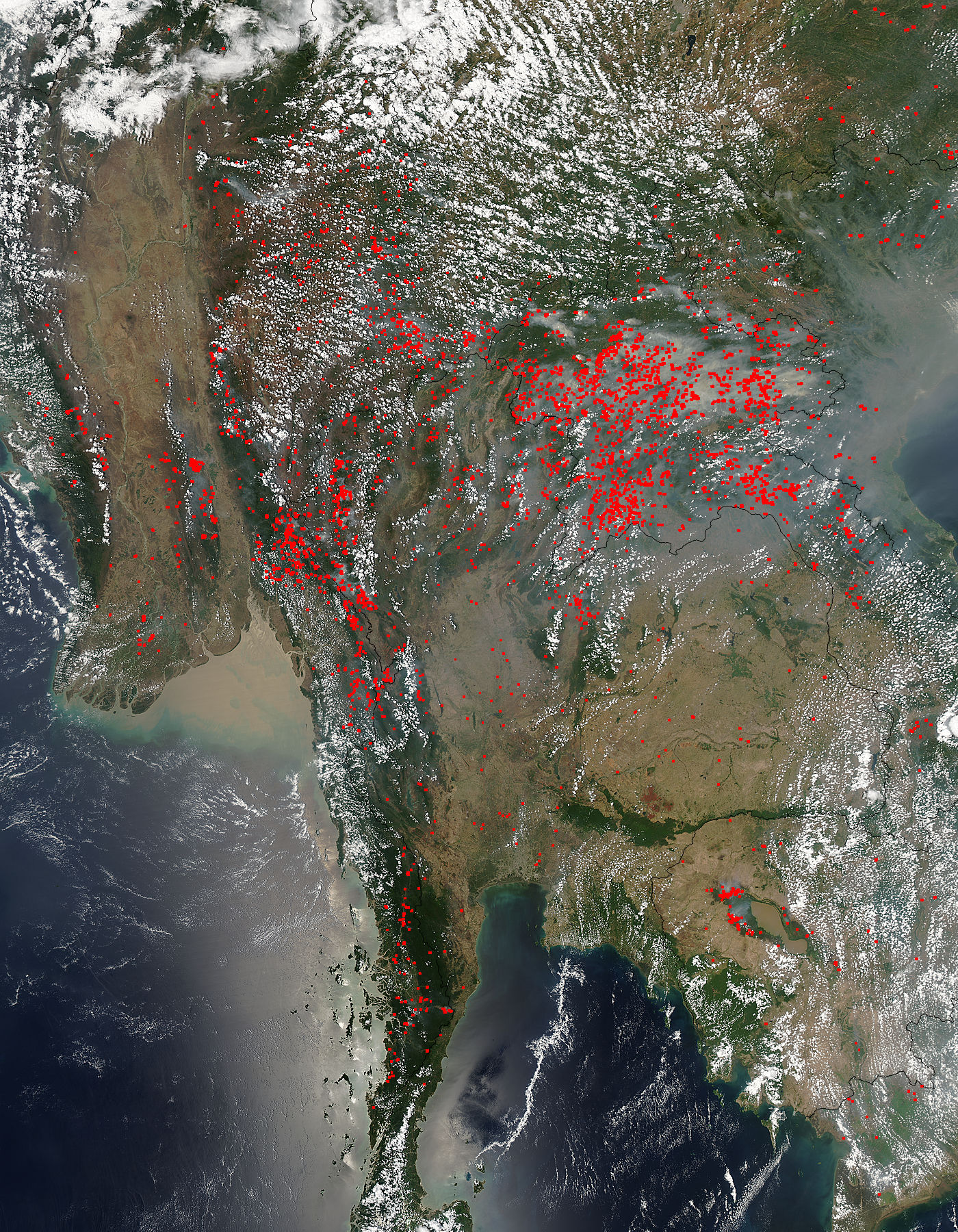
Hundreds of fires burned across Indochina in early April, 2015. The Moderate Resolution Imaging Spectroradiometer (MODIS) aboard NASA’s Aqua satellite captured this true-color image on April 4.
Red hotspots speckle the landscape, clustering most heavily in Laos, which appears just east of center in this image. Fires are also especially prominent in Myanmar (Burma) and the western section of Thailand. Smoke from the fires curls over the region, especially over Laos and Thailand.
The time of year, location, widespread nature, and number of fires suggest that they were deliberately set to manage land. Farmers often use fire to return nutrients to the soil and to clear the ground of unwanted plants. While fire helps enhance crops and grasses for pasture, the fires also produce smoke that degrades air quality.
Image Facts
Satellite:
Aqua
Date Acquired: 4/4/2015
Resolutions:
1km (1.1 MB), 500m (3.8 MB), 250m (9 MB)
Bands Used: 1,4,3
Image Credit:
Jeff Schmaltz, MODIS Land Rapid Response Team, NASA GSFC
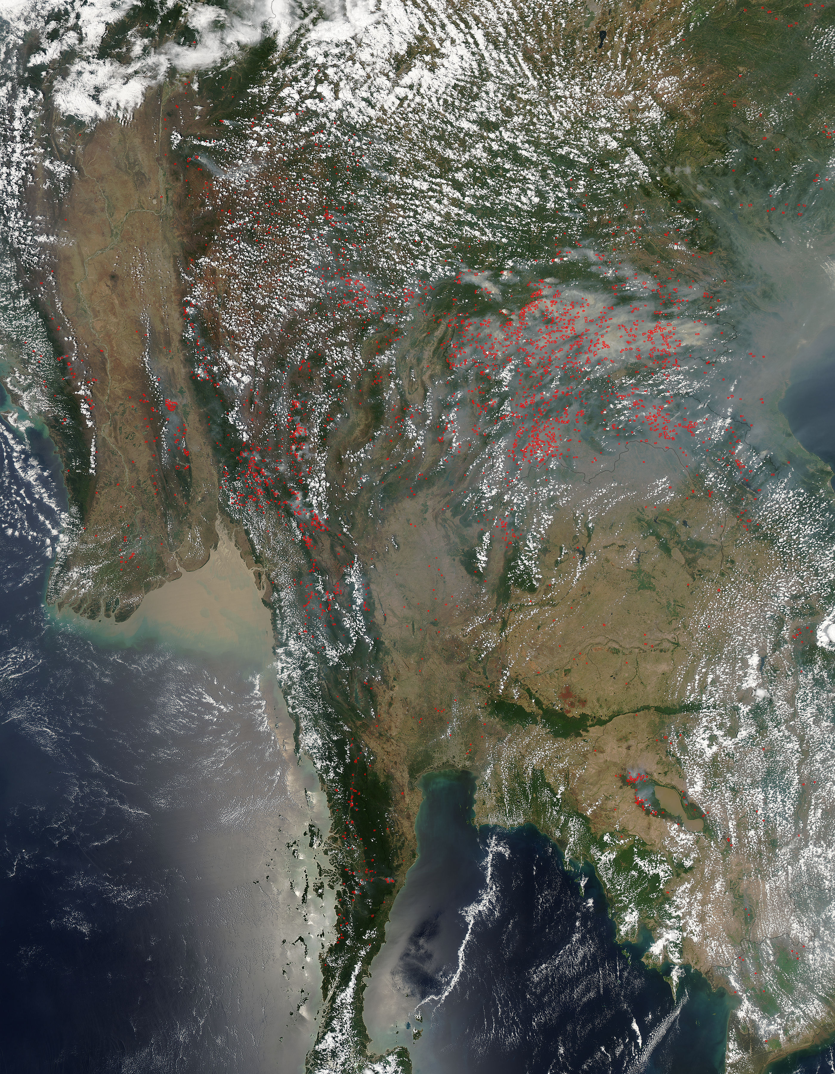
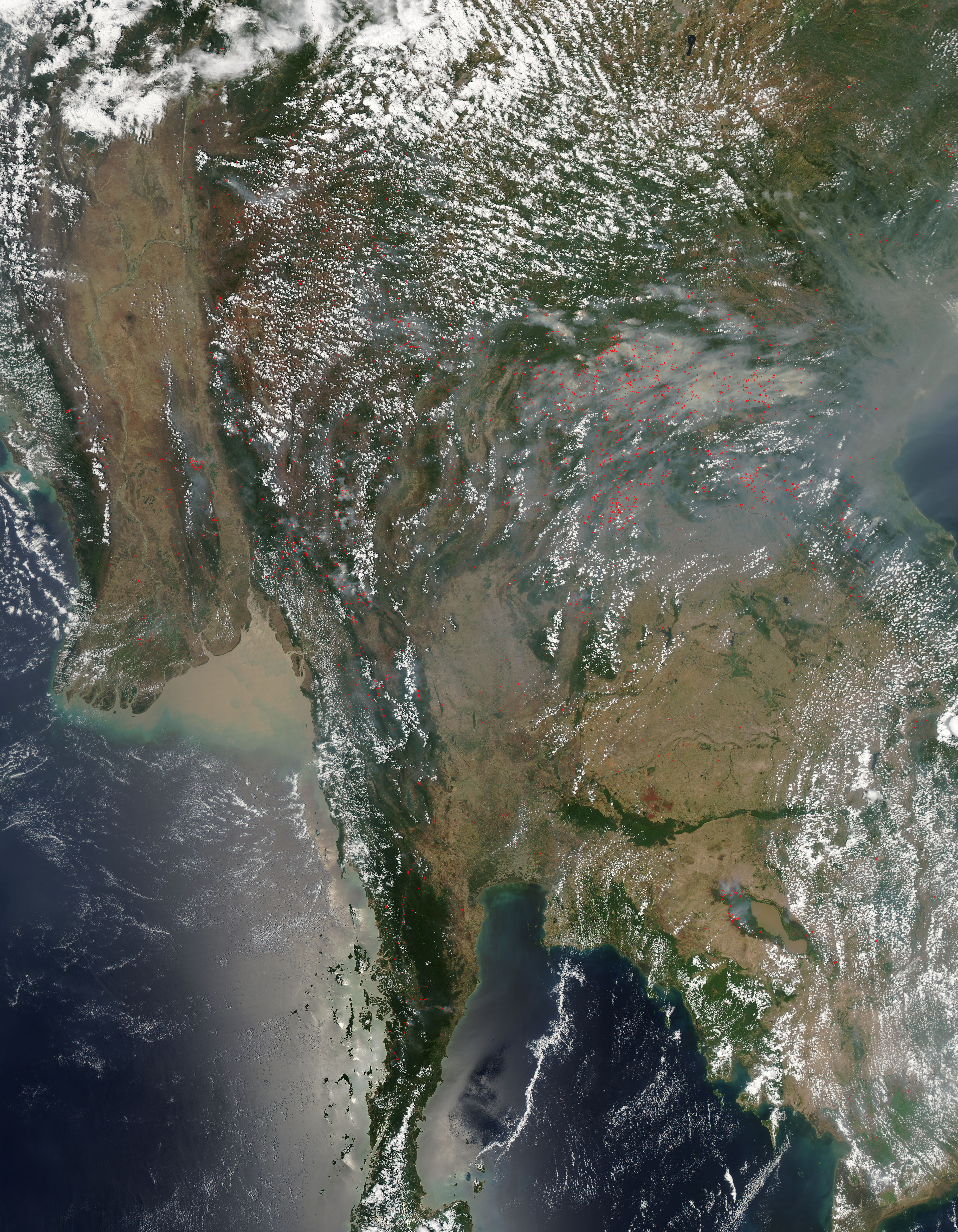
