
Images


May 3, 2015 - Iceland
 Tweet
Tweet
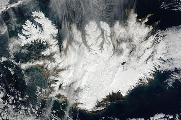
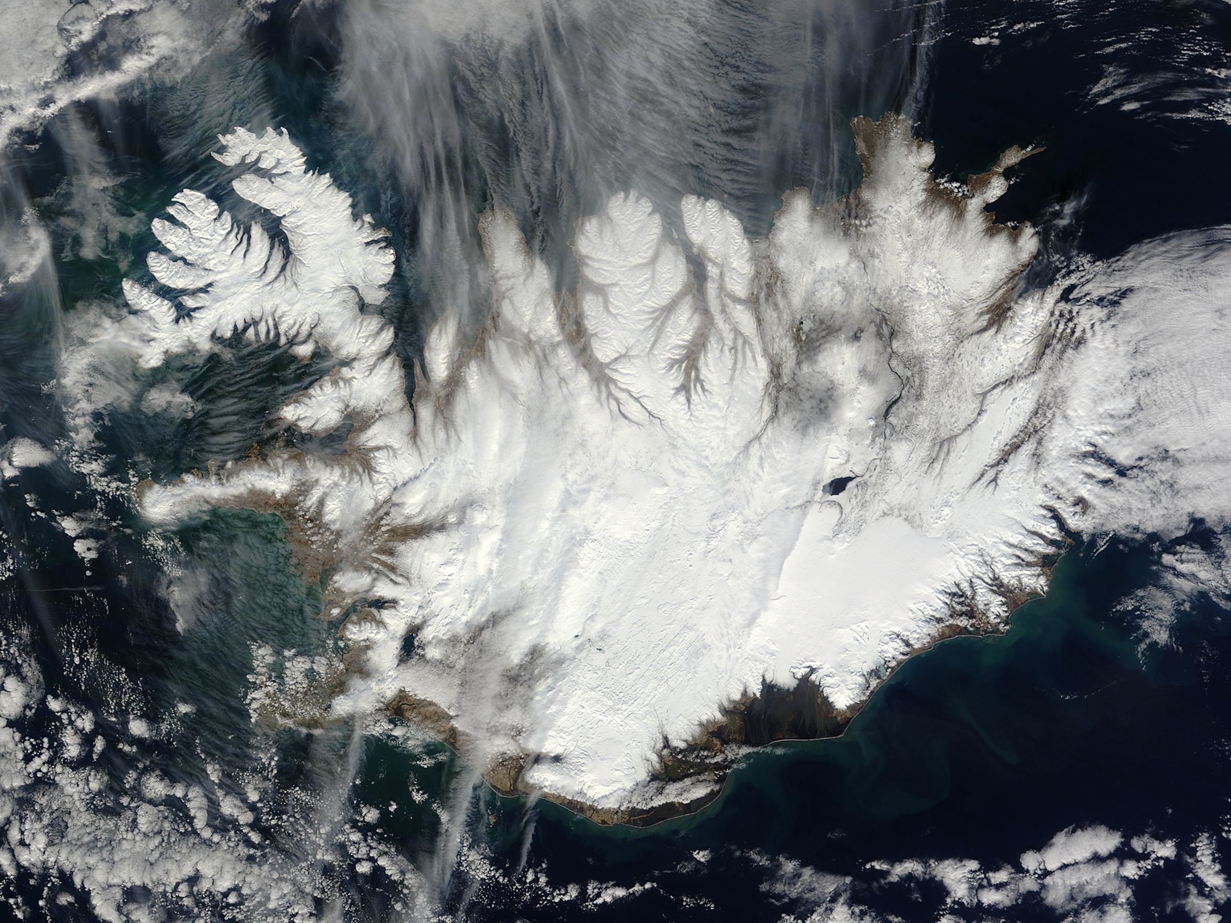
On April 15, 2015 NASA’s Terra satellite flew over Iceland, allowing the Moderate Resolution Imaging Spectroradiometer (MODIS) aboard to capture this true-color image of the ice-covered land as it begins to awake from winter hibernation.
Iceland sits just south of the Arctic Circle and becomes quite cold in winter, although the island’s position in the path of the warm North Atlantic Current moderates the cold to some extent. The northern part of the island has winter temperatures of around −25 to −30 °C (−13 to −22 °F), while the south hovers more around 0 °C (32 °F).
By April, daylight is beginning the lengthen and temperatures being to creep up, bringing typical daytime highs between 1°C to 6°C (33.8-42.8 degrees F). While not yet truly warm, the snow begins to melt, especially in the southern and coastal regions and roads begin to reopen for travel, although many roads remain closed until late may – and a few roads into the central highlands may remain closed until July.
Because warmer waters flow of the North Atlantic Current flow underneath colder Arctic air off of Iceland, the region frequently is hidden under clouds and fog. This mixing also can bring abruptly shifting weather. The changeable conditions can bring sunshine, wind and rain, all within a few hours, especially in the changeable month of April.
Image Facts
Satellite:
Terra
Date Acquired: 4/15/2015
Resolutions:
1km (85.3 KB), 500m (294.3 KB), 250m (680 KB)
Bands Used: 1,4,3
Image Credit:
Jeff Schmaltz, MODIS Land Rapid Response Team, NASA GSFC
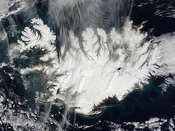
