
Images


May 17, 2015 - Korea
 Tweet
Tweet
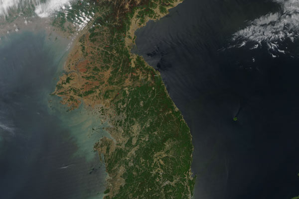
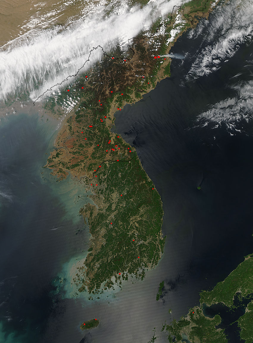
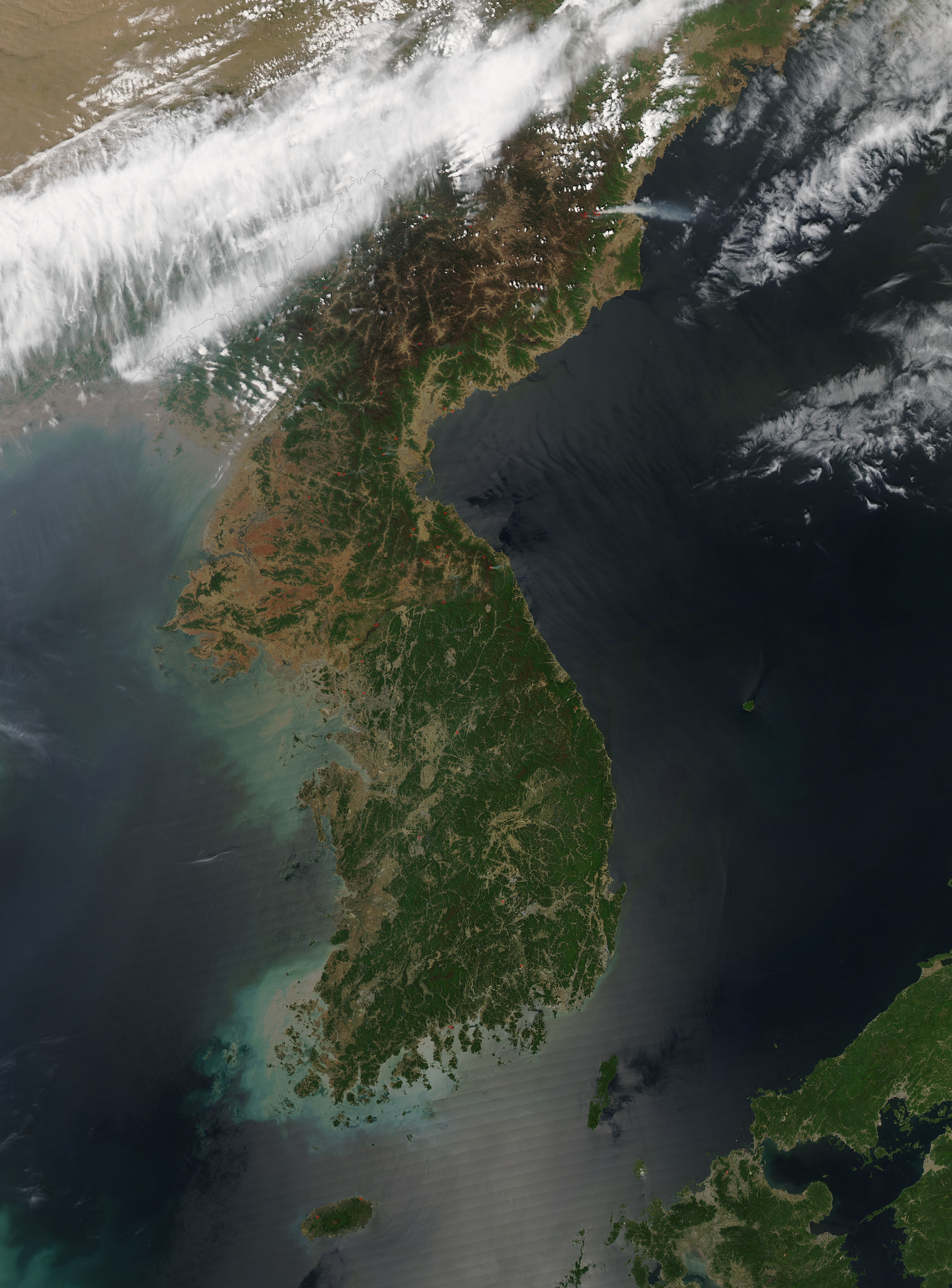
On May 5, 2015 NASA’s Aqua satellite flew over the Korean Peninsula, allowing the Moderate Resolution Imaging Spectroradiometer flying aboard to capture this true-color image.
Fields and grasslands, found mainly in coastal plains, appear light brown. Forests appear green, although at the highest elevations some forests have a brown tint as they are just beginning to green up at in mid-spring. A large bank of white clouds lies over the border between North Korea and China. Red hotspots, detected by the thermal bands of MODIS, mark actively burning fires. Gray smoke billows from many of the fires, particularly in eastern North Korea. Most of the hotspots cluster in North Korea, with only a few located in South Korea.
Satellites often detect fires in North Korea in April and early May. As snow retreats in the spring, many farmers use fire to clear away last year’s crop debris and to fertilize the soil for the coming season. Such fires generally remain small and produce only modest amounts of smoke. But at times the fires can get out of control, and become wild fires. Several fires in eastern North Korea appear to be very large, with large amounts of smoke extending over the Sea of Japan.
North Korea faced a serious drought in the summer of 2014. While reasonably warm and wet weather was a late-season boon to crops in November, a dry winter followed. Dried out forests have raised concerns about potential food shortages in the spring.
Image Facts
Satellite:
Aqua
Date Acquired: 5/5/2015
Resolutions:
1km (222.8 KB), 500m (784 KB), 250m (1.9 MB)
Bands Used: 1,4,3
Image Credit:
Jeff Schmaltz, MODIS Land Rapid Response Team, NASA GSFC
