
Images


May 20, 2015 - Typhoon Dolphin (07W) in the Pacific Ocean
 Tweet
Tweet
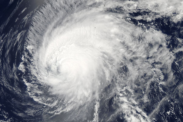
NASA's Aqua satellite passed over a weakening Typhoon Dolphin on May 18 as it moved closer to Iwo To island, Japan, in the Northwestern Pacific Ocean.
The Moderate Resolution Imaging Spectroradiometer (MODIS) aboard NASA's Aqua satellite passed over Typhoon Dolphin on May 18 at 04:00 UTC (12 a.m. EDT) and captured this true-color image. At the time this image was acquired, southwesterly vertical wind shear was affecting the storm and pushing clouds and showers to the northeast of the center of circulation.
Dolphin was becoming embedded in the westerlies which were stretching the storm out. Westerlies are prevailing winds that blow from west to east (between 30 and 60 degrees latitude) in the middle latitudes. At 1500 UTC (11 a.m. EDT), Typhoon Dolphin's maximum sustained winds were near 104 mph (167 km/h) and the storm was centered at 22.8 North latitude and 138.8 East longitude, or about 233 miles (376 km) southwest of Iwo To, Japan. Dolphin was moving to the north-northeast at about 9.2 mph (14.8 km/h).
Dolphin began as Tropical Depression 07W which formed southeast of Pohnopei, one of the Federated States of Micronesia on May 8, following the passage of Typhoon Noul. It passed over Micronesia, then passed through the Rota Channel on May 15. The center of the storm passed only 25 miles from the northern tip of Guam, close enough for the southern half of the eye wall to rake the northern part of the island with winds gusts up to 109 mph (175 km/h). According to the Global Disaster Alert and Coordination System (GDACS), up to 160,000 people may have been affected by winds greater than 120 mph. According to KUAM News, up to 300 people may have been left homeless in Guam due to the storm.
By May 19, Typhoon Dolphin had weakened and begun to dissipate. The Joint Typhoon Warning Center issued it final advisory on the storm at 15:00 UTC (11:00 a.m. EDT) that same day as the remnants of Dolphin faded in the seas north-northwest of Iwo To.
Image Facts
Satellite:
Aqua
Date Acquired: 5/18/2015
Resolutions:
1km (960.8 KB), 500m (3.1 MB), 250m (7.3 MB)
Bands Used: 1,4,3
Image Credit:
Jeff Schmaltz, MODIS Land Rapid Response Team, NASA GSFC
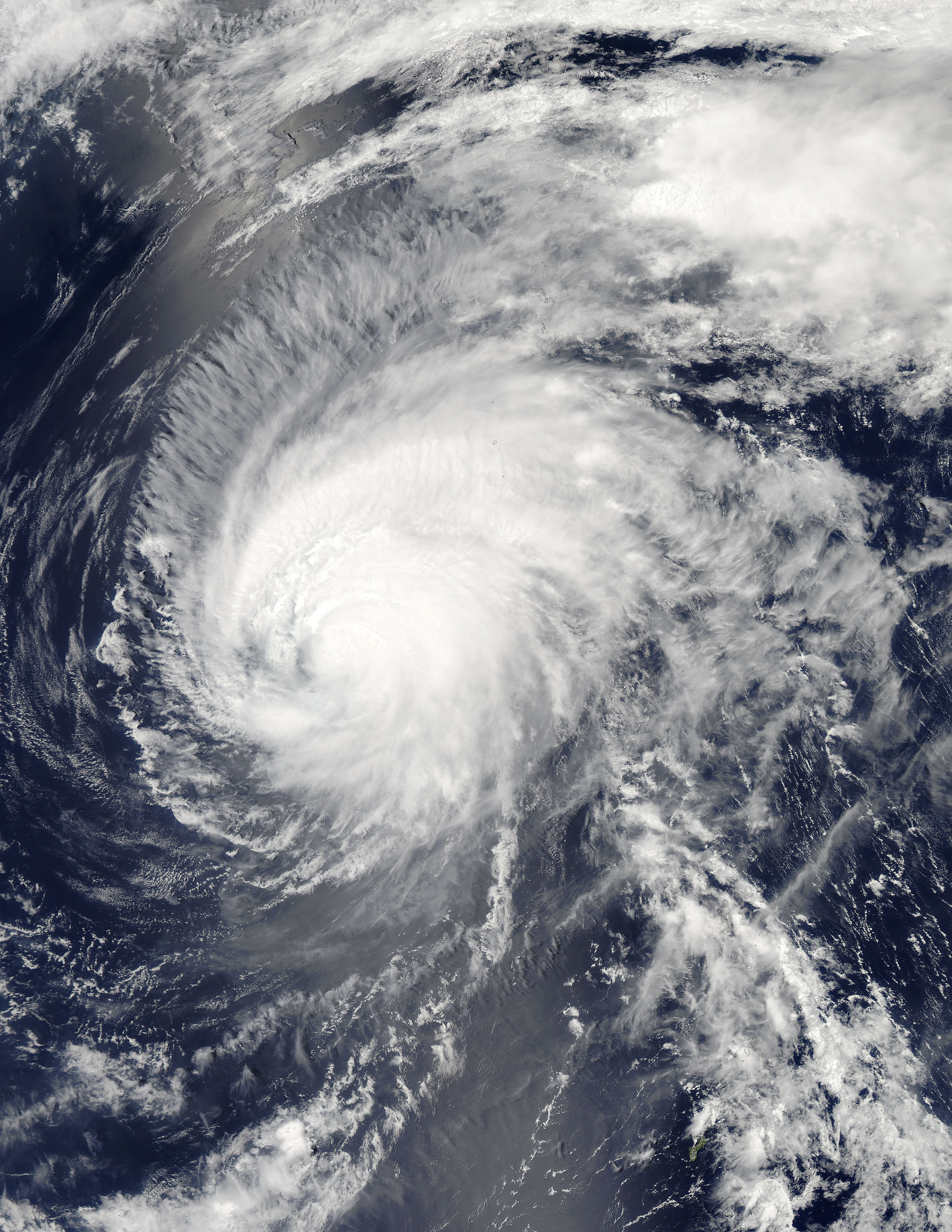
