
Images


June 20, 2015 - Tropical Storm Bill (02L) approaching Texas and Louisiana
 Tweet
Tweet
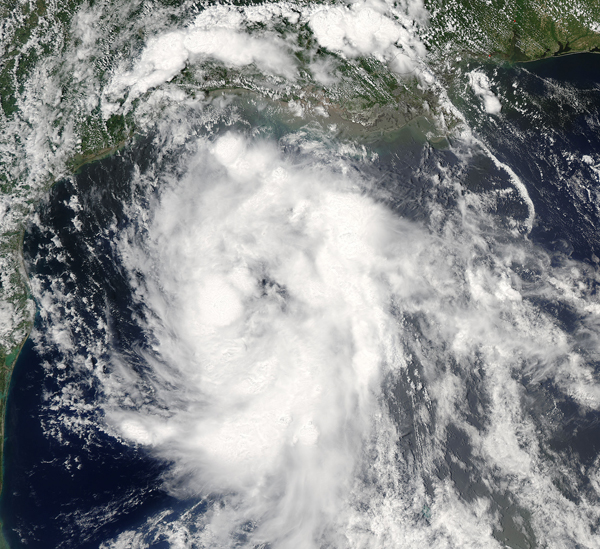
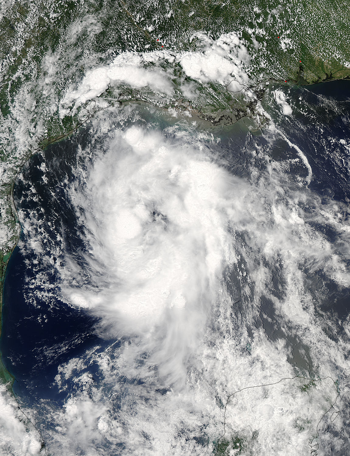
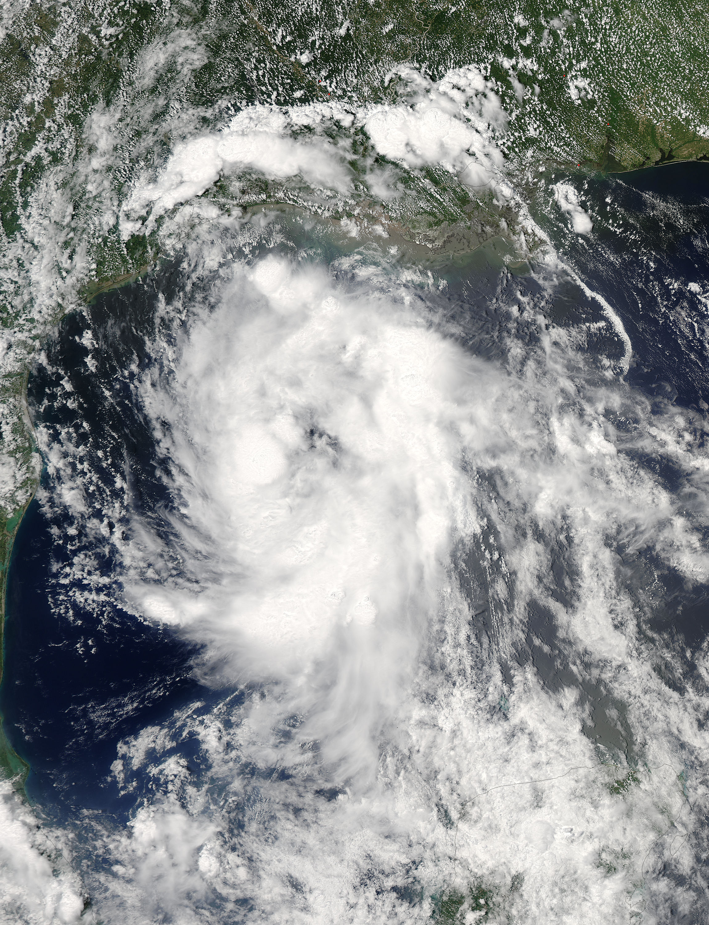
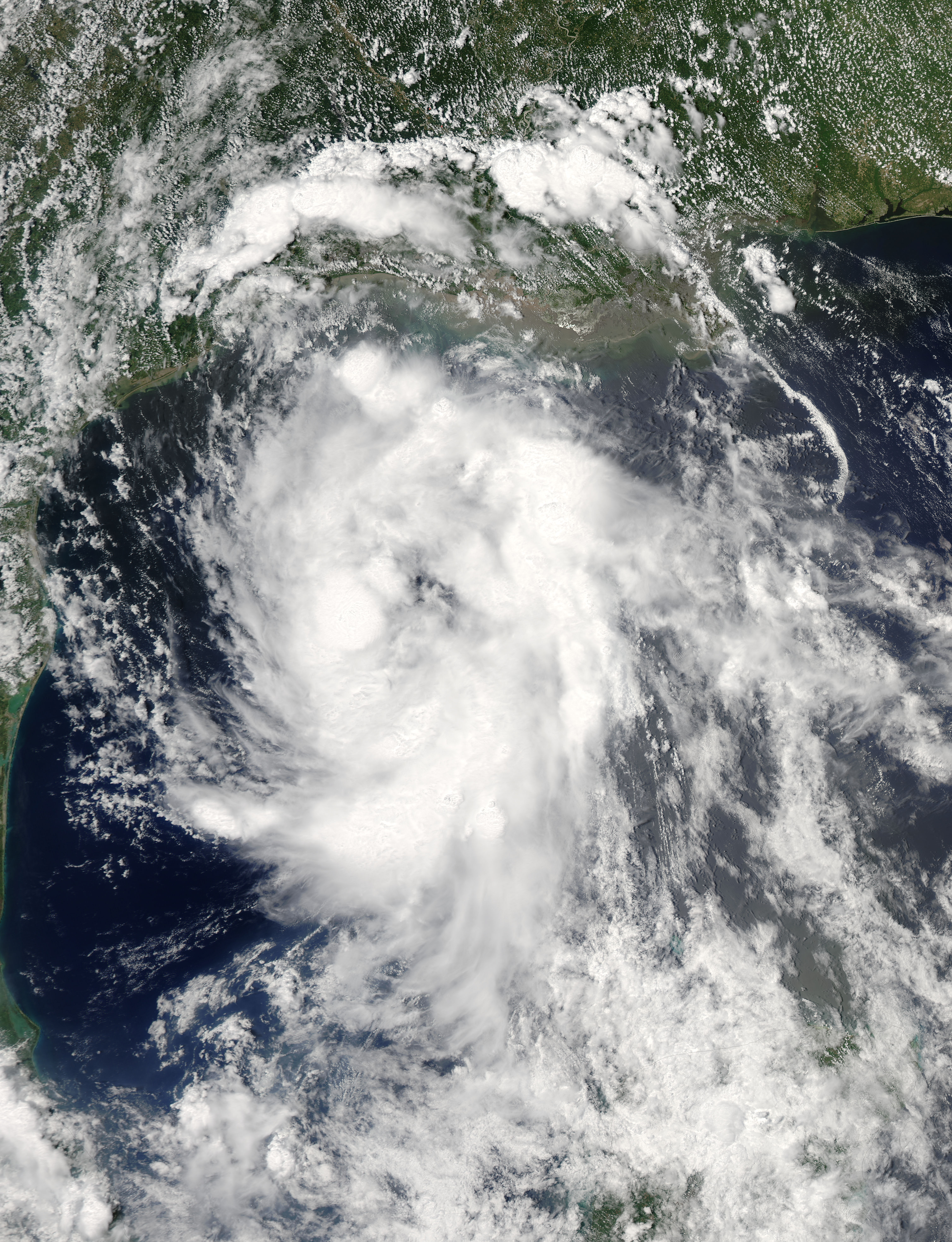
On June 15, 2015 the second name tropical storm of the 2015 Atlantic hurricane season was taking aim on Texas. The Moderate Resolution Imaging Spectroradiometer (MODIS) aboard the Aqua satellite captured this true-color image of Tropical Storm Bill at 9:15 UTC (3:15 p.m. EDT)as it moved over the Gulf of Mexico. Powerful, soaking thunderstorms circled the center in fragmented bands.
The National Hurricane Center (NHC) issued the first advisory on Tropical Storm Bill at 5:00 UTC (1:00 a.m. EDT) on June 15. At that time, the maximum sustained winds were listed at 50 mph (85 km/h) and Bill was centered at 27.1 North and 94.2 West, or about 155 mi (250 km) east south-east of Galveston, Texas. It was moving towards the northwest at 12 mph (19 km/h).
Tropical Storm Bill made landfall at 4:00 UTC (12:00 noon EDT) Matagorda Island, Texas on June 16, bringing drenching rain to an already-soaked region. The storm’s winds were never very strong, but the flooding took at least one life in Texas, and two additional lives in Oklahoma.
Bill initially soaked Texas and Louisiana, then moved northward through Oklahoma as the storm weakened to mere wet remnants on June 17. By June 19, the remnants continued to pour rain across Missouri, Illinois and Indiana as the path turned towards the east, taking aim at a swath of the east coast, including Maryland and the District of Columbia, on the weekend of June 20.
Tropical Storm Bill was an unusual storm, because of the possibility that it might strengthen after landfall. Normally tropical storms decay rapidly after reaching land because they get cut off from evaporating ocean water, their main energy source. However, when soils are wet enough prior to the storm moving across it, the storms can maintain strength or possibly even strengthen, driven by the moisture in the soil.
Image Facts
Satellite:
Aqua
Date Acquired: 6/15/2015
Resolutions:
1km (612.8 KB), 500m (2 MB), 250m (4.7 MB)
Bands Used: 1,4,3
Image Credit:
Jeff Schmaltz, MODIS Land Rapid Response Team, NASA GSFC
