
Images


June 29, 2015 - Central Brazil
 Tweet
Tweet
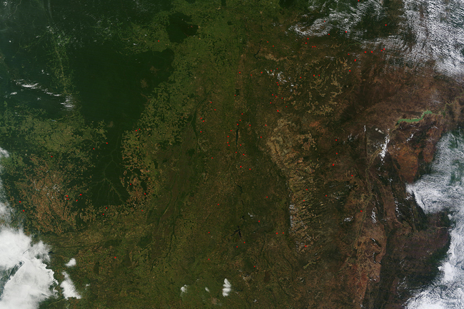
Fires speckled the landscape of central Brazil early in the dry season of 2015. The Moderate Resolution Imaging Spectroradiometer (MODIS) aboard NASA’s Terra satellite captured this true-color image on June 16. The dry season in central Brazil begins in May and ends in September.
Fires are most prominently located in the cerrado region, although some also can be found along the edges of the dark green forest. Given the location and time of year, the fires appear to be primarily agricultural in origin. Such fires are deliberately set to manage land for crops or improve pasturage, but can also cause air pollution and can slip out of control to cause significant damage. Fire is often used as a primary tool of deforestation in this region as forest and raw land is destroyed to be turned into cropland.
Brazil’s rainforest is a sensitive ecosystem, and there is pressure to try to preserve the last remaining stands. The cerrado is a tropical savanna that makes up most of the Great Plateau of central Brazil. It is a drier region that the forest, and the vegetation ranges from grasslands to scrubby woodland. Traditionally it has been a rather inhospitable place for agriculture, but as Brazilian agriculture expands into a strong export market, the demand for more land has put increasing pressure on the cerrado.
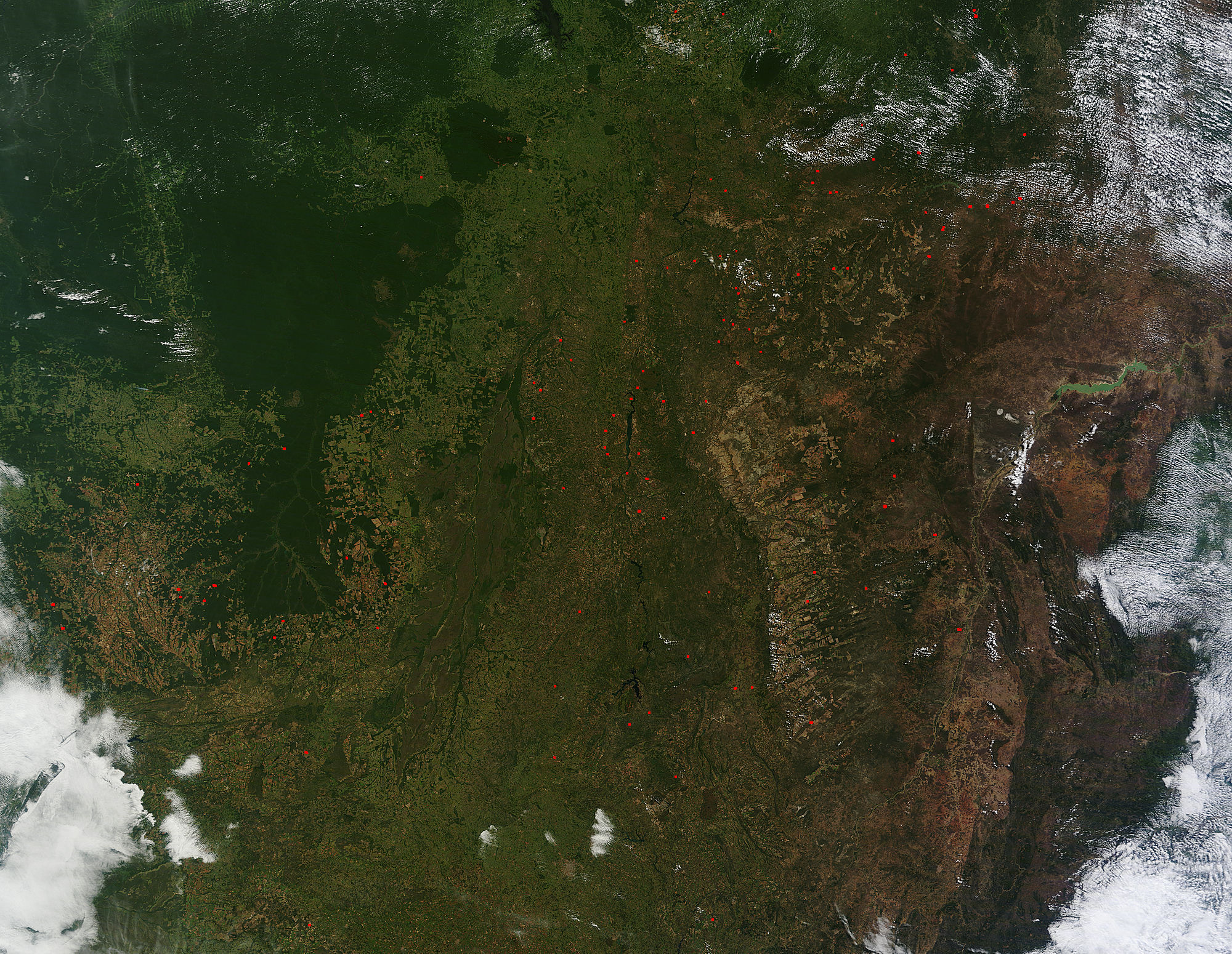
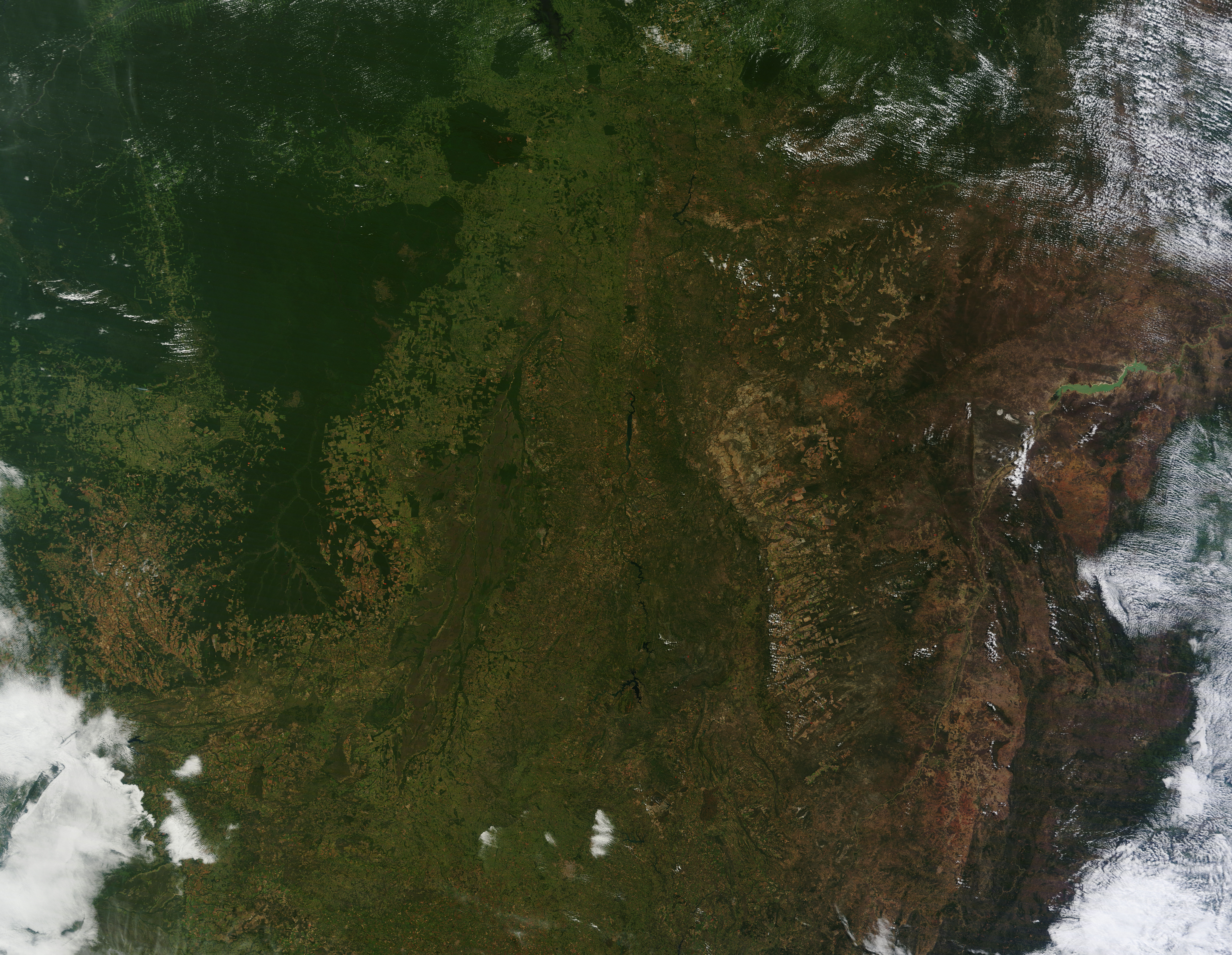
It is interesting to view the higher resolution of this image, which can be done by clicking on 500m or 250m. At those resolutions, the location of each red hotspot (which marks a fire) can be seen in greater detail. Also, the large amount of agricultural land – including juxtaposed to and intruding upon the forest – can be easily viewed.
Image Facts
Satellite:
Terra
Date Acquired: 6/16/2015
Resolutions:
1km (1.1 MB), 500m (4.1 MB), 250m (9.9 MB)
Bands Used: 1,4,3
Image Credit:
Jeff Schmaltz, MODIS Land Rapid Response Team, NASA GSFC
Fires speckled the landscape of central Brazil early in the dry season of 2015. The Moderate Resolution Imaging Spectroradiometer (MODIS) aboard NASA’s Terra satellite captured this true-color image on June 16. The dry season in central Brazil begins in May and ends in September.
Fires are most prominently located in the cerrado region, although some also can be found along the edges of the dark green forest. Given the location and time of year, the fires appear to be primarily agricultural in origin. Such fires are deliberately set to manage land for crops or improve pasturage, but can also cause air pollution and can slip out of control to cause significant damage. Fire is often used as a primary tool of deforestation in this region as forest and raw land is destroyed to be turned into cropland.
Brazil’s rainforest is a sensitive ecosystem, and there is pressure to try to preserve the last remaining stands. The cerrado is a tropical savanna that makes up most of the Great Plateau of central Brazil. It is a drier region that the forest, and the vegetation ranges from grasslands to scrubby woodland. Traditionally it has been a rather inhospitable place for agriculture, but as Brazilian agriculture expands into a strong export market, the demand for more land has put increasing pressure on the cerrado.
It is interesting to view the higher resolution of this image, which can be done by clicking on 500m or 250m. At those resolutions, the location of each red hotspot (which marks a fire) can be seen in greater detail. Also, the large amount of agricultural land – including juxtaposed to and intruding upon the forest – can be easily viewed.
Image Facts
Satellite:
Terra
Date Acquired: 6/16/2015
Resolutions:
1km (1.1 MB), 500m (4.1 MB), 250m (9.9 MB)
Bands Used: 1,4,3
Image Credit:
Jeff Schmaltz, MODIS Land Rapid Response Team, NASA GSFC
