
Images


July 23, 2015 - Smoke across central Canada and United States
 Tweet
Tweet
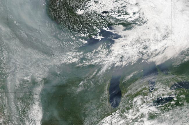
Hundreds of wildfires continued to burn in Canada and Alaska in July, 2015, burning millions of acres of vegetation and bringing smoky air to many millions of people.
The Moderate Resolution Imaging Spectroradiometer (MODIS) aboard NASA’s Aqua satellite captured this true-color image on July 3. Fires, marked as red hotspots in this image, can be seen burning in Manitoba, Canada and are a source of some of the smoke. The majority on the massive gray pall, however, originates further west, off of the image.
The dense smoke which hangs over Manitoba and Saskatchewan (to the west) has been caught by the jet stream and pours across the Canada-US border to pour into the United States. In this image, the primary arc of the river of smoke covers the following states: North Dakota, South Dakota, Minnesota, Wisconsin and Michigan. Part of the plume also drifts over Nebraska, Kansas, Iowa, Missouri, Illinois and Indiana.
The smoke has eroded air quality in many provinces and states in both June and July, 2015. On the day this image was captured, local news sources in Bismarck, North Dakota, reported that the Environmental Protection Agency (EPA) rated the air quality in the state as unhealthy, defined as capable of causing discomfort for anyone and potentially causing serious problems for people with lung problems.
Image Facts
Satellite:
Aqua
Date Acquired: 7/3/2015
Resolutions:
1km (1.3 MB), 500m (4.5 MB), 250m (10.9 MB)
Bands Used: 1,4,3
Image Credit:
Jeff Schmaltz, MODIS Land Rapid Response Team, NASA GSFC
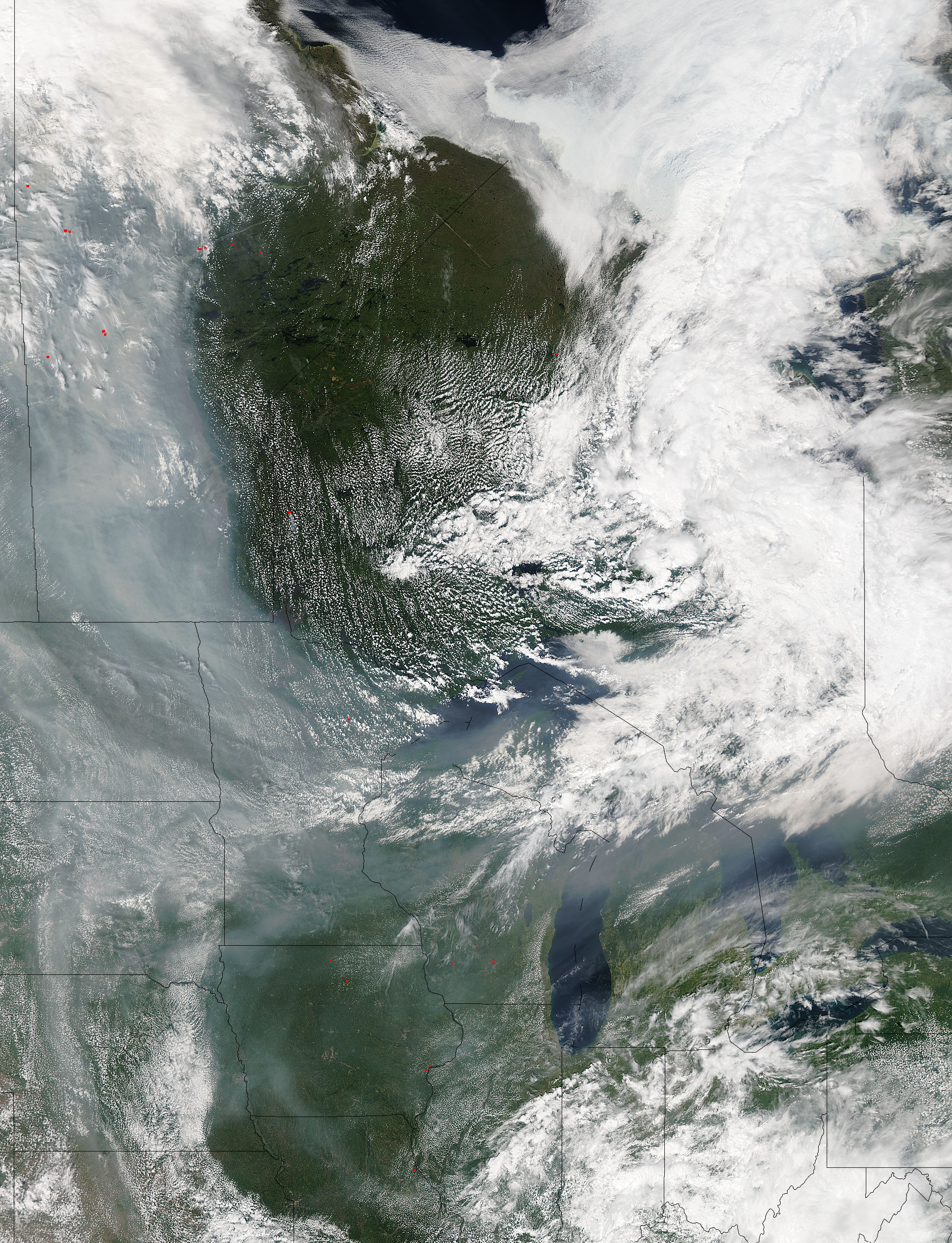
