
Images


August 4, 2015 - Tropical Storm Dolores (05E) over Mexico
 Tweet
Tweet
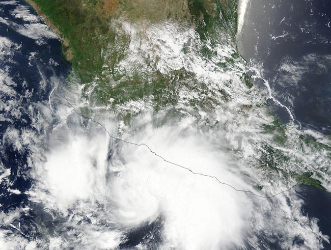
Tropical Storm Dolores formed close to the southwestern coast of Mexico and lingered there for a couple of days before strengthening into a Category 4 hurricane. NASA's Terra satellite captured an image of the storm riding the coast early in its ride through the Pacific Ocean.
The Moderate Resolution Imaging Spectroradiometer (MODIS) aboard NASA’s Terra satellite captured this true-color image of Tropical Storm Dolores on July 12 at 17:25 UTC (3:25 p.m. EDT). At that time the center of the strengthening storm was off the southern coast and the northeastern quadrant hung over southwestern Mexico. The bulk of thunderstorms associated with Dolores were east of center.
The system was first reported as a tropical depression on July 11. By the evening of July 25 Delores had become a Category 1 storm with maximum sustained winds of 75 mph (120 km/h). Two days later the winds had picked up to the peak of 132 mph (213 km/h) and these winds were creating dangerous swells. The National Hurricane Center (NHC) warned on July 15 that "swells generated by Dolores are affecting portions of the coast of southwestern Mexico and the southern coast of the Baja California peninsula. These swells could cause life-threatening surf and rip currents."
By July 16 the storm was beginning to interact with cooler water temperatures as well as moving into drier air with unfavorable wind shear and was beginning to weaken slowly to a tropical depression. The NHC issued its last advisory on Delores late on July 19. At that time it was a post-tropical cyclone with maximum sustained winds near 35 mph (55 km/h) and was located near 25.6 North and 119 West. It was moving towards the north-northwest. Remnants of Delores pumped moisture into southern California and the Desert Southwest of the United State, creating heavy rain. This rainfall may provide some drought relief to a region which has been suffering from exceptional drought.
Image Facts
Satellite:
Terra
Date Acquired: 7/12/2015
Resolutions:
1km (1 MB), 500m (3.5 MB), 250m (8.4 MB)
Bands Used: 1,4,3
Image Credit:
Jeff Schmaltz, MODIS Land Rapid Response Team, NASA GSFC
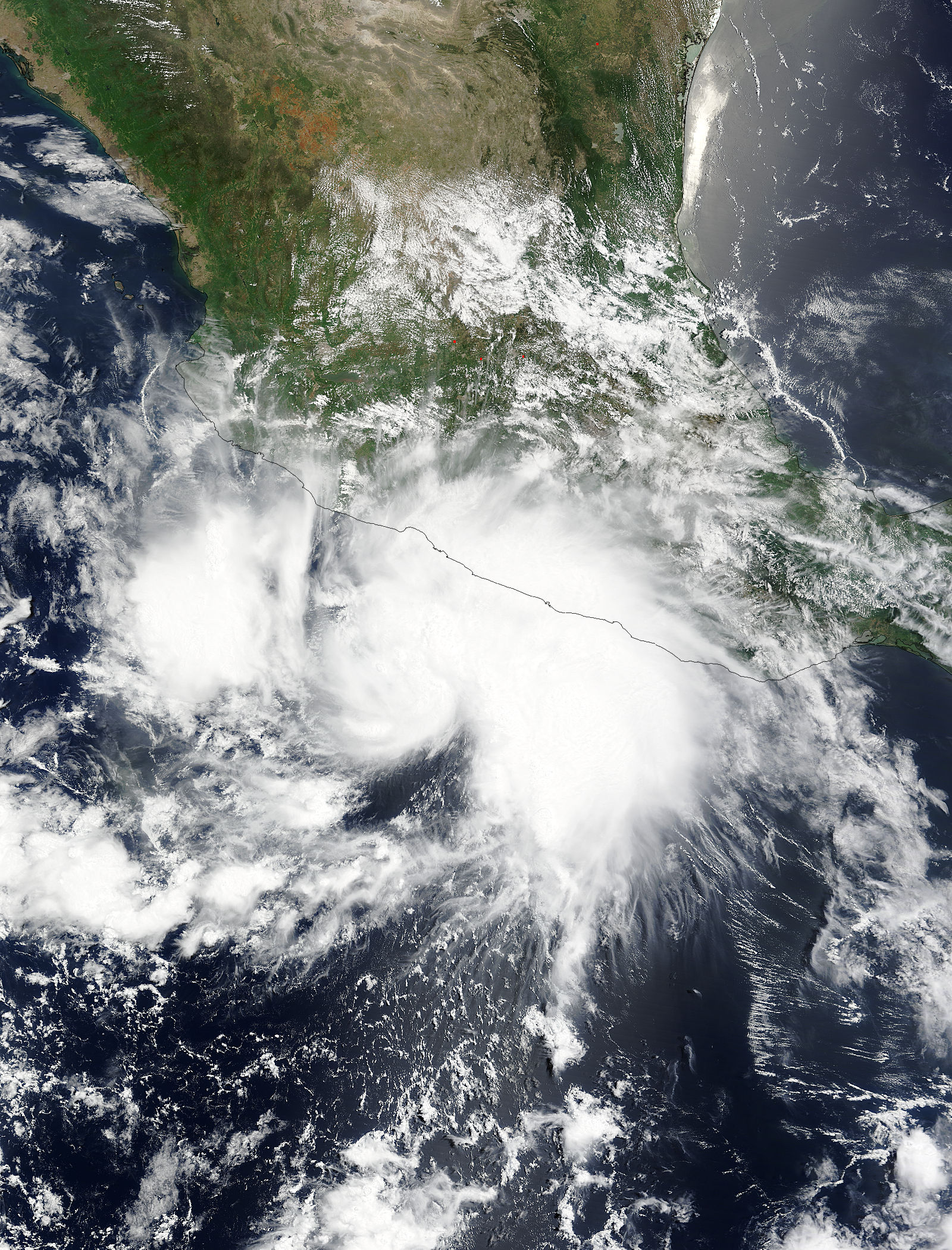
