
Images


November 22, 2015 - Iceland
 Tweet
Tweet
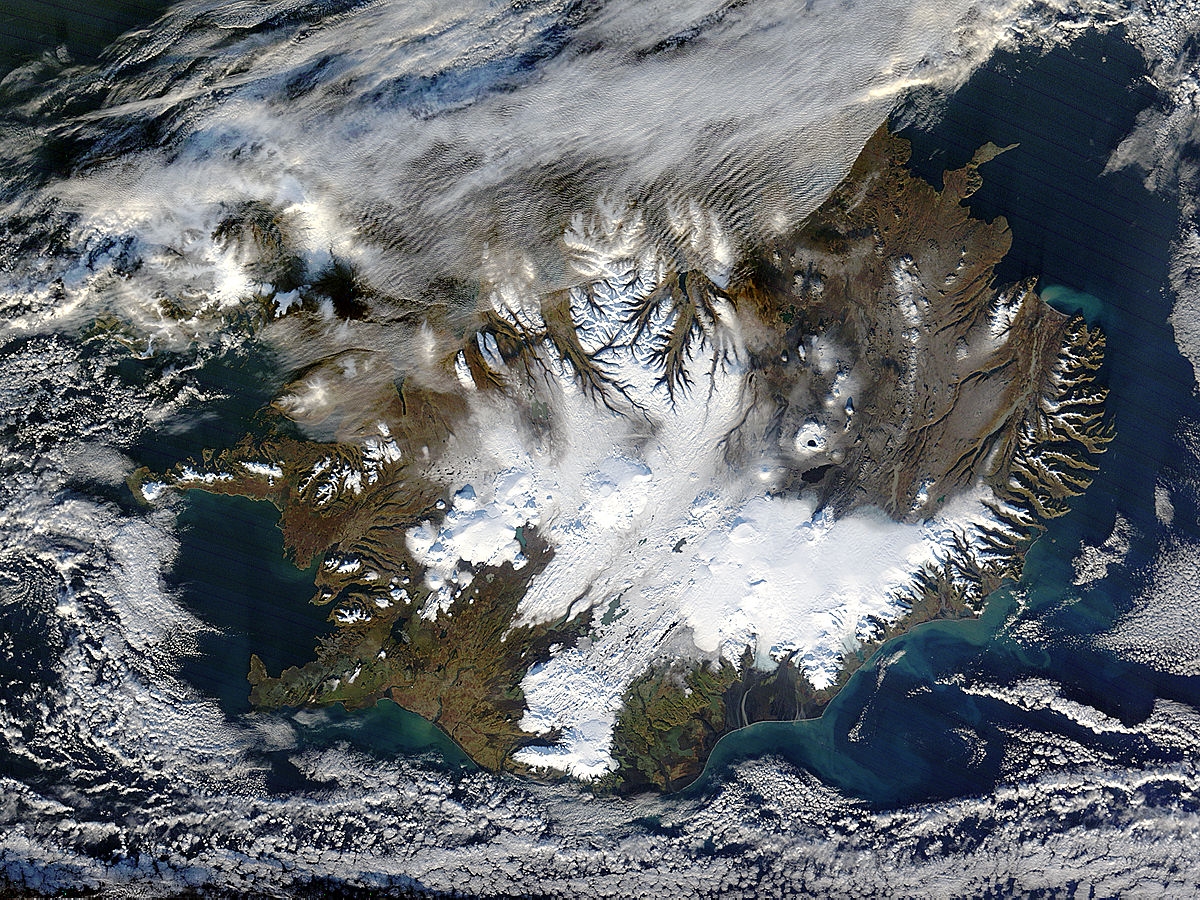
Winter storms can blanket Iceland almost entirely with snow. The relative warmth of summer and fall, however, exposes a spectacular, varied landscape. The Moderate Resolution Imaging Spectroradiometer (MODIS) on NASAÆs Terra satellite acquired this true-color image of the Nordic island nation on November 9, 2015.
ōThe visible snow cover is typical for this time of year, compared to conditions during the past 15-20 years,ö said Thorsteinn Thorsteinsson, a glaciologist at the Icelandic Meteorological Office. He noted, however, that compared to the reference period of 1961-1990, snow cover is ōalmost certainlyö less than average in the highland and mountain regions above 400 meters in elevation.
The melting of seasonal snow cover accentuates the boundaries of IcelandÆs permanent ice caps. The ice caps appear smooth and rounded in contrast with the snow-covered interior plateau of the snow-capped ridges along the glacier-carved coastline.
September and October have been unusually warm, melting snow and allowing melt water to flow into the islandÆs numerous lakes and reservoirs. One such lake is ųskjuvatn crater lake, which can be seen just northeast of center. It is nearly round and is surrounded by a circle of white snow. Just to the south of the lake is another long, dark feature that could easily appear to be a water-filled lake. However, it is actually a fresh lava field deposited by the Holuhraun eruption from August 2014 to February 2015. During the eruption, lava poured from fissures just north of the Vatnaj÷kull ice cap and near the Bardarbunga volcano. By January 2015, the Holuhraun lava field had spread across more than 84 sq. km. (32 sq. mi.).
Image Facts
Satellite:
Terra
Date Acquired: 11/9/2015
Resolutions:
1km (130.2 KB), 500m (493.8 KB), 250m (1.2 MB)
Bands Used: 1,4,3
Image Credit:
Jeff Schmaltz, MODIS Land Rapid Response Team, NASA GSFC
