
Images


April 25, 2016 - Scotland, Ireland, and Wales
 Tweet
Tweet
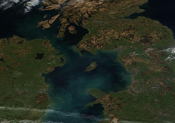
The skies were clear over Scotland, Ireland, and Wales on April 20, 2016, when NASA's Terra satellite passed over the United Kingdom. The Moderate Resolution Imaging Spectroradiometer (MODIS) aboard that satellite captured this true-color image that same day.
Scotland, Wales and Northern Ireland, along with England, belong to the United Kingdom. The United Kingdom is roughly the size of the state of Pennsylvania and is home to over 64 million people. Scotland, England, and Wales comprise the island of Great Britain, which sits across the Irish Sea from the island of Ireland. On its southeast side Great Britain is separated from France by the English Channel. Scotland covers the northern third of the island of Great Britain. Wales is found in the southwest section of Great Britain and is known for its mountainous terrain and complex coastline. In the image, Scotland sits at the northern edge and Wales can be seen near the southeast (lower right) corner.
Ireland lies in the North Atlantic Ocean west of Great Britain. About one-sixth of the northern part of the island belongs to Northern Ireland while the rest belongs to the Republic of Ireland. Most of the Irish land seen in this image belongs to Northern Ireland.
Image Facts
Satellite:
Terra
Date Acquired: 4/20/2016
Resolutions:
1km (80.8 KB), 500m (185.2 KB), 250m (589.5 KB)
Bands Used: 1,4,3
Image Credit:
Jeff Schmaltz, MODIS Land Rapid Response Team, NASA GSFC
