
Images


May 23, 2016 - Smoke from western wildfires over central Canada
 Tweet
Tweet
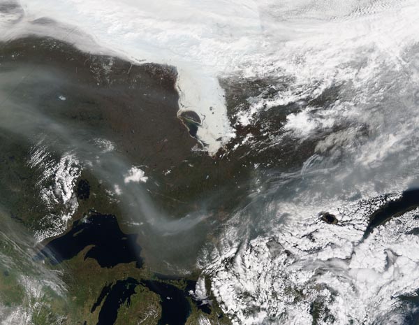
Wildfires burning in western Canada continued to consume vegetation and pump smoke high into the atmosphere in mid-May 2016. The billowing smoke became entrained in high-level winds and have been carried hundreds of kilometers across Canada to the Atlantic Ocean, affecting air quality in eastern Canada, the Great Lakes region, the northeastern United States, the northern Plains states, and the Northern Mississippi Valley.
On May 19, 2016 the Moderate Resolution Imaging Spectroradiometer (MODIS) aboard NASA's Terra satellite captured this true-color image of a broad band of smoke flowing eastward over Canada from fires in Alberta and British Columbia. The thickest band of smoke dips southward towards the Great Lakes, and is so thick that it is not possible to see the land underneath. Northeast of the Great Lakes the smoke mingles with cloud and even appears to be above the cloud in some areas.
Image Facts
Satellite:
Terra
Date Acquired: 5/19/2016
Resolutions:
1km (842.4 KB), 500m (2.8 MB), 250m (6.7 MB)
Bands Used: 1,4,3
Image Credit:
Jeff Schmaltz, MODIS Land Rapid Response Team, NASA GSFC
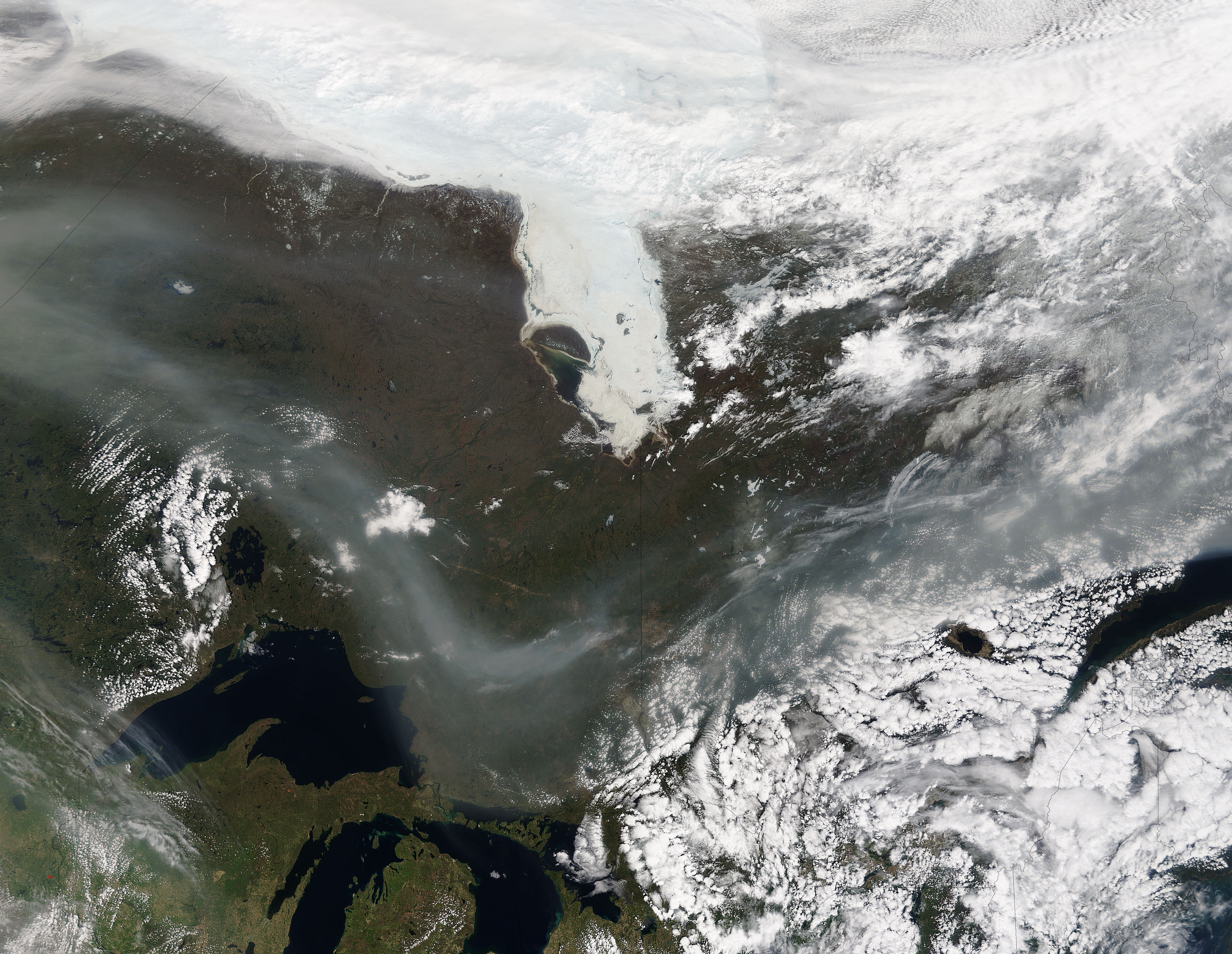
