
Images


June 16, 2016 - Cloud over southwest Australia
 Tweet
Tweet
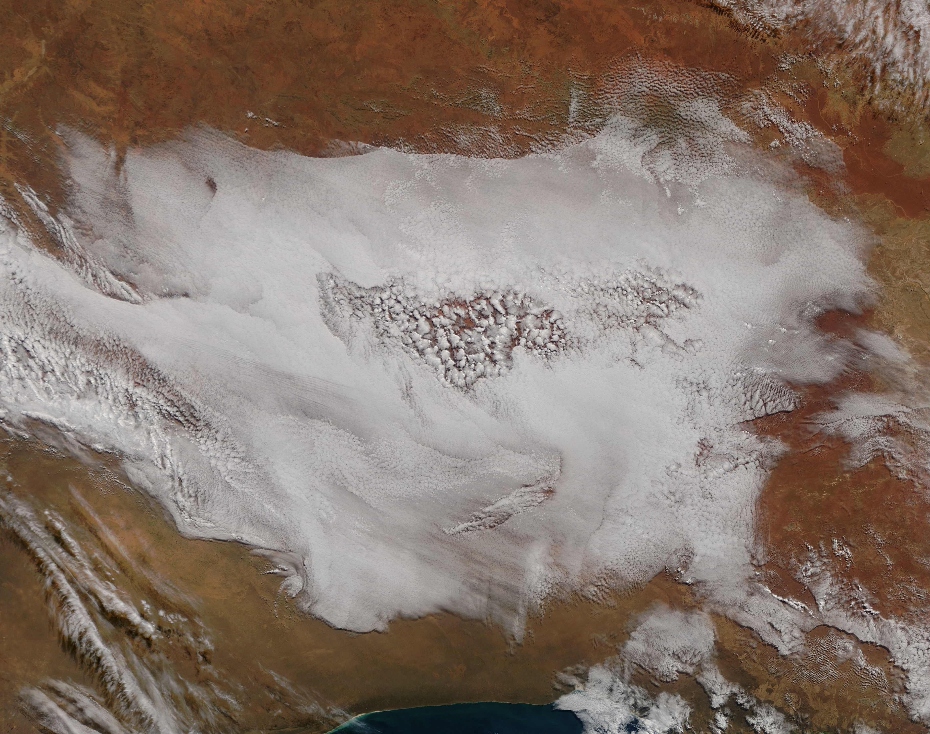
Dramatic clouds covered parts of the Great Victoria Desert in mid-June 2016. The Moderate Resolution Imaging Spectroradiometer (MODIS) aboard the Terra satellite captured this true-color image on June 10 at 01:20 UTC (10:50 a.m. local time).
The Great Victoria Desert is Australia's largest desert, spanning more than 435 mi (700 km) from west to east. It lies in Western Australia (in the west) and South Australia in the east. Although the desert is arid, it receives an average of 200-205 cm (78.7 - 98.4 in) precipitation annually. Rainfall is sporadic and unreliable, often falling during thunderstorms which arise - and dissipate - quickly.
The clouds in this image are complex. A fine-grained layer of cloud appears to be low cloud (fog), which is widespread. Part of the fog bank, near its center, appears to have a broken pattern. The clouds in this area appear to float at a higher level in the atmosphere than the low cloud, as these clouds ride over the fog bank's disrupted edge.
This image was captured on an early winter morning. In the winter, temperatures in the desert fall quickly at night, often to near-freezing in early June. The intense morning sun can heat the land - and atmosphere - quickly, with temperatures rising to 20-25 degrees C (68-77 degrees F) by midday. It is possible the rising morning temperatures have created thermals (areas of warmer, rising air) in the center of the fog bank. Where the air warms and rises, the low cloud (which hugs the ground in cool, humid conditions) would dissipate. As the warm air rises, it cools, and clouds once again form at higher levels.
Image Facts
Satellite:
Terra
Date Acquired: 6/10/2016
Resolutions:
1km (216.4 KB), 500m (797.3 KB), 250m (1.9 MB)
Bands Used: 1,4,3
Image Credit:
Jeff Schmaltz, MODIS Land Rapid Response Team, NASA GSFC
