
Images


June 17, 2016 - Cloud vortices induced by the Kuril Islands
 Tweet
Tweet
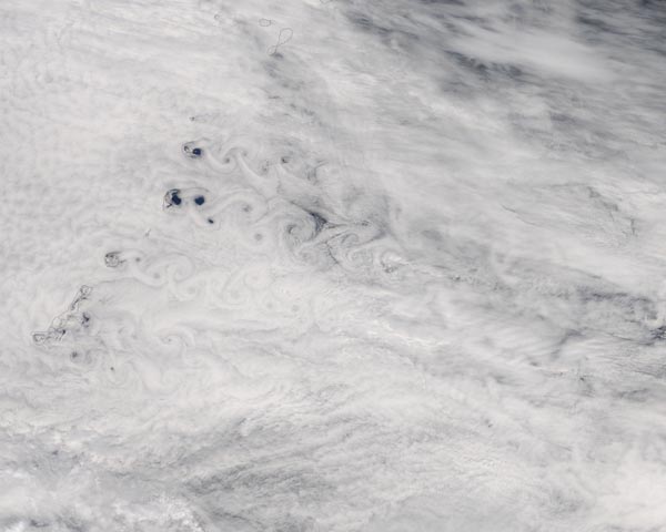
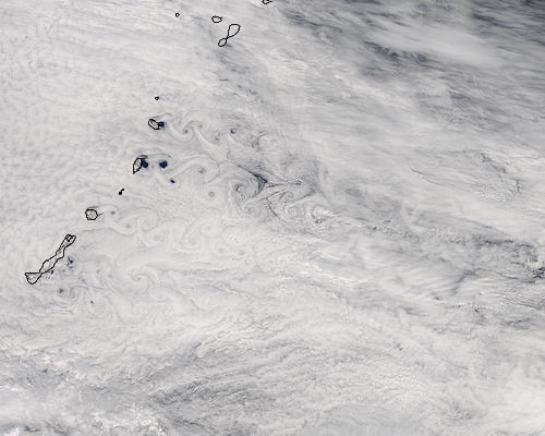
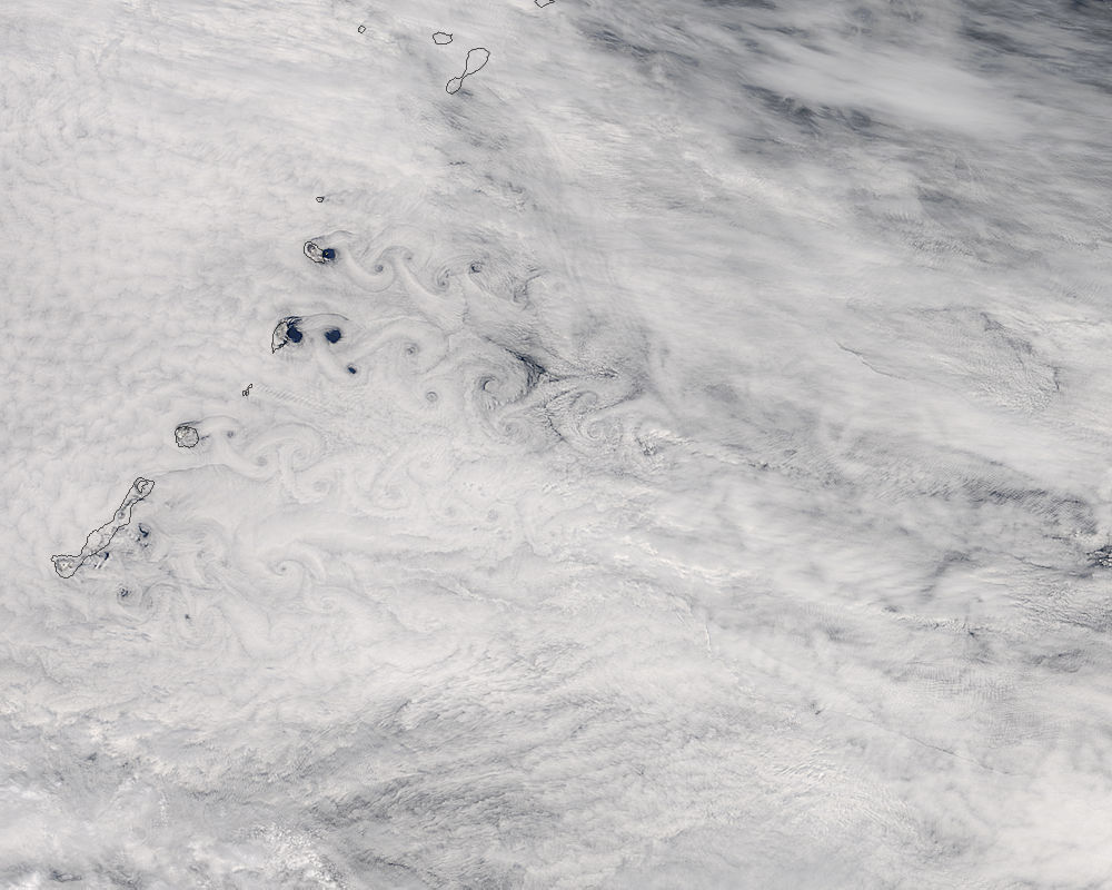
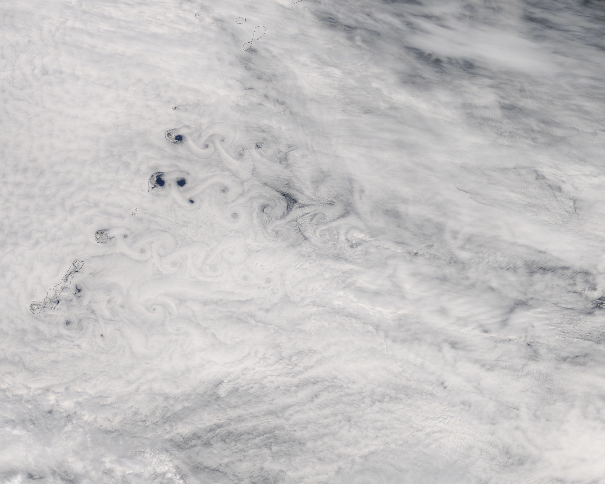
Swirling eddies snaked through the clouds behind the Kuril Islands in early June 2016. The Moderate Resolution Imaging Spectroradiometer (MODIS) aboard NASA's Terra satellite acquired this true-color image on June 5 as it passed over the North Pacific Ocean off of Eastern Russia.
Russia's Kuril Island chain stretches about 1,300 km (810 mi) between Kamchatka and Hokkaido, Japan and separates the Sea of Okhotsk (west) from the North Pacific Ocean (east). The islands are volcanic in origin and many have rugged, steep topography.
Theodore von Karman, a Hungarian-American physicist, was the first to describe the physical processes that create long chains of spiral eddies like the ones seen in the clouds in this image. Known as von Karman vortices, the patterns can form nearly anywhere that fluid flow is disturbed by an object. In this case, the unique flow occurs as winds rush past the tall peaks on the volcanic islands. As winds are diverted around these high areas, the disturbance in the flow propagates downstream in the form of vortices that alternate their direction of rotation. When clouds are plentiful, such atmospheric disturbances become visible from space.
Image Facts
Satellite:
Terra
Date Acquired: 6/5/2015
Resolutions:
1km (37.7 KB), 500m (122.4 KB), 250m (304.6 KB)
Bands Used: 1,4,3
Image Credit:
Jeff Schmaltz, MODIS Land Rapid Response Team, NASA GSFC
