
Images


June 24, 2016 - Dust storm over the Red Sea
 Tweet
Tweet
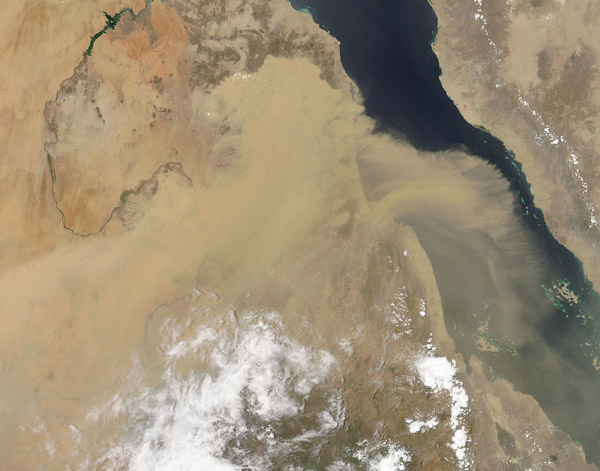
Strong winds continued to blow massive amounts of dust from Africa east-northeastward over the Red Sea towards the Arabian Peninsula on June 17, 2016. The Moderate Resolution Imaging Spectroradiometer (MODIS) aboard NASA's Aqua satellite captured this true-color image at 10:55 UTC (1:55 p.m. local time) on that same day.
The river of wind-blown sand appears most dense over the Tokar Delta in southern Sudan, funneled into that location, most likely, from a topographic feature lying about 30 mi (50 km) inland. This feature, the Tokar Gap, is a break in the tall mountains lying parallel to the coast. In June through September, winds blowing southeastward from Africa - often carrying large amounts of dust - finds its way through the Tokar Gap and carries dust towards the Arabian Peninsula.
The MODIS instrument on the Aqua satellite also captured a true-color image of the dust storm on June 15 - two days before this image was captured. NASA's Earth Observatory published that spectacular image, along with more details about dust storms in this region, on June 17. That image can be viewed at: http://earthobservatory.nasa.gov/NaturalHazards/view.php?id=88211&eocn=home&eoci=nh
Image Facts
Satellite:
Aqua
Date Acquired: 6/17/2016
Resolutions:
1km (275.6 KB), 500m (907.6 KB), 250m (2.2 MB)
Bands Used: 1,4,3
Image Credit:
Jeff Schmaltz, MODIS Land Rapid Response Team, NASA GSFC
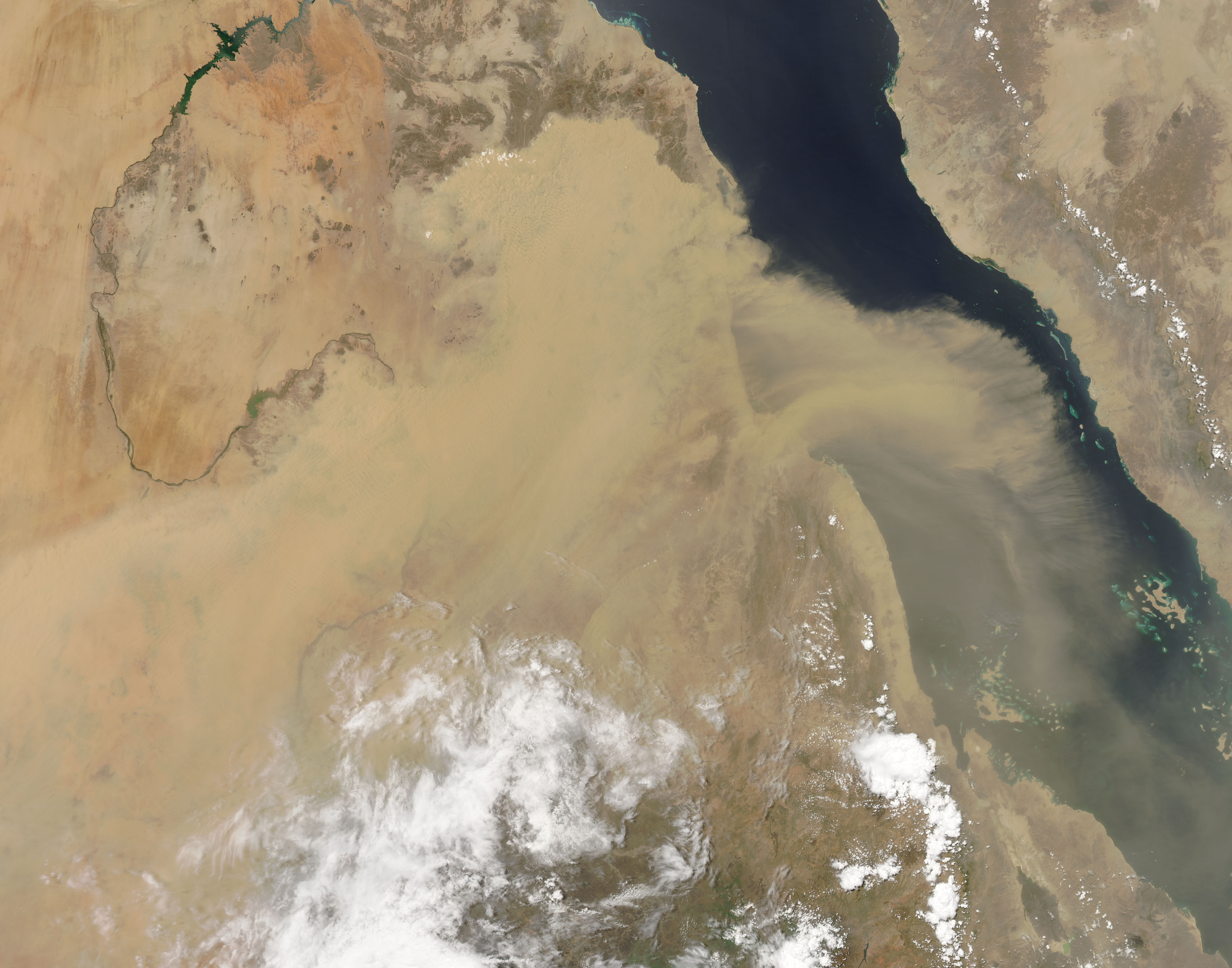
