
Images


July 13, 2016 - Sea ice in Hudson Bay
 Tweet
Tweet
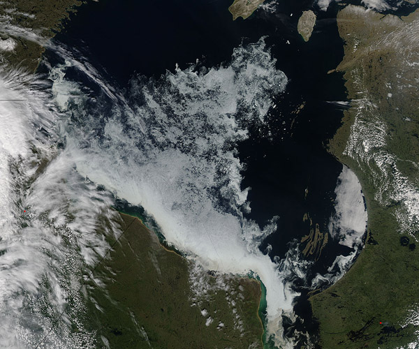
The first week of July typically brings a sharp decline in sea ice in the Hudson Bay, and the first week of July 2016 was no different. The Moderate Resolution Imaging Spectroradiometer (MODIS) aboard NASA's Aqua satellite captured this true-color image of dwindling sea ice on July 9.
Hudson Bay experiences annual cycles dominated by ice and open water. Thick layers of sea ice cover most of the surface during the winter. As longer and warmer days arrive in late May and June, the ice begins to thaw and thin, slowly beginning to break up. Rapid melting typically begins in early July and by August, Hudson Bay is typically ice-free. As temperatures drop in October and November the cycle begins again as ice forms and thickens.
The ice cycle of Hudson Bay has a profound effect on the local environment, especially the Polar Bear. This top-of-the-food-chain mammal is tied closely to healthy sea ice. Ice is where they forage for seals, whales, and other aquatic animals, and where they raise their young. Each summer as the ice breaks up, the Hudson Bay population of Polar Bear moves onto the mainland and embark on a slow, hungry migration northwards. By late October to November, a long line of migrating Polar Bears have lumbered to the shores near Churchill, Manitoba, where they meet freshly frozen sea ice and return to the ice for the winter.
Most Hudson Bay Polar Bears leave the sea ice near or just after break up in the southwest section of the Bay. This location is well illustrated in this image, as it is the area where sea ice remains closest to the shore. Churchill, known as the "Polar Bear Capital", is hidden under cloud in the northwest section of the image.
Image Facts
Satellite:
Aqua
Date Acquired: 7/9/2016
Resolutions:
1km (651.8 KB), 500m (2.3 MB), 250m (5.7 MB)
Bands Used: 1,4,3
Image Credit:
Jeff Schmaltz, MODIS Land Rapid Response Team, NASA GSFC
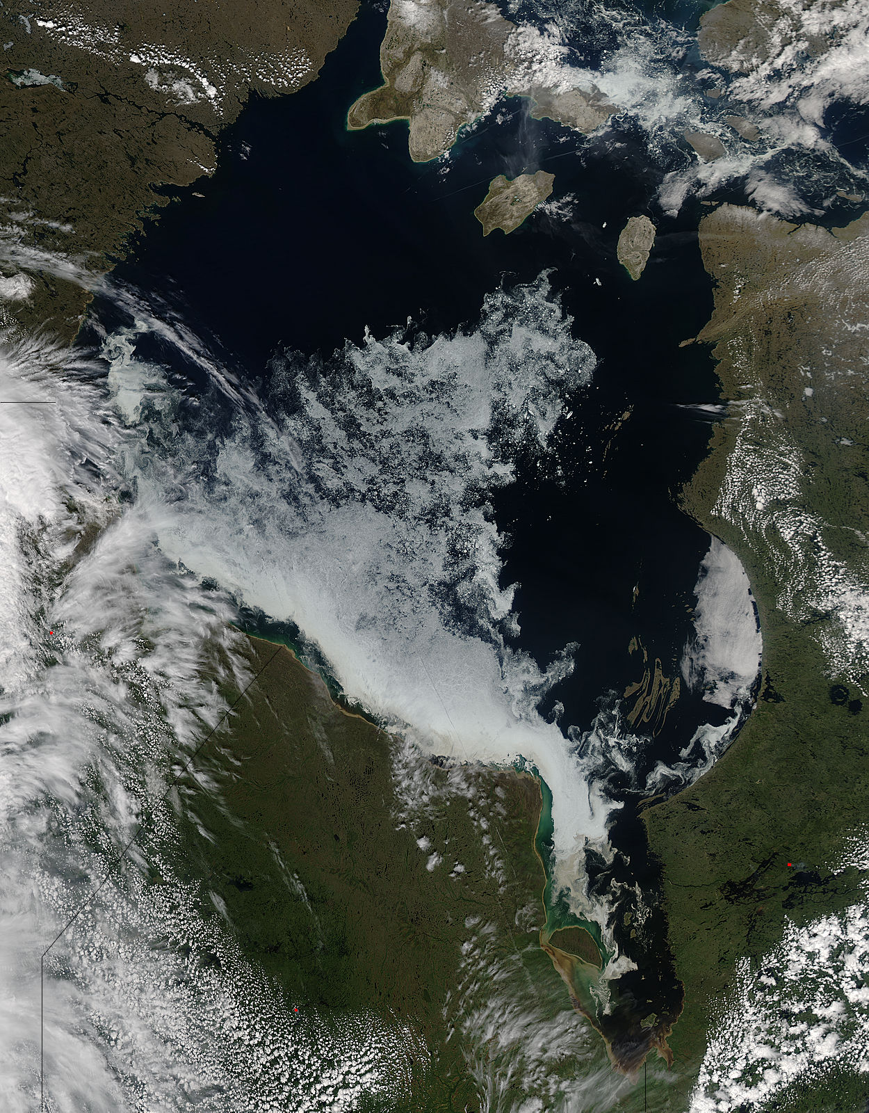
