
Images


July 24, 2016 - The Iberian Peninsula
 Tweet
Tweet
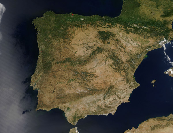
On July 16, 2016, the Moderate Resolution Imaging Spectroradiometer (MODIS) aboard NASA's Aqua satellite captured a true-color image of a sunny summer day on the Iberian Peninsula.
The Iberian Peninsula fills the southwestern tip of Europe and is home to Spain, Portugal, Andorra and the British overseas Territory in Gibraltar. The Iberian Peninsula, which is slightly larger than the state of Nevada sits between the Atlantic Ocean and the Mediterranean Sea. It is separated from northern Africa by the narrow Strait of Gibraltar while the tall Pyrenees Mountains that separate Spain and France.
In the central part of the peninsula, the grasslands of the broad Meseta (central plateau) is dressed in tans, which contrast to the greens of the mountainous ridges that are prominent features. The Meseta makes up approximately three-quarters of the octagonal Iberian Peninsula, and is ringed and crossed by various mountain ranges.
Image Facts
Satellite:
Aqua
Date Acquired: 7/16/2016
Resolutions:
1km (336.1 KB), 500m (1.2 MB), 250m (3 MB)
Bands Used: 1,4,3
Image Credit:
Jeff Schmaltz, MODIS Land Rapid Response Team, NASA GSFC
