
Images


July 27, 2016 - Cliff Creek and Lava Mountain Fires, Wyoming
 Tweet
Tweet
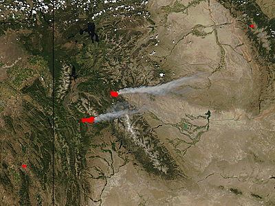
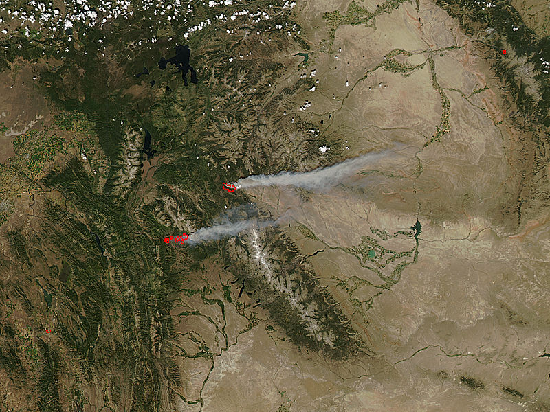
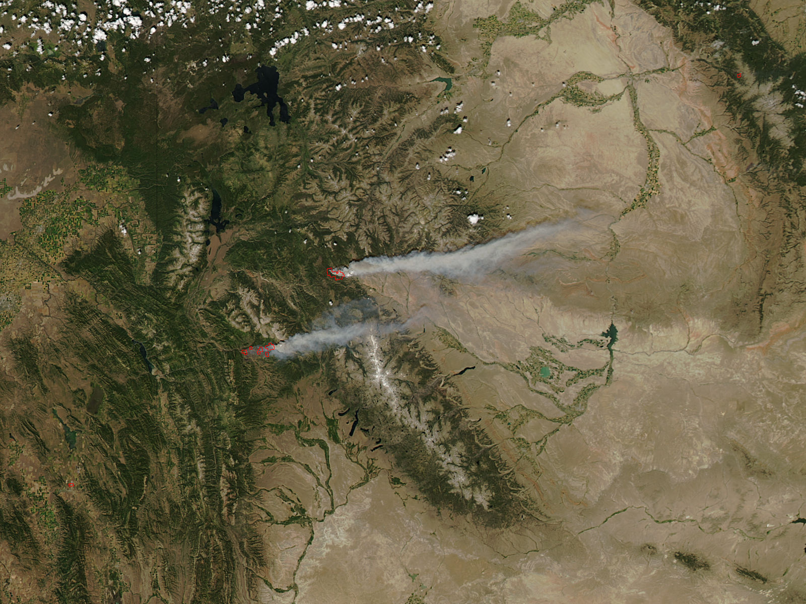
Fires blazed across Wyoming in late July 2016, threatening seasonal homes and raising evacuation orders as over a thousand firefighters battle active wildfires across the state. According to Inciweb Incident Management System, nine currently active fires had consumed over 40,000 acres by July 26.
The Moderate Resolution Imaging Spectroradiometer (MODIS) aboard NASA’s Aqua satellite captured this true-color image of two fires, the Cliff Creek Fire and the Lava Mountain Fire on July 23.
The Cliff Fire (lower left) had burned 16, 863 acres as of July 7 and had been10% contained. It ignited on July 17 by lightning strike in timberland located about 5 miles north of Bondurant, Wyoming. Burnout operations, which are fires strategically lit and controlled to burn fuel ahead of the fire, are being used to limit the fires spread. The fire will be permitted to burn in the Gros Ventre Wilderness area as fire plays an ecological role in the wilderness area.
The Lava Mountain fire ignited on the morning of July 11 from a lightning strike. It burns in dense standing timber about 20 miles north of Dubois, Wyoming. As of July 26, 8,020 acres have been consumed and no containment percentage has been given. The south section of the fire is pushing east and, with gusting wind, is expected to move towards the Union Pass Road. Residents of Union Pass, Porcupine, Warm Springs, and Hat Butte are all urged to evacuate immediately as windy conditions and low humidity are expected to spur fire growth in the immediate future.
Image Facts
Satellite:
Aqua
Date Acquired: 7/23/2016
Resolutions:
1km (49.1 KB), 500m (189.2 KB), 250m (473.4 KB)
Bands Used: 1,4,3
Image Credit:
Jeff Schmaltz, MODIS Land Rapid Response Team, NASA GSFC
