
Images


August 28, 2016 - Typhoon Lionrock (12W) off Japan
 Tweet
Tweet
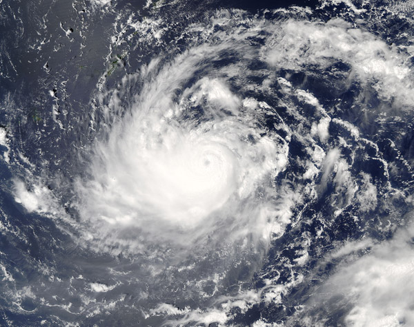
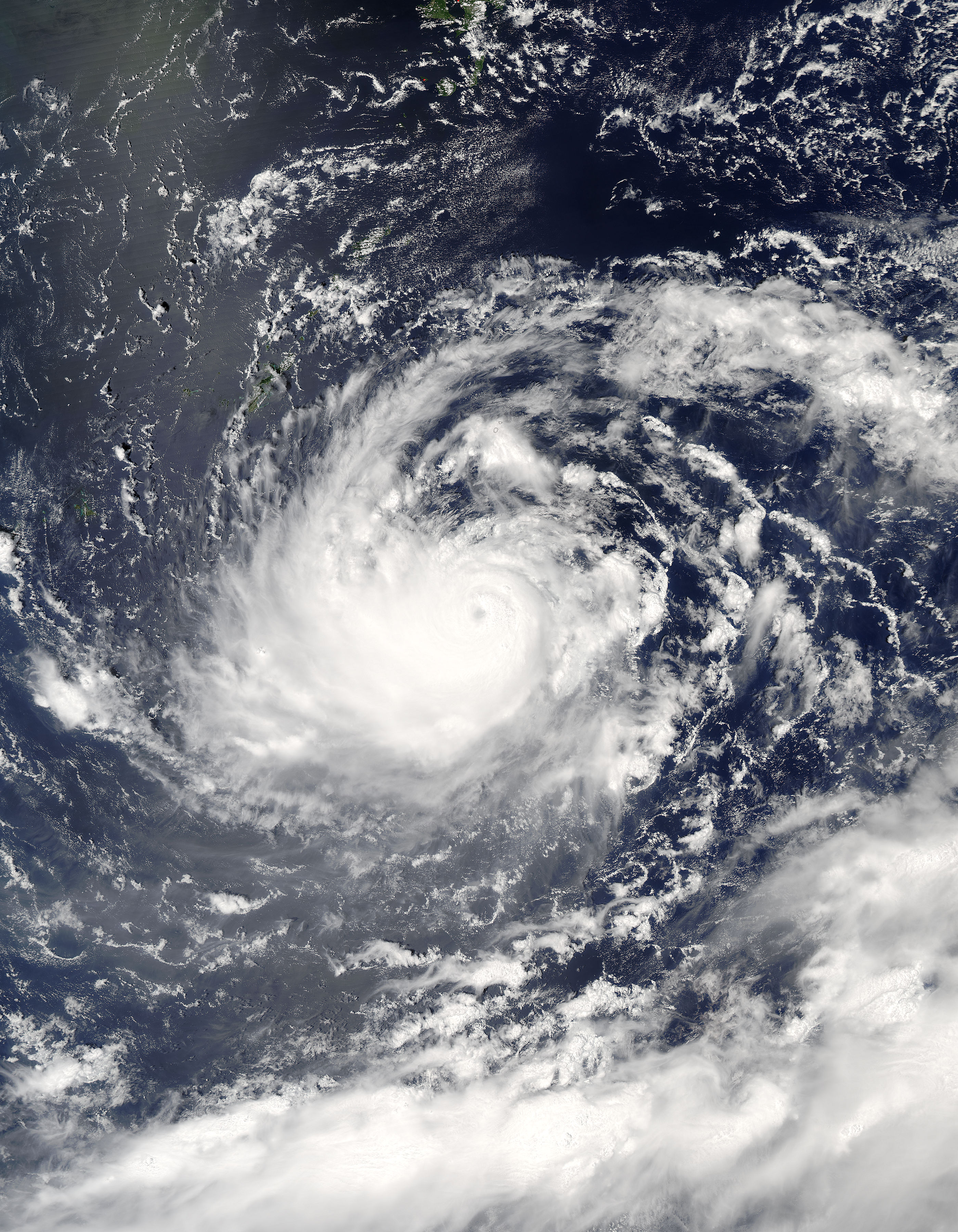
Typhoon Lionrock continued to spin slowly towards Japan in late August 2016. The Moderate Resolution Imaging Spectroradiometer aboard NASA’s Aqua satellite captured this true-color image of the storm on August 27. At that time Lionrock had a distinct and partially cloud-filled eye with a tight apostrophe shape.
Since its formation on August 16, when it was classified as a tropical depression by the Japan Meteorological Agency, Lionrock has taken a circuitous court in the ocean southeast of Japan. However, it seems to now be setting course towards Japan's Honshu Island.
On August 28 at 0300 UTC (11:00 p.m. EDT August 27), the Joint Typhoon Warning Center (JTWC) reported that Typhoon Lionrock was located near 26.0 north and 136.6 east, or about 305 mi (491 km) west-northwest of Iwo To. The storm packed maximum one-minute sustained winds of 126 mph (202.8 km/h), making it a Category 3 storm on the Saffir-Simpson Hurricane Wind Scale.
According to the JTWC, the near-term forecast predicts that Lionrock will maintain intensity around 121 mph (195 km/h). After 24 hours, the environment starts to deteriorate and steady weakening of the storm is expected. In about 48 hours Lionrock is expected to take a turn to the northwest track, and will likely reach Japan on about August 30 or 31, with landfall over northern Honshu, bringing heavy rain to the region. After landfall, Tropical Storm Lionrock is expected to quickly weaken, rapidly becoming extra-tropical.
Image Facts
Satellite:
Aqua
Date Acquired: 8/25/2016
Resolutions:
1km (797.8 KB), 500m (2.7 MB), 250m (6.3 MB)
Bands Used: 1,4,3
Image Credit:
Jeff Schmaltz, MODIS Land Rapid Response Team, NASA GSFC
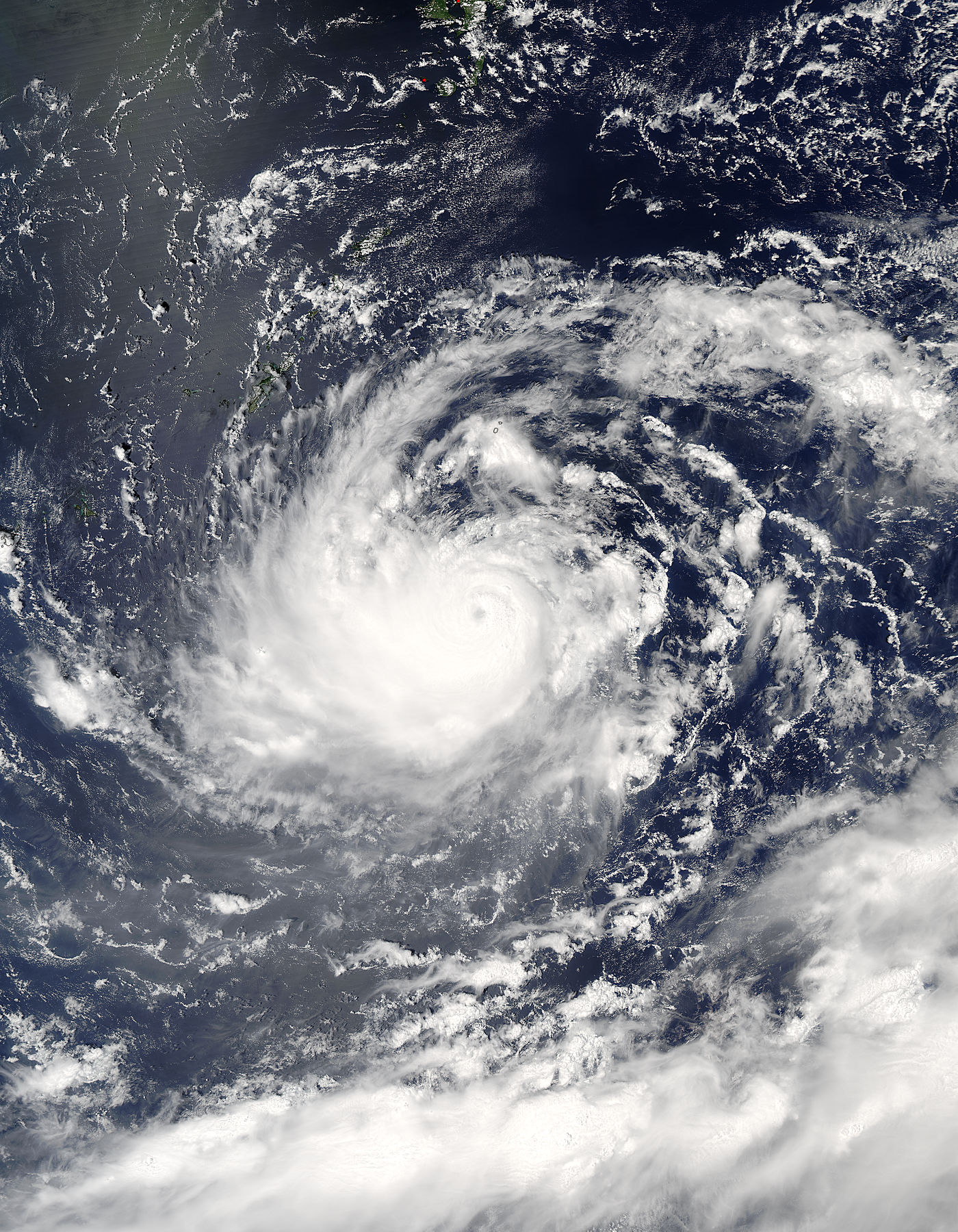
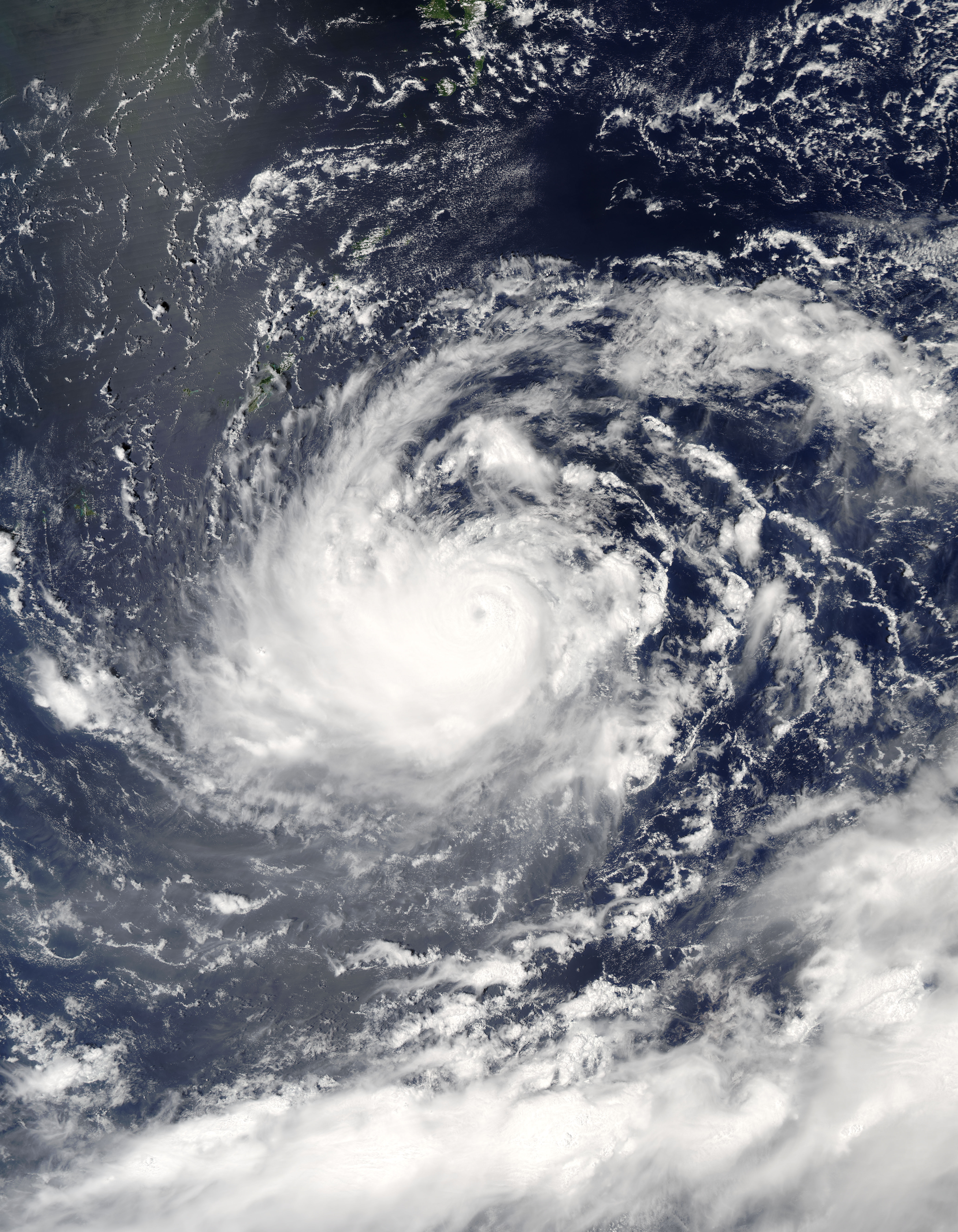
