
Images


August 31, 2016 - Hurricane Gaston (07L) in the central Atlantic Ocean
 Tweet
Tweet
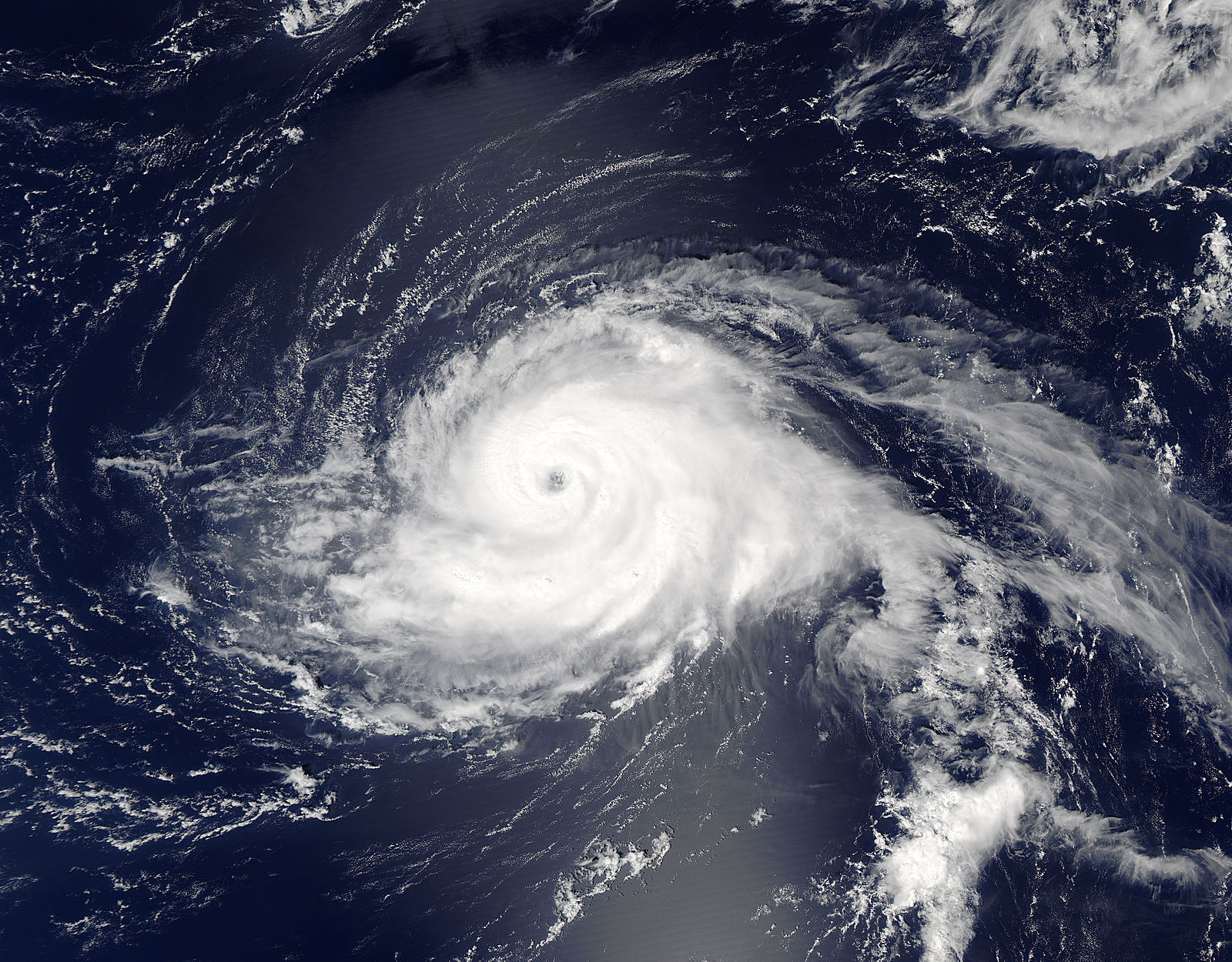
On August 28 at 12:45 p.m. EDT (1645 UTC) the Moderate Resolution Imaging Spectroradiometer (MODIS) aboard NASA's Aqua satellite captured a true-color image of Hurricane Gaston. At the time, Gaston had maximum sustained winds near 105 mph and was a Category 2 hurricane on the Saffir-Simpson Hurricane Wind Scale. Gaston had developed a clear eye about 15 nautical miles wide that was surrounded by powerful thunderstorms. Late on August 29, Gaston’s maximum sustained winds reached 120 mph (195 km/h), bringing to major hurricane status as a Category 3 storm.
At 5:00 p.m. EDT (2100 UTC) on Tuesday, August 30, the National Hurricane Center (NHC) reported that Gaston carried maximum sustained winds of 110 mph (175 km/h), teetering just below the cutoff for a Category 3 storm (111 mph or 178 km/h). At that time, Hurricane Gaston was located at 32.6 North, 51.9 West or 750 mi (1210 km) east of Bermuda and 1445 mi (2330 km) west of the Azores, and was moving towards the east-northeast near 10 mph (17 km/h).
The NCH forecasts Hurricane Gaston to continue to move in the same general direction over the next 48 hours, with some weakening likely. While there are no warnings up at present, residents and interests in the Azores should monitor the motion of the storm as it heads towards the islands over the next several days.
Image Facts
Satellite:
Aqua
Date Acquired: 8/28/2016
Resolutions:
1km (577.5 KB), 500m (2 MB), 250m (4.7 MB)
Bands Used: 1,4,3
Image Credit:
Jeff Schmaltz, MODIS Land Rapid Response Team, NASA GSFC
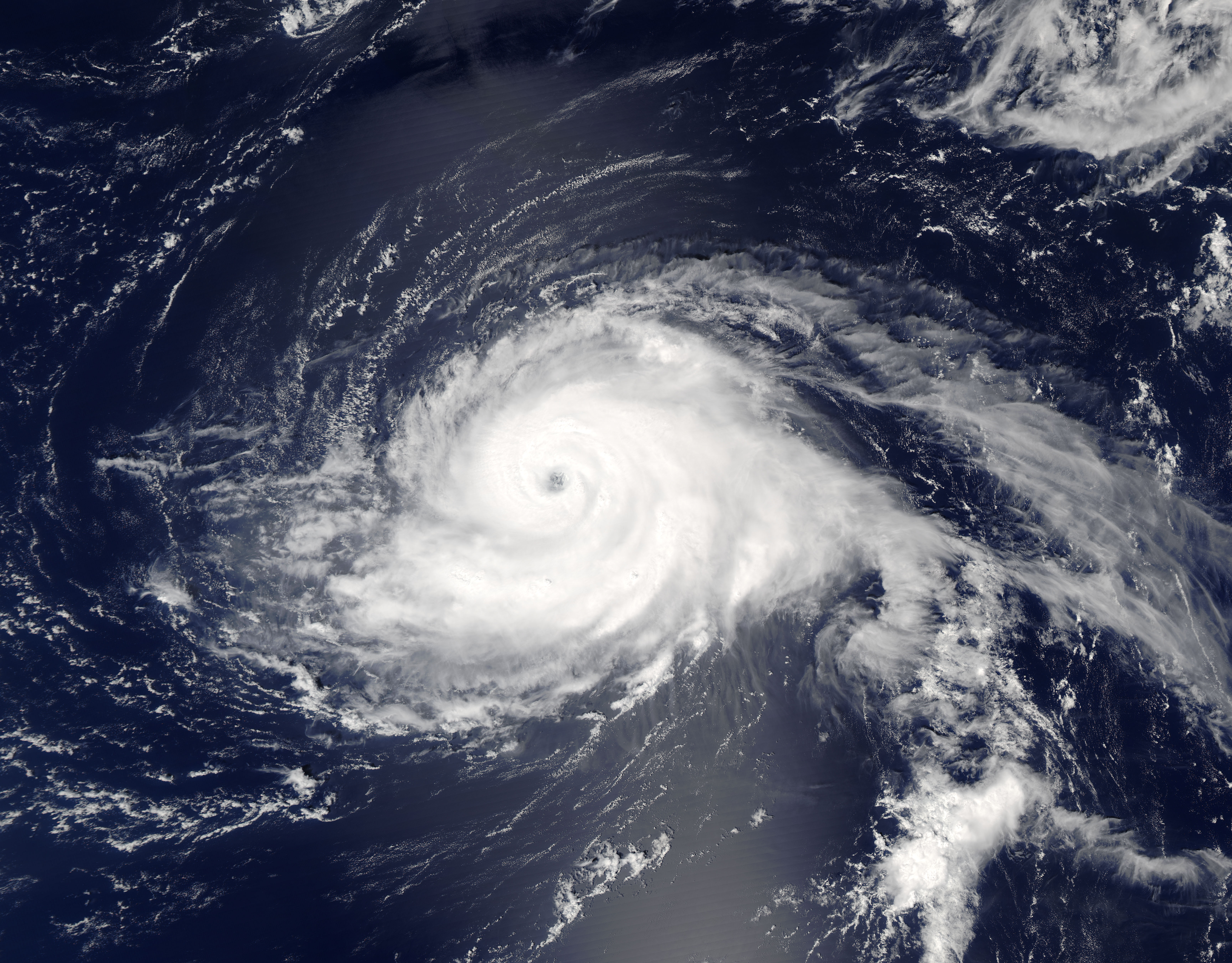
