
Images


July 20, 2018 - Thawing Ice in Foxe Basin
 Tweet
Tweet
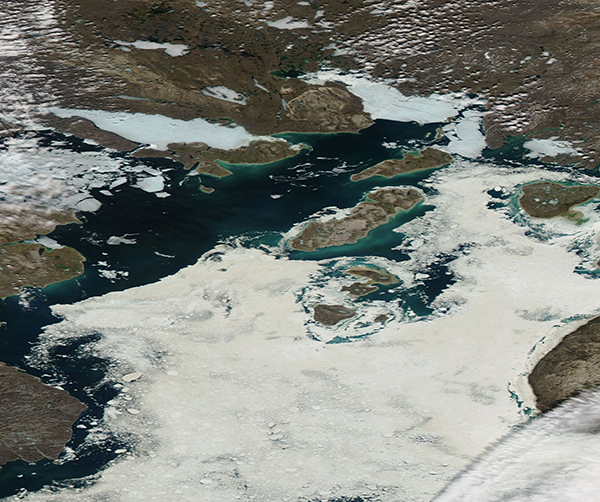
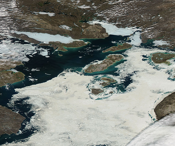
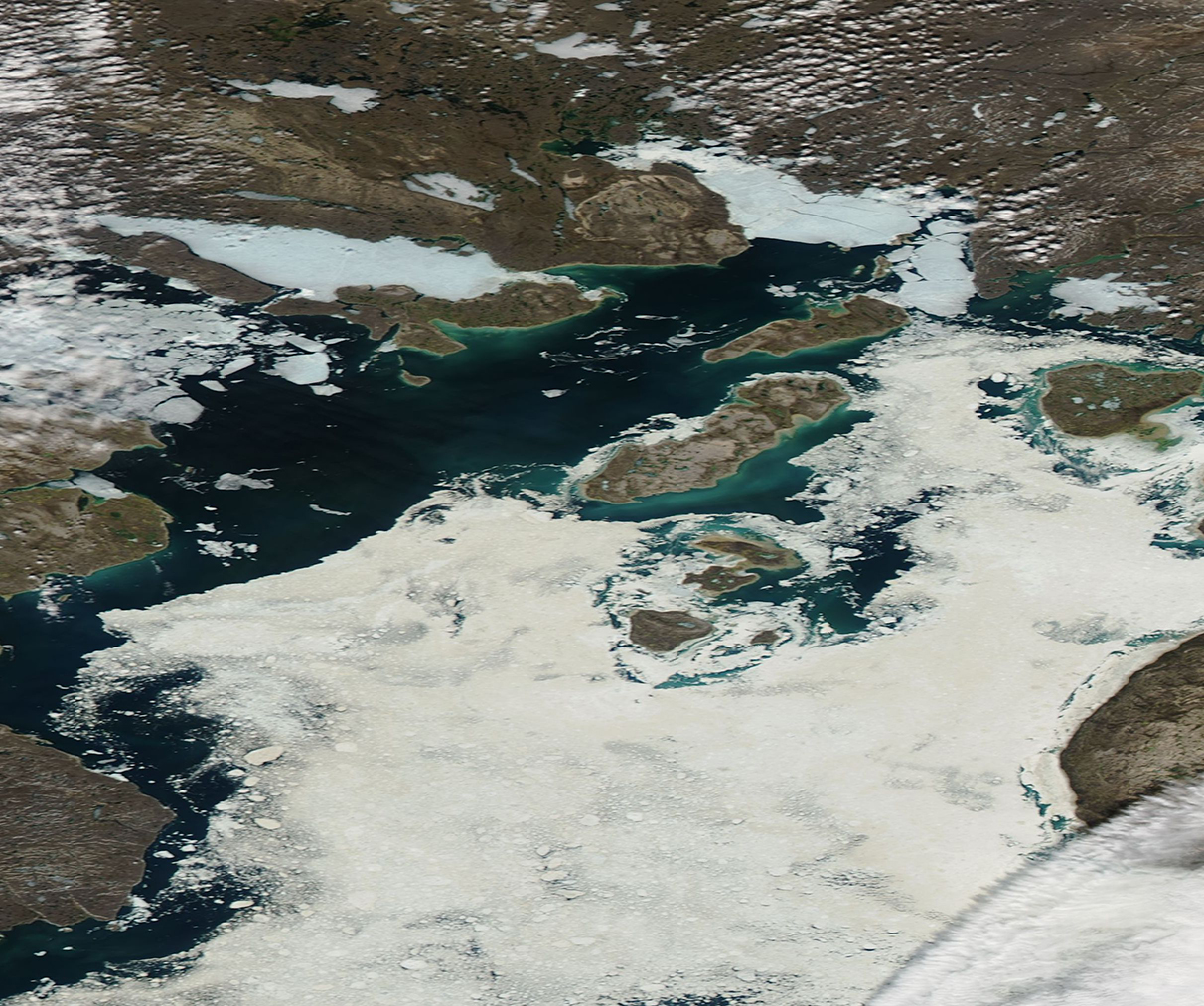
Foxe Basin sits in northeastern Canada, north of and connected with the Hudson Bay and south of Baffin Bay. As part of Canada’s Eastern Arctic waters, ice covers the basin for 9 – 10 months of the year, often not melting completely until late September.
On July 15, 2018, NASA’s Aqua satellite flew over the Foxe Basin, allowing the Moderate Resolution Imaging Spectroradiometer (MODIS) on board to acquire a true-color image of melting ice covering the blue waters of the Bay.
Streaks and swirls of greens and blues color the areas of open water. Some of the color may be caused by floating sediment, especially next to the coastline. The most likely cause of most of the color is phytoplankton – small, plant-like organisms that live in these waters year-round. Typically present in small numbers, the hours of lengthening sunlight along with melting ice and warming temperatures encourages a robust and explosive burst of growth. These large colonies – also called “blooms” – can easily be seen from space.
Image Facts
Satellite:
Aqua
Date Acquired: 7/15/2018
Resolutions:
1km (330.9 KB), 500m (846.2 KB), 250m (716.1 KB)
Bands Used: 1,4,3
Image Credit:
Jeff Schmaltz, MODIS Land Rapid Response Team, NASA GSFC
