
Images


August 22, 2018 - Wildfires in British Columbia
 Tweet
Tweet
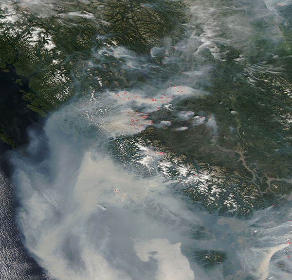
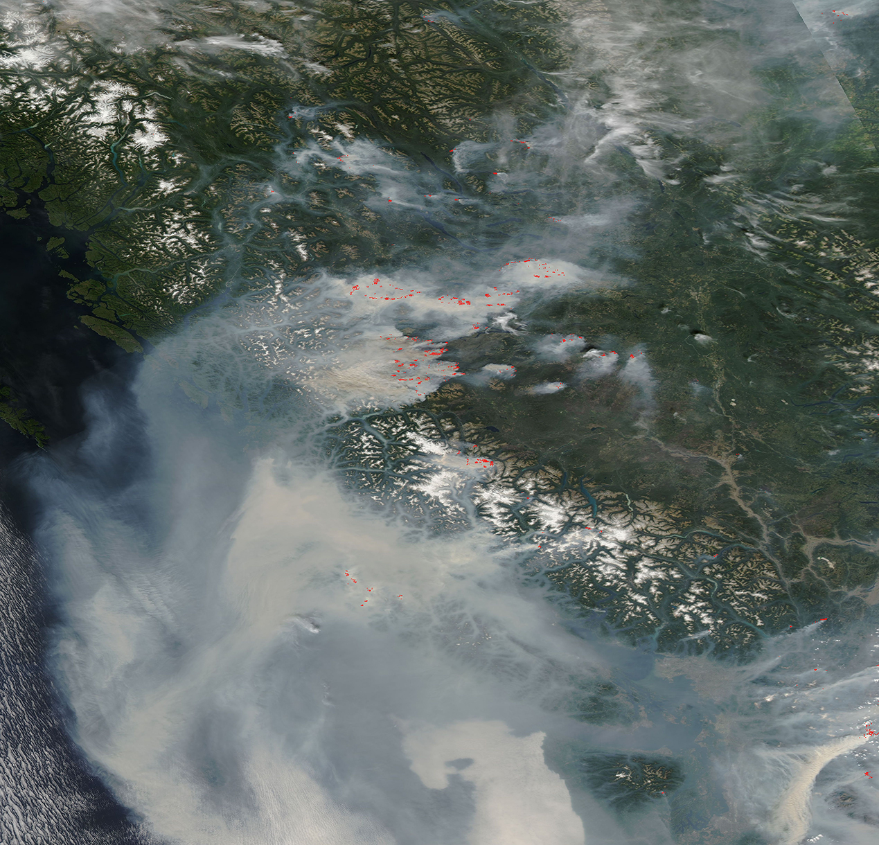
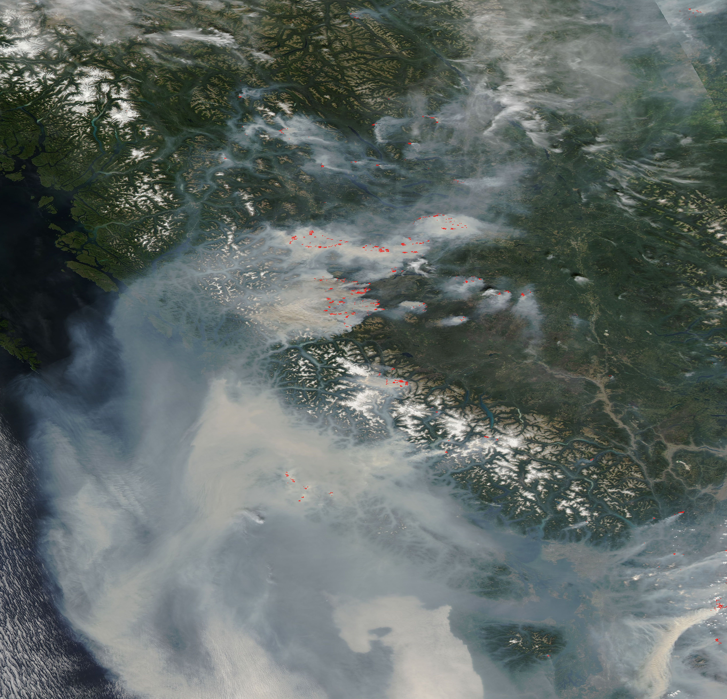
When lightning storms passed over the Canadian province of British Columbia in July and August 2018, they ignited several hundred fires in forests that were already primed to burn. Abnormally hot, dry weather had stressed vegetation and parched the soil. And infestations of mountain pine beetles had left many forests with large numbers of dead trees. By the morning of August 21, British Columbia’s Wildfire Service reported 55 large fires remained active throughout the province.
The Moderate Resolution Imaging Spectroradiometer (MODIS) on NASA’s Aqua satellite flew over western Canada and acquired a true-color image of many dozens of fire and dense gray smoke on August 20. The prevailing wind is blowing most of the smoke westward then southward, where it mingles with copious, thick smoke from fires in the western United States, creating a toxic atmospheric brew that completely obscures much of the landscape – including Vancouver Island and northern Washington State.
Plumes of wildfire smoke can have a significant impact on people and the environment. Small particles in smoke pose a health risk because they can easily enter the lungs and bloodstream. And dark particles in smoke can land on snow and ice and accelerate melting by absorbing heat and reducing the reflectivity of the surface. Ash falling on water surfaces of lakes and streams impact water quality and chemistry and may affect aquatic plants and organisms.
Image Facts
Satellite:
Aqua
Date Acquired: 8/20/2018
Resolutions:
1km (1.2 MB), 500m (3 MB), 250m (2.3 MB)
Bands Used: 1,4,3
Image Credit:
MODIS Land Rapid Response Team, NASA GSFC
