
Images


October 10, 2018 - Hurricane Michael
 Tweet
Tweet
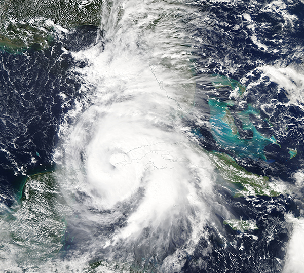
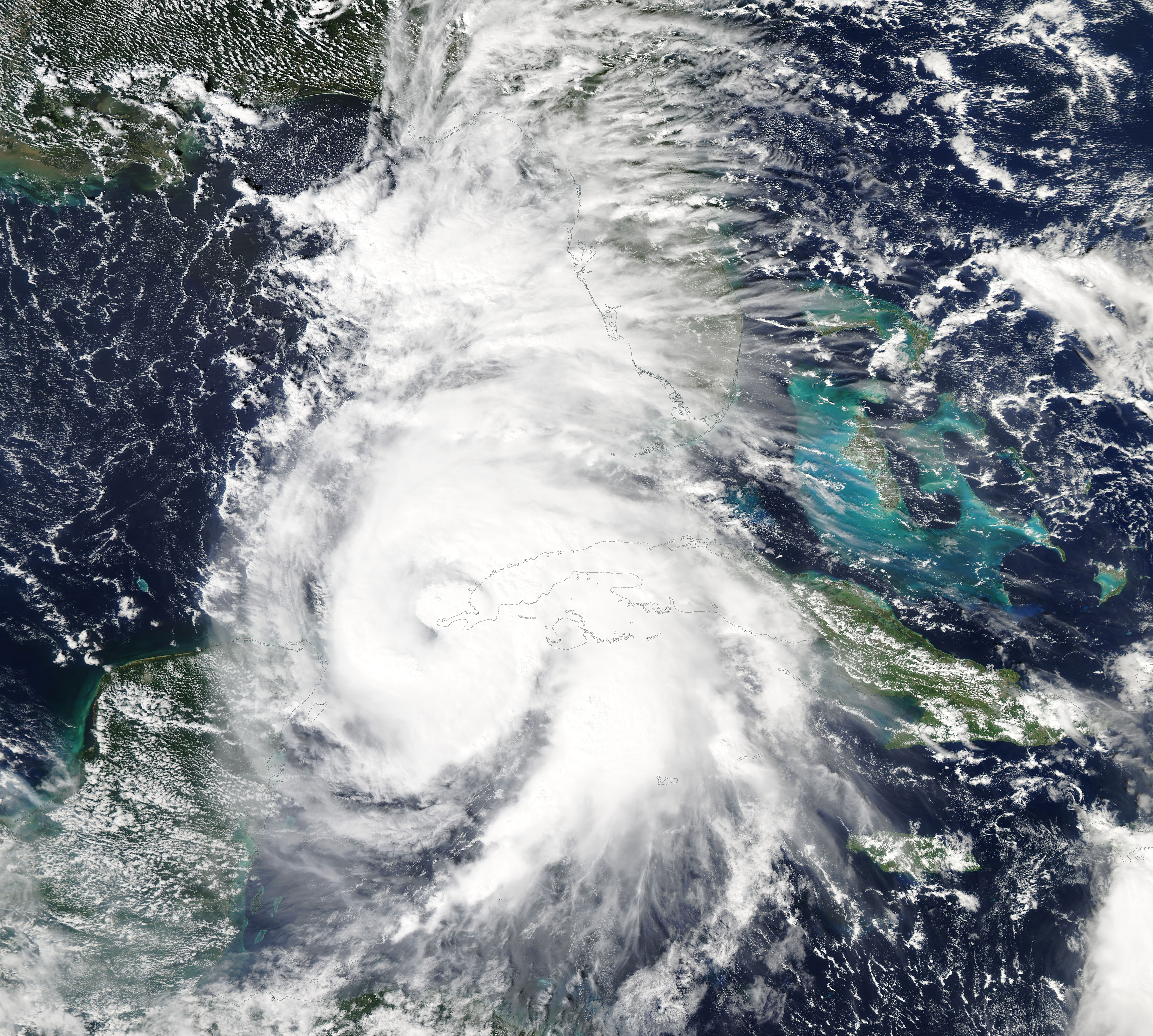
On October 8, 2018, Hurricane Michael was mustering strength as it took direct aim at the panhandle of Florida. The Moderate Resolution Imaging Spectroradiometer (MODIS) aboard NASA’s Aqua satellite acquired a spectacular true-color image of the large storm as it strengthened in the Gulf of Mexico.
On 11:00 p.m. EDT on October 8, the National Hurricane Center (NHC) reported the Category 1 storm sat about 485 miles (780 km) south of Panama City, Florida. Michael was producing heavy rainfall and carrying maximum sustained winds of 90 mph (145 km/h) as it moved northward at 12 mph (19 km/h).
The center of Michael was moving over the western tip of Cuba at 2:00 p.m. on October 8, bringing heavy rain and hurricane-force wind along with it. At the time this image was acquired, the poorly-formed eye was over the province of Pinar del Rio, Cuba, while the western bands were bringing rain to the Yucatan Peninsula, Mexico. Early reports of damage in Cuba include reports of storm surge causing flooding, sunken boats, and damages to homes.
On October 9, Michael managed to strengthen despite facing significant westerly shear in the Caribbean Sea, something the National Hurricane Center called “most unusual.” It then passed into an area of low shear and warm ocean water, where it continued to intensify. At 8:00 p.m. EDT, the NHC reported that Hurricane Michael’s maximum sustained winds had reached 120 mph (193 km/h), or a strong Category 3 Hurricane. It was located about 255 mi (410 km) south of Panama City and about 235 mi (375 km) south southwest of Apalachicola, Florida and moving north at 12 mph (19 mph).
The storm is forecast to turn towards the northeast and is expected to make landfall on the Florida Panhandle or Florida’s Big Bend area on October 10. After landfall it is expected to move across the southeastern United States, moving across the Mid-Atlantic coast then over the Atlantic Ocean by October 12.
Michael is also forecast to continue to strengthen to near Category 4 strength by the time it makes landfall, and weakening will as Michael moves across the U.S. A dangerous storm surge is expected and may be as much as 13 feet in some areas. Heavy rain is expected along the entire path of Michael as it passes over the land, and hurricane conditions are forecast for parts of the Florida Panhandle, southeastern Alabama and southwestern Georgia.
Image Facts
Satellite:
Aqua
Date Acquired: 10/8/2018
Resolutions:
1km (3.6 MB), 500m (9.6 MB), 250m (8.4 MB)
Bands Used: 1,4,3
Image Credit:
MODIS Land Rapid Response Team, NASA GSFC
