
Images


October 12, 2018 - English Channel
 Tweet
Tweet
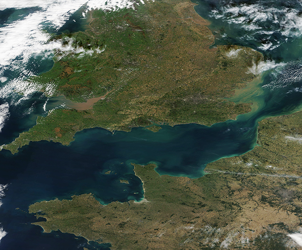
Covering about 29,000 square miles (75,000 square km), the English Channel stretches about 350 miles (560 km) between the North Sea and the Atlantic Ocean and separates southern England from northern France. At the widest point it spans 150 miles (240 km) while the width pinches to only 20.7 miles (33.3 km) at the Strait of Dover. The Channel supports some of the heaviest shipping traffic in the world.
On October 9, 2018, the Moderate Resolution Imaging Spectroradiometer (MODIS) aboard NASA’s Terra satellite acquired a true-color image of the English Channel.
The tan colors in the blue waters are primarily caused by sediment, which pours into the channel from several sources. One of the largest source is the River Thames via the Thames Estuary just east of the Strait of Dover. Sediment also spills into the Channel from runoff from rainwater and other streams and rivers in both England and France. Some of the color is likely also from phytoplankton – microscopic plant-like organisms that live in these waters year round and begin to grow robustly when conditions are right. The North Sea, just to the northeast of the image, was also experiencing a large phytoplankton bloom at the time this image was acquired.
Image Facts
Satellite:
Terra
Date Acquired: 10/9/2018
Resolutions:
1km (730.2 KB), 500m (1.9 MB), 250m (1.6 MB)
Bands Used: 1,4,3
Image Credit:
MODIS Land Rapid Response Team, NASA GSFC
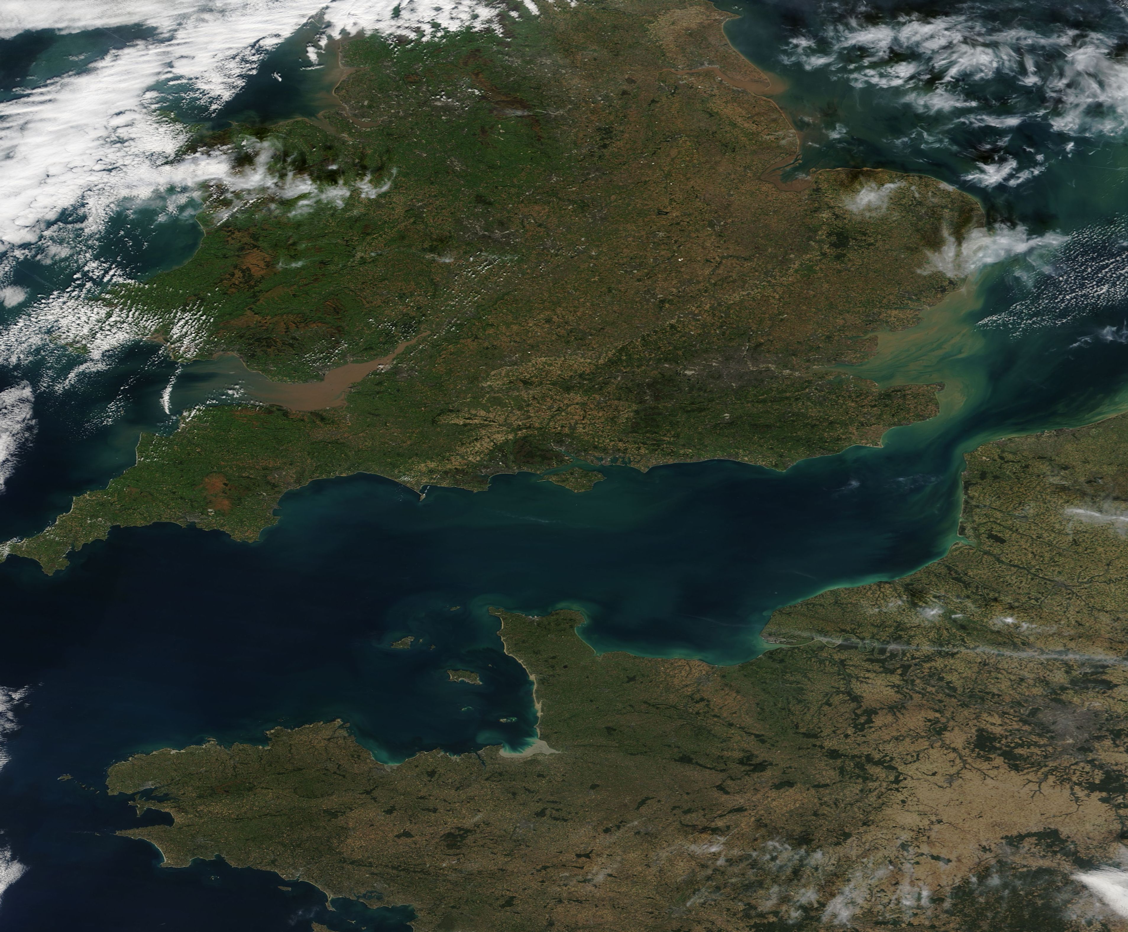
