
Images


October 13, 2018 - Hurricane Michael
 Tweet
Tweet
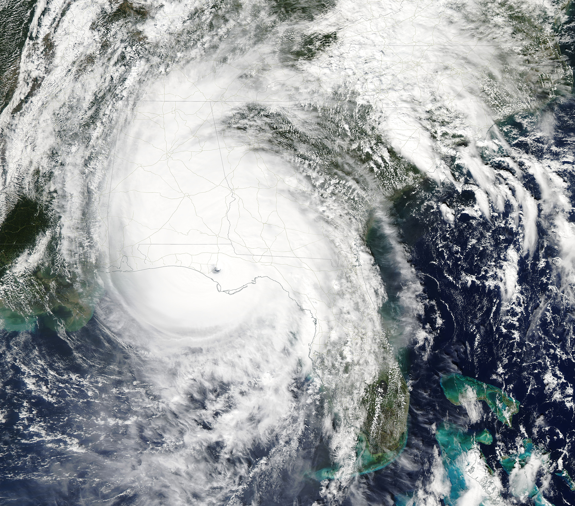
At approximately 1:30 p.m. Eastern Daylight Time (17:30 Universal Time) on October 10, 2018, Hurricane Michael made landfall near Mexico Beach, Florida. Wind speeds were estimated to be 155 miles (250 kilometers) per hour, making the Category 4 hurricane the strongest storm on record to hit the Florida Panhandle.
Hurricane Michael utterly ravaged a large portion of the coastal towns nearest landfall, including Mexico Beach which has been described as “total devastation”. As of Friday, October 12, FEMA officials warn that returning to the hardest-hit areas, especially Bay County, remained unsafe.
Since making landfall, Hurricane Michael weakened throughout October 10 and was downgraded to a tropical storm by October 11. It tracked across parts of Florida, Alabama, Georgia, South Carolina, North Carolina, and Virginia before heading out to the Atlantic Ocean, leaving severe property damage and deaths along its path. As of October 12, the death toll stood at 17, but it is likely to rise as emergency responders can more thoroughly evaluate the damage.
The Moderate Resolution Imaging Spectroradiometer (MODIS) aboard NASA’s Terra satellite acquired a true-color image of Hurricane Michael shortly after landfall on October 10. The large eye is just north of both Mexico Beach and Panama City, Florida.
Image Facts
Satellite:
Terra
Date Acquired: 10/10/2018
Resolutions:
1km (2.6 MB), 500m (7.2 MB), 250m (6.5 MB)
Bands Used: 1,4,3
Image Credit:
MODIS Land Rapid Response Team, NASA GSFC
