
Images


November 13, 2018 - Fires & Burn Scars in Chad
 Tweet
Tweet
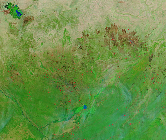
In early November, 2018, NASA’s Aqua satellite flew over southern Chad, allowing a broad view of fires and fire scars across the savanna. On November 9, the Moderate Resolution Imaging Spectroradiometer (MODIS) on board that satellite acquired a stunning false-color image that highlighted results of widespread fire damage.
False-color images combine visible and shortwave infrared light (MODIS bands 7-2-1). The burn scar appears in shades of orange and dark brown; vegetation is green; bare ground is light brown; and water is dark blue. Old burn scars tend to lighten with time as vegetation fills in the charred soils. Actively burning fire are red and smoke is blue-gray. This image shows a land that has been pock-marked with fires, both small and large, over many years. Several active fire are also burning, especially in the southwest section of the image.
“Most, if not all, fires in Africa are man-made in one of its various forms: prescribed, agricultural, accidental, or arson,” said climate and fire researcher Charles Ichoku of Howard University when speaking to NASA’s Earth Observatory in October, 2018. The veldt (grassland) fire season in southern Chad typically runs from May to November.
Image Facts
Satellite:
Aqua
Date Acquired: 11/9/2018
Resolutions:
1km (100.1 KB), 500m (293.8 KB), 250m (554.6 KB)
Bands Used: 7,2,1
Image Credit:
MODIS Land Rapid Response Team, NASA GSFC
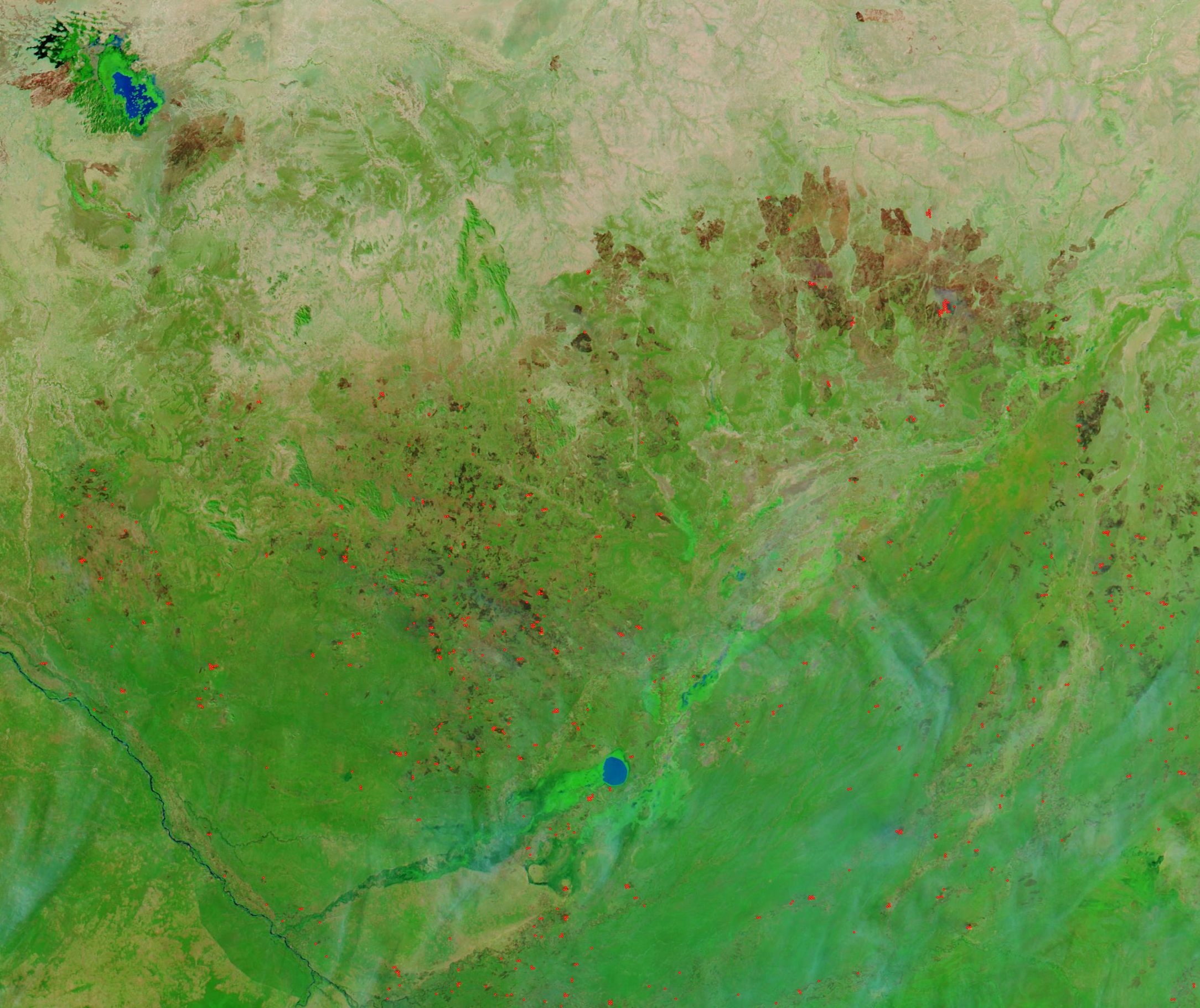
