
Images


November 18, 2018 - Snow in the Alps
 Tweet
Tweet
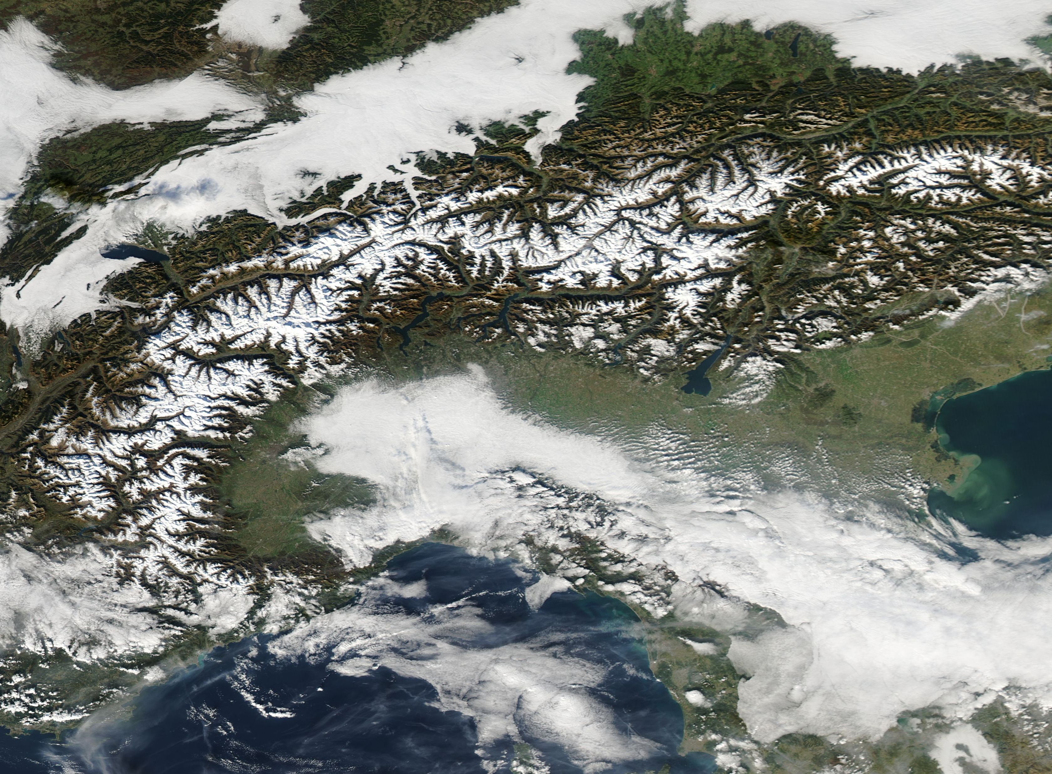
The Alps were covered in snow and surrounded by cloud on November 14, 2018. The Moderate Resolution Imaging Spectroradiometer (MODIS) on board NASA’s Aqua satellite acquired a true-color image of the wintery scene on that same day. On that day, snow blanketed the upper elevations of the Alps while low cloud (fog) hung over the plains inland as well as over the coast and much of Italy.
While fresh snow started falling across most of the Alps in October, several ski reports suggest that snowfall so far this winter has been intermittent, with hopes for cooler weather and heavier snow in the upcoming weeks. Earlier in the month, the Swiss Academy of Sciences released a report stating that Swiss glaciers have lost 2.5 percent of their volume this year – that’s about 1.4 billion cubic meters of ice melt in one year. The winter of 2017-2018 was a year of extreme snow, at least up until the end of March when, according to the report, “there was still more than twice as much snow as usual above an altitude of 2,000 meters (6,560 feet)”. Unfortunately, the temperatures from April to September were the hottest on record, with very little snowfall.
Image Facts
Satellite:
Aqua
Date Acquired: 11/14/2018
Resolutions:
1km (250.6 KB), 500m (627.5 KB), 250m (1.5 MB)
Bands Used: 1,4,3
Image Credit:
MODIS Land Rapid Response Team, NASA GSFC
