
Images


December 14, 2018 - Salt Lakes in Australia's Wheatbelt
 Tweet
Tweet
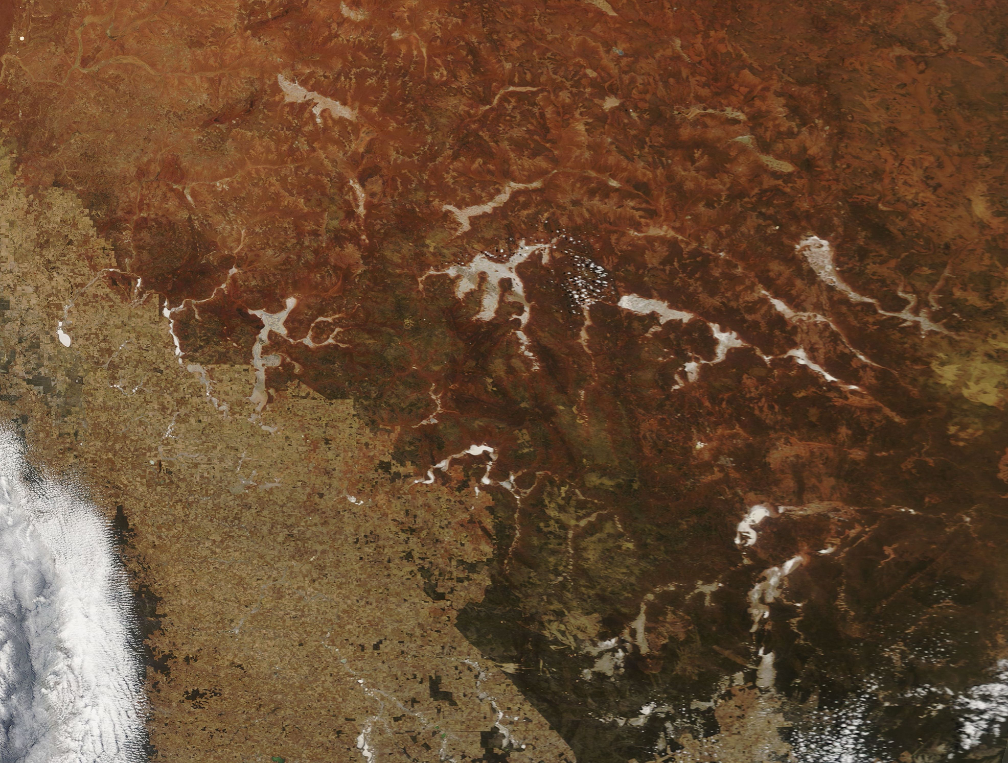
Salt has been accumulating in the soils and salt lakes of Western Australia’s Wheatbelt for tens of thousands of years, but the vast number and extent of the saline lakes in the region shows not only ancient geochemistry, but also the imprint of recent human activity. Once a diverse ecosystem rich in eucalypt woodlands and a low-height shrub-and- woodlands known as “mallee”, the Wheatbelt region of Western Australia began to be cleared in the late 1800’s for agriculture. The widespread removal of native vegetation and the replacement of deep-rooted perennial species with shallow-rooted annual crops caused a substantial reduction in water use by vegetation. This reduced use of water played a strong role in the rise in local water tables and mobilization of salt previously stored in the saline, acid soils. Known as secondary salinization, this process has increased the number of salt lakes in the region.
According to the Government of Western Australia’s Department of Environment, the waterway and wetland systems of the Wheatbelt have been shaped over millions of years by the climate and geology. The Wheatbelt landscape of today is very flat and the ancient river valleys (paleochannels) have become filled with sediment. Today, the once-flowing rivers in these remnant valleys are often reduced to chains of salt lakes that only link up and flow after exceptionally high rainfall. In most years rainfall is insufficient to cause the systems to flow and the high rates of evaporation mean that the lakes and pools are dry for much of the year.
NASA’s Terra satellite flew over part of Australia’s Wheatbelt on December 4, 2018, allowing the Moderate Resolution Imaging Spectroradiometer (MODIS) on board to acquire a true-color image of a number of saline lakes. December is nearly the end of the winter’s dry season and very little, if any, water is visible in the bright white, salt-covered lake beds.
Image Facts
Satellite:
Terra
Date Acquired: 12/4/2018
Resolutions:
1km (786.1 KB), 500m (1.8 MB), 250m (1.4 MB)
Bands Used: 1,4,3
Image Credit:
MODIS Land Rapid Response Team, NASA GSFC
