
Images


January 13, 2019 - Clouds and eddies off of Newfoundland and Labrador, Canada
 Tweet
Tweet
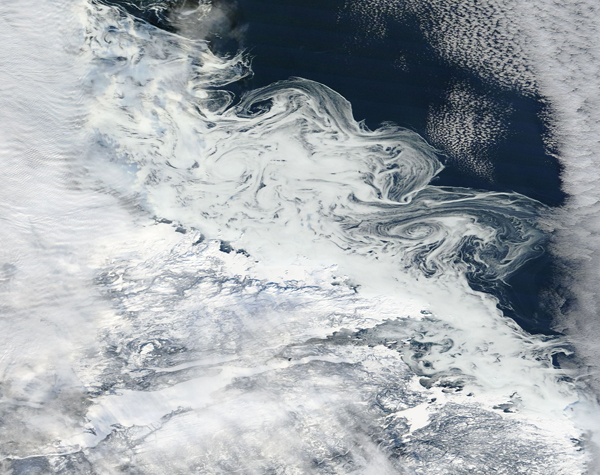
A complex pattern of clouds, snow, ice and ocean was captured in a true-color image by the Moderate Resolution Imaging Spectroradiometer (MODIS) on board NASA’s Terra satellite on January 9, 2019 as it passed over the Hamilton Inlet in Newfoundland and Labrador, Canada.
The land surrounding Hamilton Inlet, lying in the south-west third of this image, sports a snowy blanket while the waters of the inlet appear bright white, which means they are covered in ice. Heavy banks of clouds cover the western side of the image, in some places obscuring the land from view. These clouds thin as the stretch towards the east. A second bank of marine clouds can be seen alone the eastern edge of the image.
Between the banks of clouds, clear skies allow visualization of a peculiar pattern of bright white swirls just off the coast. While these appear to be white clouds, they are almost certainly actually formed by ice caught in the offshore eddies caused by the Labrador Current. The Labrador Current flows from the Arctic Ocean southward along the coast of Labrador and around Newfoundland to the east coast of Nova Scotia.
Each year, Arctic sea ice grows through the winter, reaching its maximum extent around March. It then melts through the summer, reaching its minimum in September. By January, Arctic freeze-up is well underway in many locations, such as off the coast of Labrador and Newfoundland. As ice begins to freeze, it remains malleable and can easily break into many small fragments. Such fragments can be stirred by ocean currents into cyclone-shaped vortices that may range in size from a few hundred feet to a few hundred miles in diameter. Ice eddies are most common in the spring and fall months when the ice is warm enough to fragment, but cold enough to remain frozen as it is moved by the ocean current.
Image Facts
Satellite:
Terra
Date Acquired: 1/9/2019
Resolutions:
1km (263 KB), 500m (760.2 KB), 250m (706.6 KB)
Bands Used: 1,4,3
Image Credit:
MODIS Land Rapid Response Team, NASA GSFC
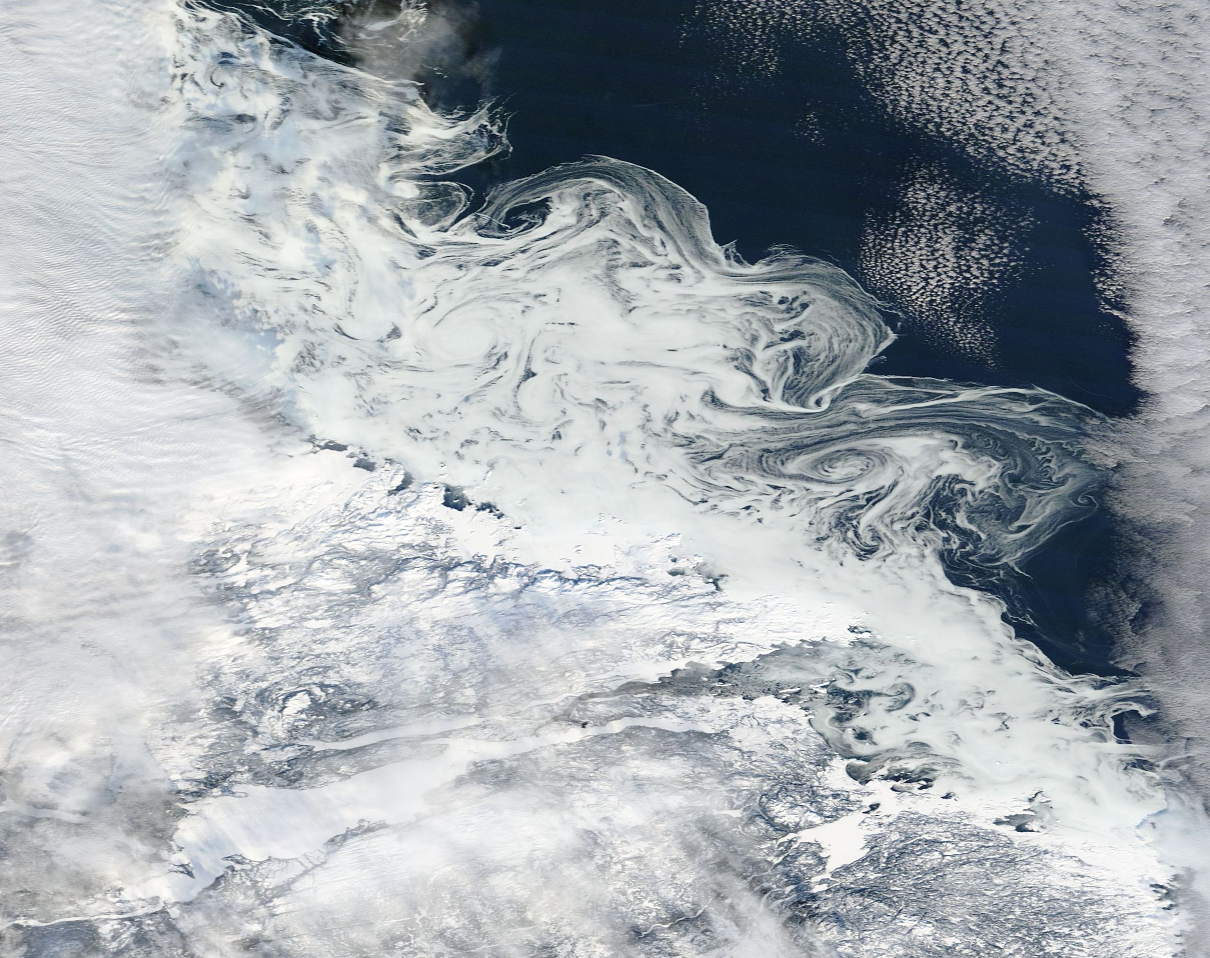
