
Images


January 15, 2019 - Snow across New York
 Tweet
Tweet
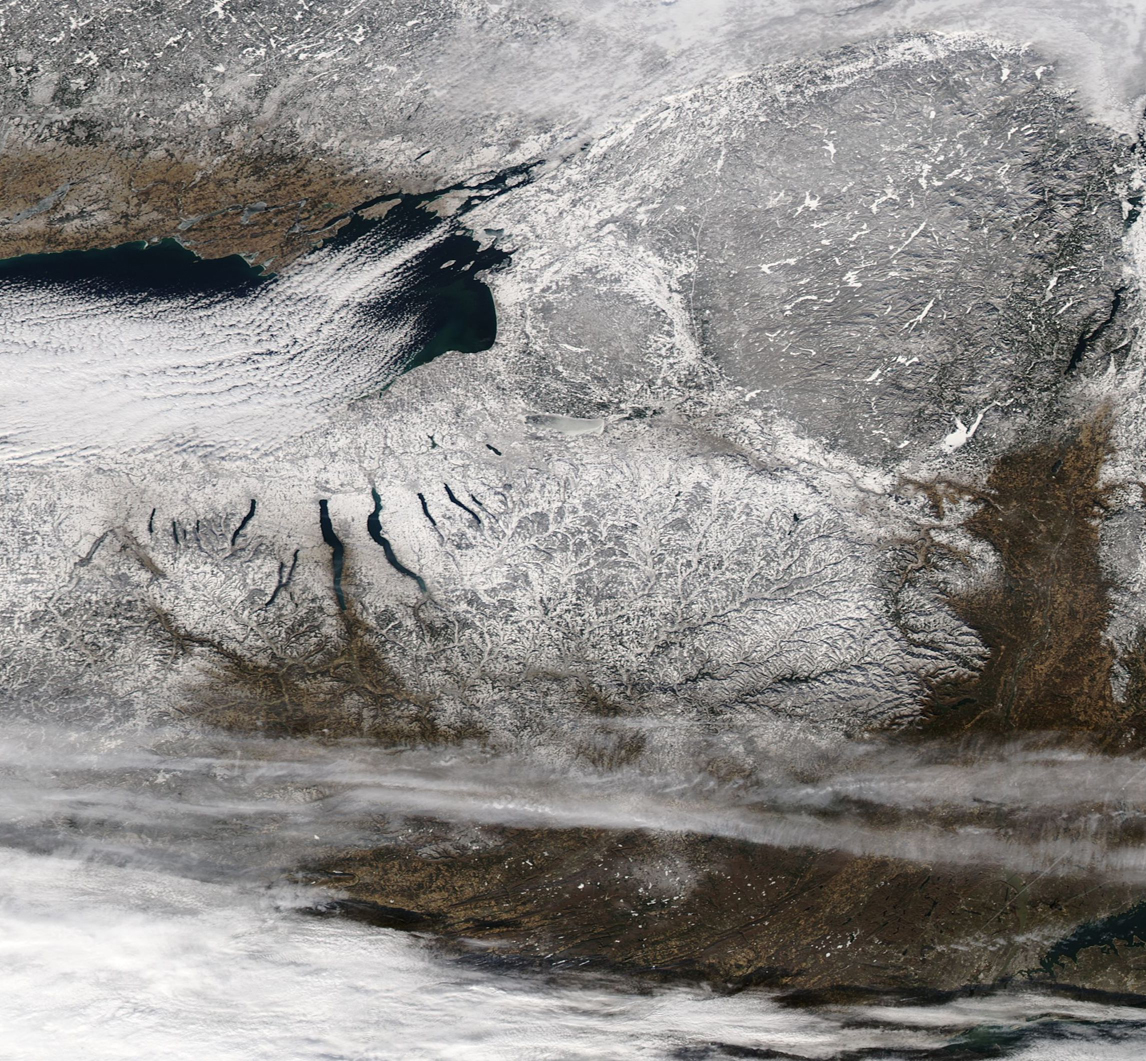
A blanket of white coated the state of New York in mid-January 2019. The Moderate Resolution Imaging Spectroradiometer (MODIS) on NASA's Aqua satellite acquired a true-color image of a wintery scene centered on New York on January 13.
In the Adirondacks, near the northeast section of the image, bright white covers almost all of the lakes, indicating sub-freezing temperatures have gripped the area for an extended time. In contrast, the Finger Lakes, which stretch from north to south in a roughly parallel, finger-like pattern, remain unfrozen and appear blue. Parallel lines of cloud, known as cloud streets, stretch over Lake Ontario. This cloud pattern often occurs when cold air blows across warmer waters, creating rising cylinders of air. Clouds form at the top of the cylinder while, as the air cools and subsequently falls, the sky is clear. The "streets" of cloud form parallel to the prevailing wind.
While the wintery scene tells a tale of cold, stormy weather, this area of New York lies just out of the crosshairs of a severe winter storm which raced across the United States from January 10 – 13. According to The Weather Channel, that storm swept about 1,500 miles across the Rockies, Great Plains, Midwest and Mid-Atlantic region in a swath that affected twenty-one states, dropping a high-snow total of 20.3 inches in Columbia Missouri. On January 13, the storm was pounding Maryland, Pennsylvania, and New Jersey but stayed south of New York. The band of heavy cloud at the bottom of this image likely represents the northern edge of the storm.
Image Facts
Satellite:
Aqua
Date Acquired: 1/13/2019
Resolutions:
1km (320.9 KB), 500m (1018.4 KB), 250m (1.1 MB)
Bands Used: 1,4,3
Image Credit:
MODIS Land Rapid Response Team, NASA GSFC
