
Images


January 18, 2019 - Fires burning in South Sudan, Ethiopia, and Uganda
 Tweet
Tweet
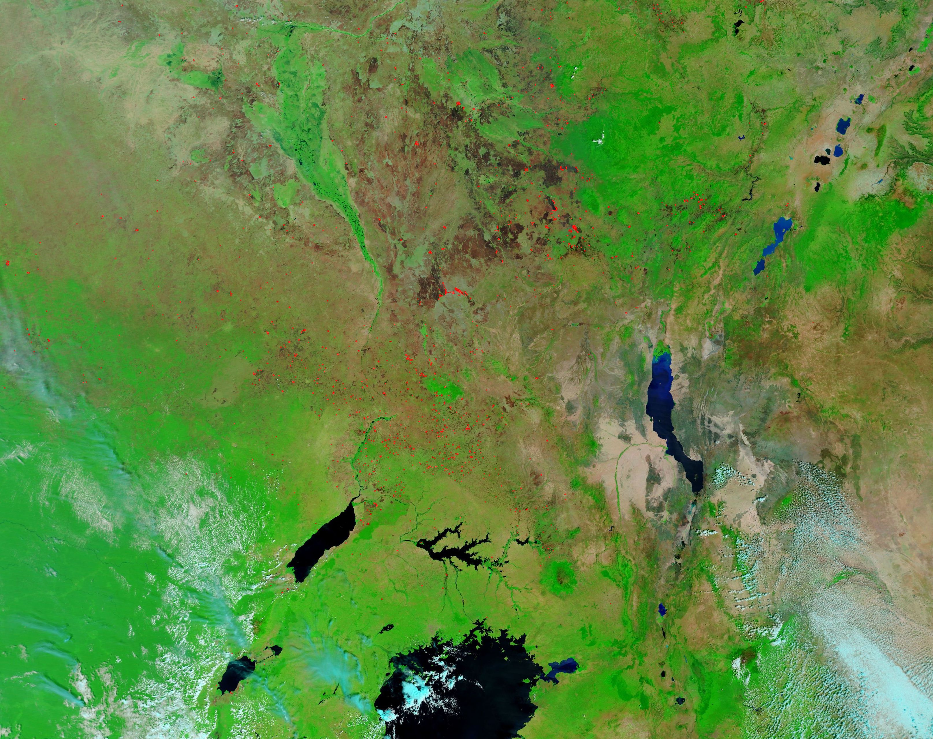
Many dozens of fires speckled the landscape of Uganda, South Sudan, and Ethiopia in mid-January 2019. The Moderate Resolution Imaging Spectroradiometer (MODIS) on board NASA’s Terra satellite acquired a false-color image of the region that highlights the fires on January 13.
Each red “hot spot” is an area where the thermal bands detected high temperatures. When combined with typical smoke, as can be seen in some locations in this image, such hot spots are diagnostic for actively burning fire. Hot spots are easily seen in true-color images, which are created with visible light, false-color images—which use both infrared and visible light—can give additional information, especially in regards to burn scars. In this false-color image vegetation appears bright green, cloud is pale blue, water appears a deeper blue, open land appears tan and fresh burn scars range from black to brown. Older burn scars tend to be lighter than fresh.
Clusters of small hot spots mark the vegetated area northwest of Lake Victoria, primarily in Uganda and southwest South Sudan. As we move to the northeast, the fires appear to trend towards becoming larger and further apart. The time of year and location of the numerous small fires suggests they are likely to be agricultural fires, which have been set to clear land or manage pasture. The large clusters that edge blackened areas, however, are much more likely to be wildfires which ring fire scars.
Image Facts
Satellite:
Terra
Date Acquired: 1/13/2019
Resolutions:
1km (411.4 KB), 500m (1.4 MB), 250m (4.8 MB)
Bands Used: 1,4,3
Image Credit:
MODIS Land Rapid Response Team, NASA GSFC
