
Images


January 22, 2019 - Northern Patagonia
 Tweet
Tweet
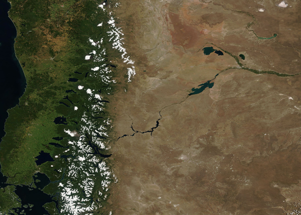
On January 10, 2019, the Moderate Resolution Imaging Spectroradiometer (MODIS) on board NASA’s Terra satellite acquired a true-color image of a summer’s day in northern Patagonia.
The Patagonian Andes are a continental landmark easily visible from space. The border between Chile (west) and Argentina (east) run along the Andes. The winds blowing onshore from the Pacific Ocean brings plenty of moisture to Chile allowing for dense, vigorous green vegetation. As the humid winds hit the mountains, they drop any remaining moisture. Snow is copious in the wintertime in the high elevations, with some snow lingering through the summer time. The lack of moisture east of the Andes creates massive rain shadow in Argentina, which sees less than 8 inches (200 mm) of rain in an entire year.
Image Facts
Satellite:
Terra
Date Acquired: 1/10/2019
Resolutions:
1km (431.3 KB), 500m (1.2 MB), 250m (1 MB)
Bands Used: 1,4,3
Image Credit:
MODIS Land Rapid Response Team, NASA GSFC
