
Images


March 14, 2019 - Strait of Gibraltar
 Tweet
Tweet
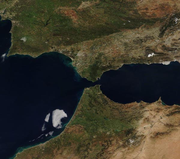
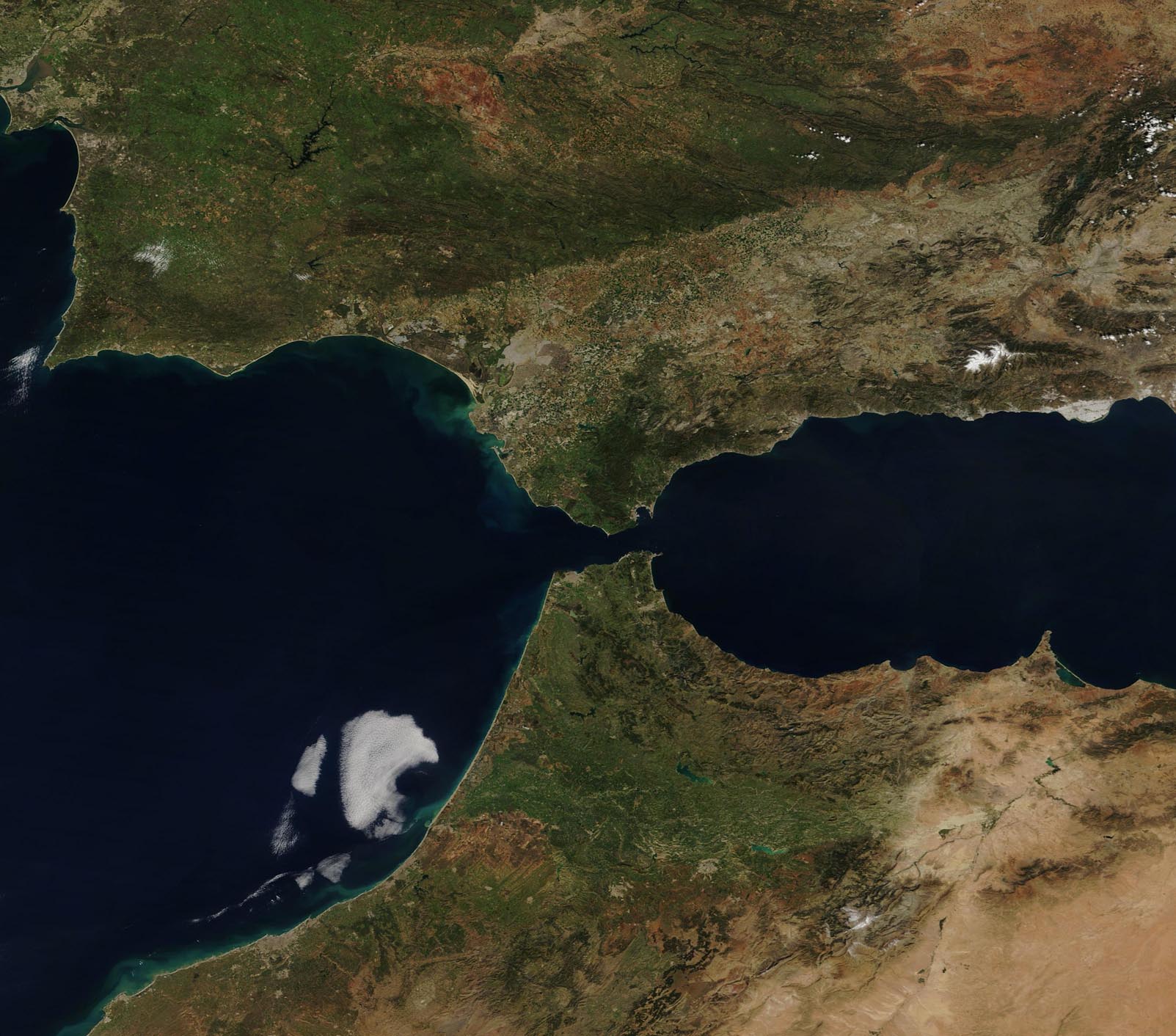
The narrow Strait of Gibraltar is the gatekeeper for water exchange between the Atlantic Ocean and Mediterranean Sea. The Strait is only about 8 miles (12.9 km) wide and 36 miles (58 km) long. The waters separate Gibraltar and Peninsular Spain in the north from Morocco and Ceuta in the south.
Gibraltar is a British Overseas Territory on Spain’s south coast and home to a tall limestone ridge known as the Rock of Gibraltar. Ceuta is a Spanish autonomous city on the north coast of Africa.
The Moderate Resolution Imaging Spectroradiometer (MODIS) on board NASA’s Terra satellite acquired a true-color image of Europe (north), Africa (south), and the Strait of Gibraltar on March 11, 2019.
Image Facts
Satellite:
Terra
Date Acquired: 3/11/2019
Resolutions:
1km (112.3 KB), 500m (299.4 KB), 250m (1 MB)
Bands Used: 1,4,3
Image Credit:
MODIS Land Rapid Response Team, NASA GSFC
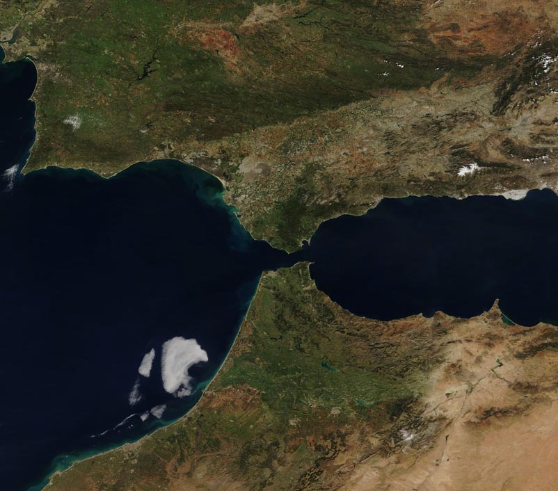
