
Images


July 10, 2019 - Tropical Cyclone Barbara
 Tweet
Tweet
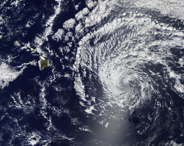
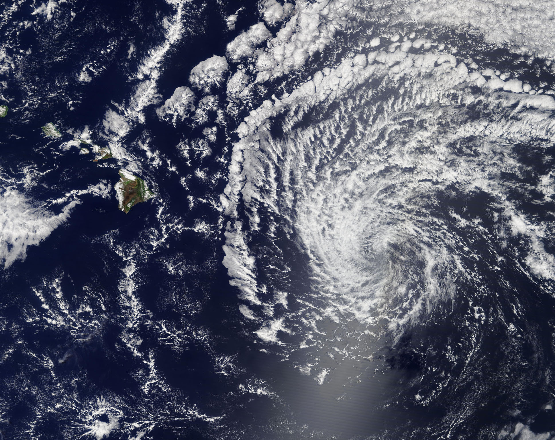
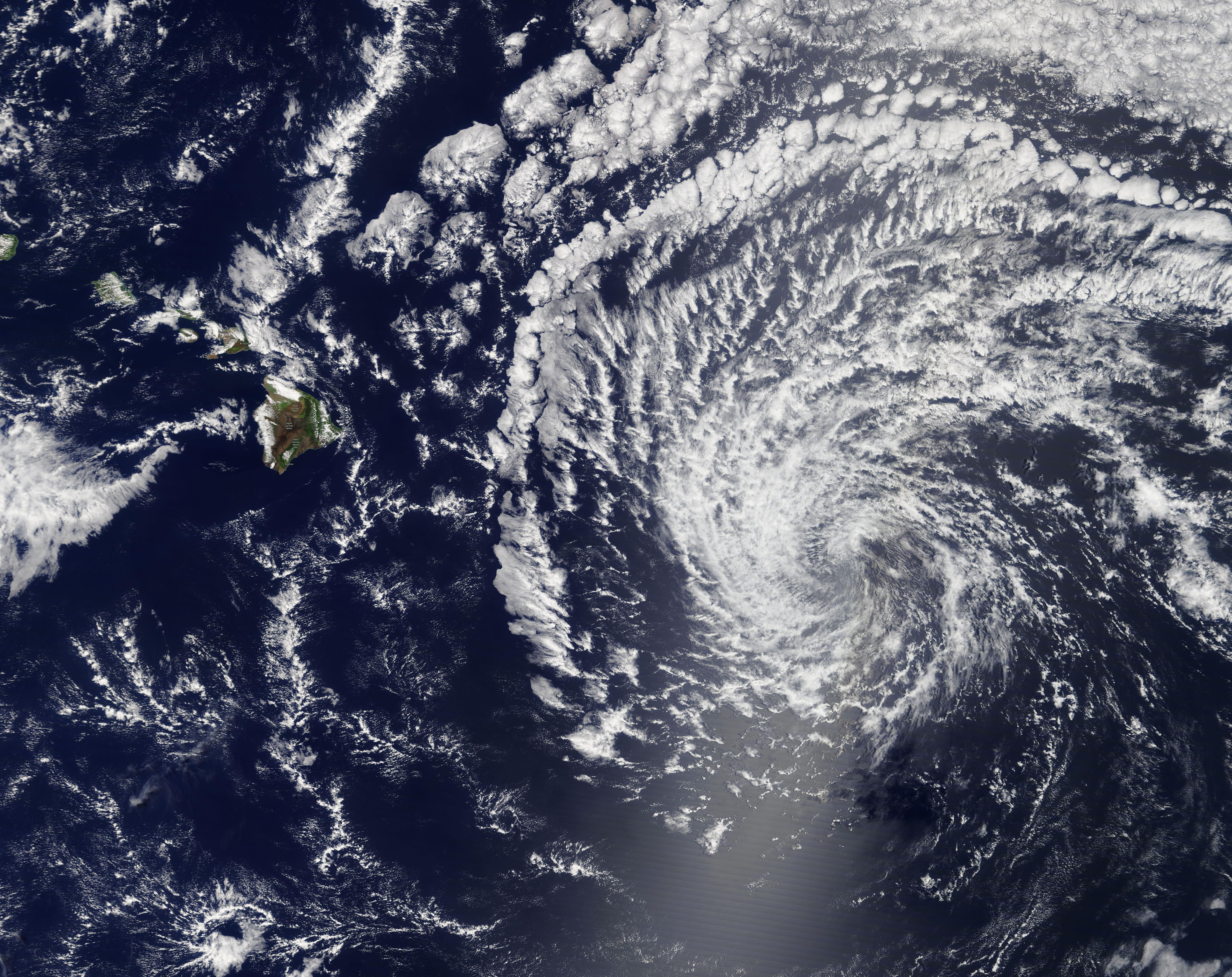
Once a strong Category 4 storm barreling across the Pacific Ocean, Tropical Cyclone Barbara fortunately dissipated before reaching Hawaii. On July 7, 2019, the Moderate Resolution Imaging Spectroradiometer (MODIS) on board NASA’s Terra satellite acquired a true-color image of the post-tropical cyclone approaching the Big Island of Hawaii. By July 9, the remnants of Barbara brought hot, humid weather to the islands, along with moderate precipitation.
Tropical Storm Barbara formed on Sunday, June 30 in the Eastern Pacific Ocean over 800 miles from the coast of western Mexico and slowly intensified as it moved westward. Barbara strengthened to become the first hurricane of the season on July 2, then rapidly intensified into a major hurricane. By 11:00 p.m. EDT on July 2 (0300 UTC on July 3), Tropical Cyclone Barbara’s winds peaked at 155 mph (250 km/h), bringing it to a very strong Category 4 storm on the Saffir-Simpson Hurricane Wind Scale. Category 5 begins at 157 mph (252 km/h). By July 3, the storm was slowly but steadily weakening. The National Hurricane Center issued the last advisory on the Barbara early in the morning of July 6, declaring it a post-tropical cyclone with winds of 40 mph (65 km/h).
Image Facts
Satellite:
Terra
Date Acquired: 7/7/2019
Resolutions:
1km (816 KB), 500m (2.5 MB), 250m (7.1 MB)
Bands Used: 1,4,3
Image Credit:
MODIS Land Rapid Response Team, NASA GSFC
