
Images


August 17, 2019 - Fires in Upemba National Park
 Tweet
Tweet
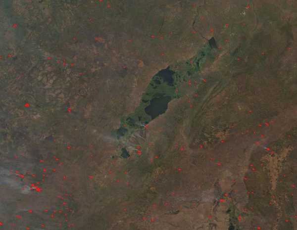
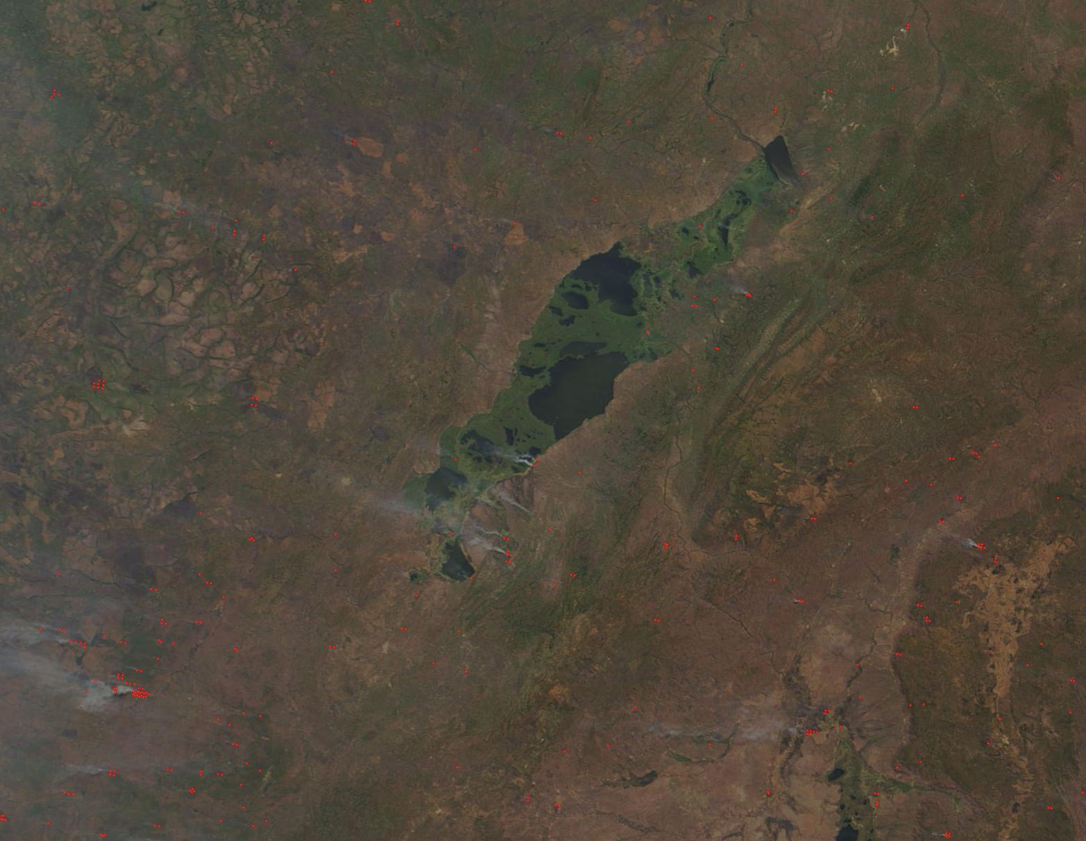
Thousands of fires burn across the Democratic Republic of Congo each year, most deliberately set to manage land for agricultural purposes. Across most of Africa, people burn residue to clear fields after harvest and they burn forest and other natural vegetation to clear new land for farming. Fire is also used to drive game and grazing animals to new locations and stimulate new growth in pastures. This annual burning is part of traditional agricultural practice and has taken place for hundreds, possibly thousands of years. Such widespread burning can have a strong impact on air quality and public health, as well as on climate and natural resources.
On August 16, 2019, the Moderate Resolution Imaging Spectroradiometer (MODIS) on board NASA’s Terra satellite flew over southern Democratic Republic of Congo (DRC) and captured a true-color image of many dozens of fires burning in vegetated areas, including within the protected parkland of Upemba National Park.
Established in 1939, Upemba is one of the oldest national parks of the DRC and was established to help protect the high biodiversity found in the area east and southeast of Lake Upemba. The park is home to about 1,800 different species, including the endemic Katanga impala. It is also the only national park in the DRC with cheetah and zebra and supports a thinning herd of elephant. Several bird species within the park are listed as threatened or endangered, including spotted ground-thrush and wattled crane, and one type of frog, Schmidt’s snouted frog, exists nowhere else on Earth.
Despite the attempt to protect the land and life within the park boundary, Upemba National Park faces pressure from many fronts, including poaching, illegal settlements, and mining. Heavily armed militia have occupied areas within the park, making enforcement of laws difficult, including but not limited to restrictions on burning.
Image Facts
Satellite:
Terra
Date Acquired: 8/16/2019
Resolutions:
1km (13.7 KB), 500m (48.7 KB), 250m (173.2 KB)
Bands Used: 1,4,3
Image Credit:
MODIS Land Rapid Response Team, NASA GSFC
