
Images


September 14, 2019 - Tropical Storm Kiko
 Tweet
Tweet
Kiko developed on September 11, 2019 as Tropical Depression 13E and strengthened into a tropical storm by September 12. Once it attained tropical storm status, it was named Kiko.
The Moderate Resolution Imaging Spectroradiometer (MODIS) on board NASA’s Aqua satellite acquired a true-color image of Tropical Storm Kiko on the morning of September 12. The storm sported a large, moderately well-defined eye with convective bands spiraling into the center. The clouds extended well north of the center.
At 11:00 a.m. EDT (1500 UTC), the National Hurricane Center (NHC) reported that the center of Tropical Storm Kiko was located near latitude 16.9 degrees north and longitude 114.4 degrees west. Kiko is far from land and about 505 miles (815 km) southwest of the southern tip of Baja California, Mexico. Kiko was moving toward the west-northwest near 10 mph (17 km/h) and this motion is expected to continue through September 16. Maximum sustained winds were near 40 mph (65 km/h) with higher gusts. Estimated minimum central pressure is 1004 millibars.
Some strengthening is forecast during the next 48 hours, and Kiko is expected to approach hurricane strength later this weekend.
Image Facts
Satellite:
Aqua
Date Acquired: 9/12/2019
Resolutions:
1km (1.6 MB), 500m (4.6 MB), 250m (3.8 MB)
Bands Used: 1,4,3
Image Credit:
MODIS Land Rapid Response Team, NASA GSFC
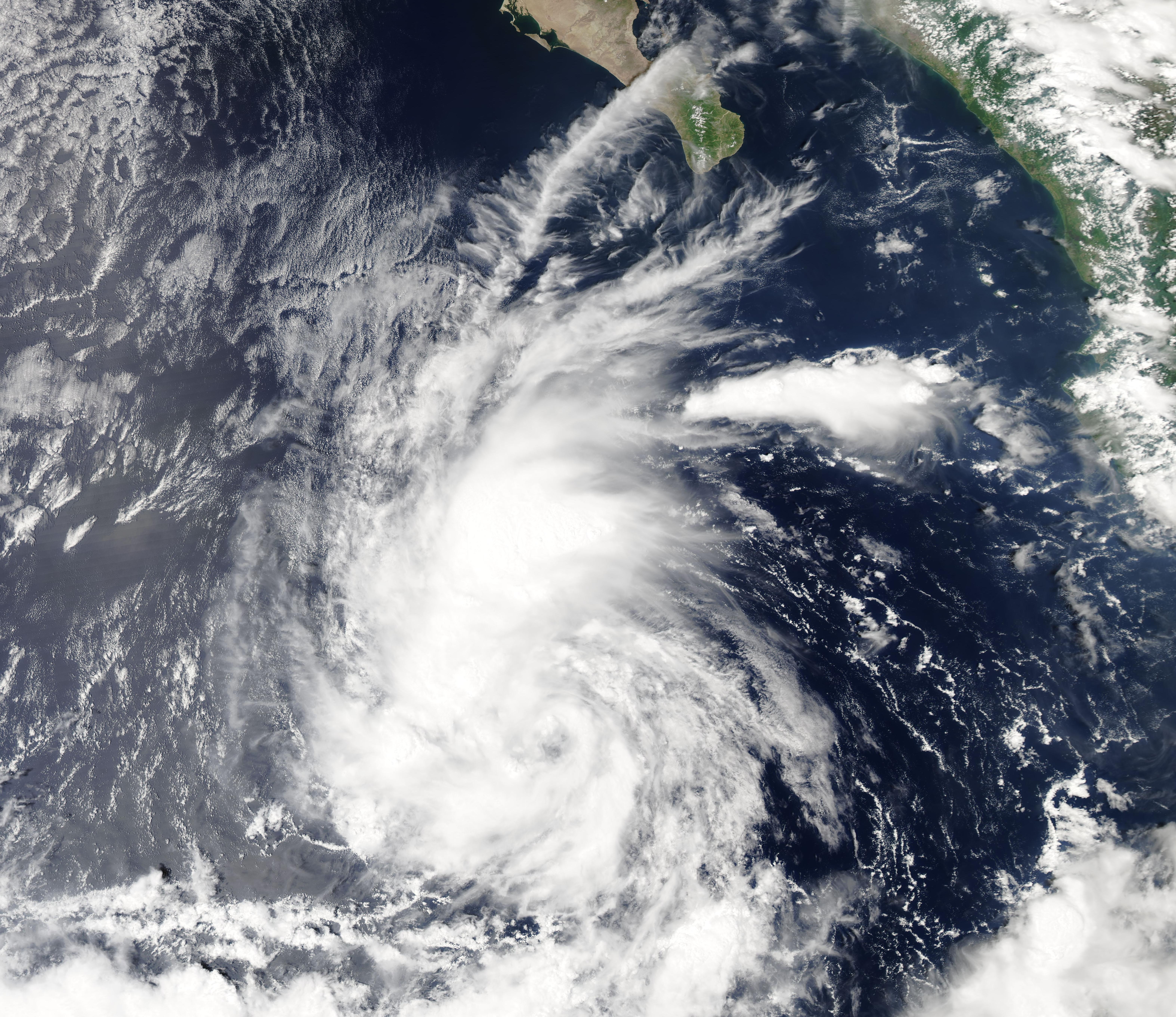
