
Images


September 20, 2019 - The Southern Alps
 Tweet
Tweet
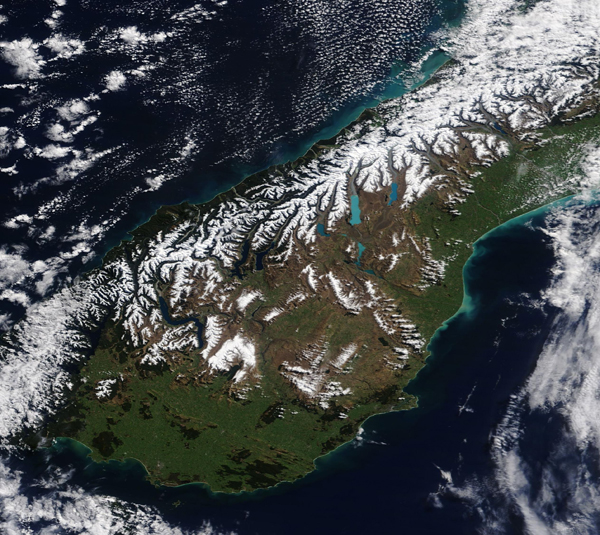
On September 15, 2019, the Moderate Resolution Imaging Spectroradiometer (MODIS) on board NASA’s Terra satellite acquired a true-color image of a spring day in New Zealand’s Southern Alps.
The snow-capped mountain chain extends about 400 miles (650 km) along the western side of New Zealand’s South Island. The higher peaks keep snow cover year-round and are often covered in cloud. From the high peaks, glaciers have gouged long, slender mountain lakes and coastal fiords. Glacial flour—the fine-grained, silt-sized rock created by the grinding motion of glaciers over underlying rock—colors water of some of the glacial lakes, such as the bright blue Lake Pukaki.
Image Facts
Satellite:
Terra
Date Acquired: 9/15/2019
Resolutions:
1km (367.2 KB), 500m (1 MB), 250m (1.9 MB)
Bands Used: 1,4,3
Image Credit:
MODIS Land Rapid Response Team, NASA GSFC
