
Images


November 6, 2019 - Tropical Cyclone Maha
 Tweet
Tweet
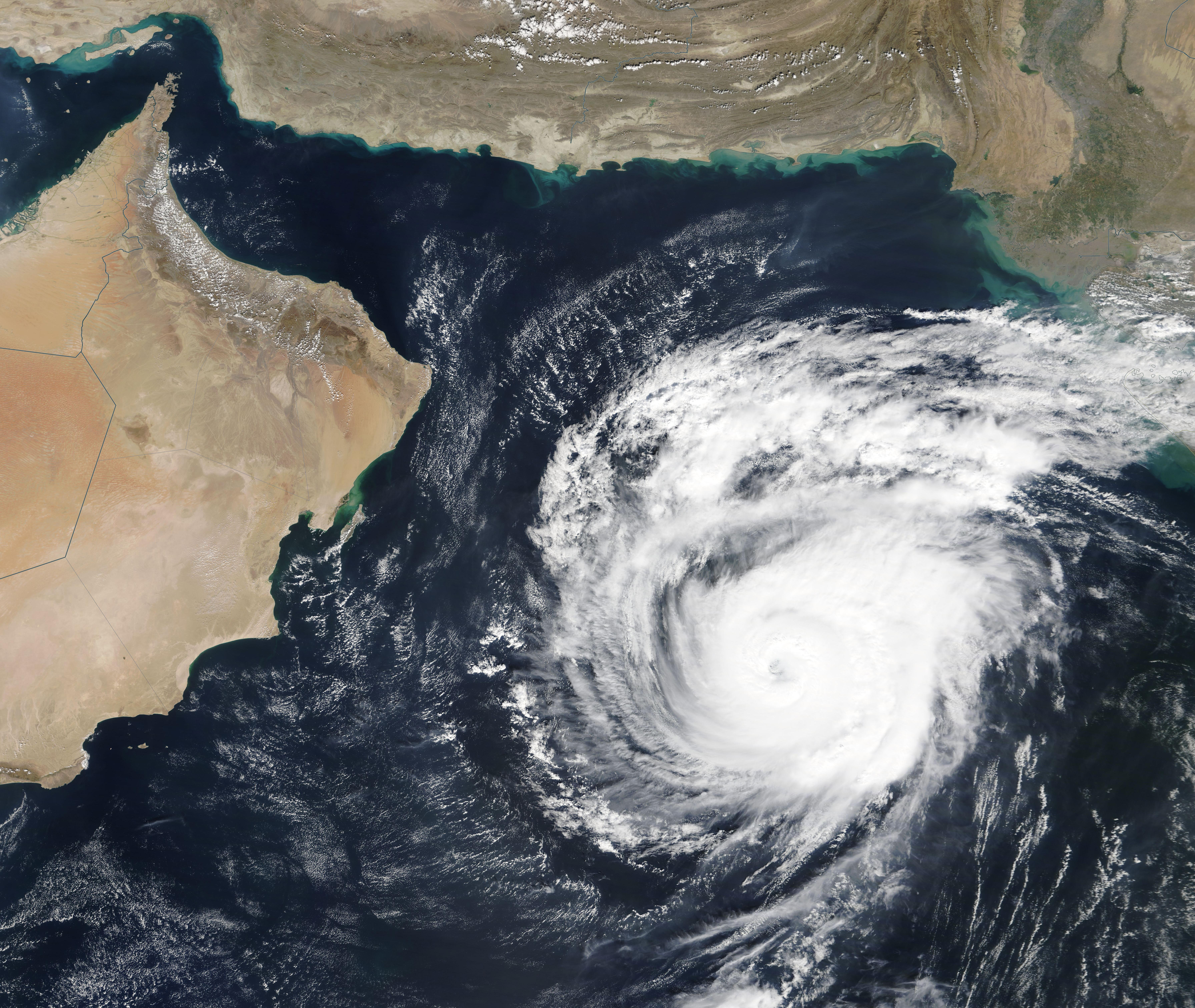
Tropical Cyclone Maha initially formed over the Laccadive Sea, west of Sri Lanka, on October 30, 2019. The storm tracked to the northwest, roughly parallel to and well offshore of the coast of western India until November 4, steadily strengthening. Maha became an extremely severe cyclonic storm with maximum sustained winds of 185 mph (298 km/h) as it spun 845 km (525 mi) west of Mumbai City in Maharashtra state, India on November 4. By November 5, Tropical Cyclone Maha began to slow and weaken, then turned to travel eastward across the Arabian Sea in the northern Indian Ocean. Maha is expected to continue to weaken, becoming a tropical depression as it continues to move toward Gujarat, India’s westernmost state. The India Meteorological Department (IMD) issued an orange alert for heavy rain and strong winds over this area for November 6-7.
On November 4, 2019, the Moderate Resolution Imaging Spectroradiometer (MODIS) on board NASA’s Terra satellite acquired a true-color image of Tropical Cyclone Maha as it spun in the Indian Ocean at near-peak strength. Convective bands spun tightly into a distinct, cloud-filled center, forming the apostrophe-shape typical of a strong storm.
Image Facts
Satellite:
Terra
Date Acquired: 11/4/2019
Resolutions:
1km (2 MB), 500m (5.8 MB), 250m (4.8 MB)
Bands Used: 1,4,3
Image Credit:
MODIS Land Rapid Response Team, NASA GSFC
