
Images


November 21, 2019 - Tropical Storm Sebastien
 Tweet
Tweet
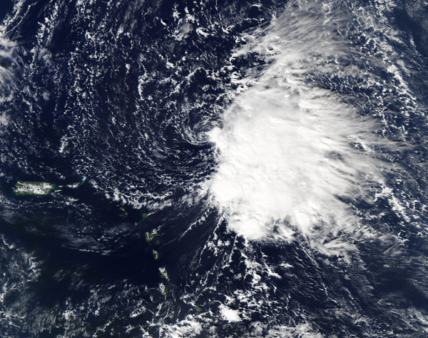
On November 19, 2019 the Moderate Resolution Imaging Spectroradiometer (MODIS) on board NASA’s Aqua satellite acquired a true-color image of late-forming Tropical Sebastien over the Atlantic Ocean. At that time, the storm was becoming more defined as it strengthened from a low-pressure area to a tropical storm.
At 1500 UTC (11:00 a.m. EST) on that same day, the National Hurricane Center (NHC) noted that the center of Tropical Storm Sebastien was located near latitude 20.1 north and longitude 58.7 west. That is about 275 miles (445 km) northeast of the Leeward Islands.
Sebastien was moving toward the north-northwest near 8 mph (13 km/h). A turn to the north is expected on November 21, followed by a turn to the northeast and an increase in forward speed that night. Maximum sustained winds were near 45 mph (75 km/h) with higher gusts. Some strengthening is forecast before Sebastian is expected to become an extratropical cyclone in a couple of days and be absorbed by a cold front on November 22.
Image Facts
Satellite:
Aqua
Date Acquired: 11/19/2019
Resolutions:
1km (2.9 MB), 500m (8.3 MB), 250m (6.9 MB)
Bands Used: 1,4,3
Image Credit:
MODIS Land Rapid Response Team, NASA GSFC
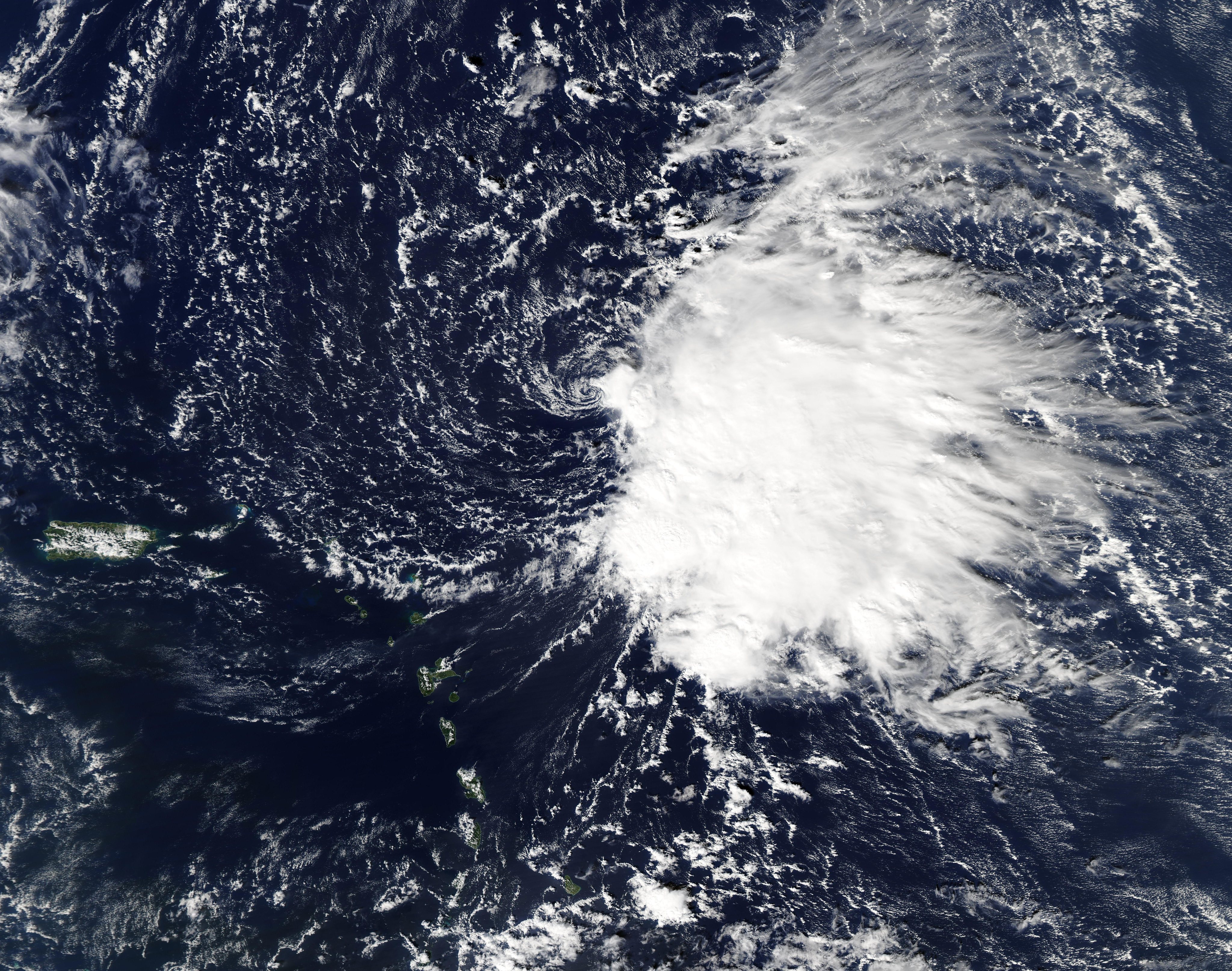
