
Images


January 17, 2020 - Sea Ice off Newfoundland and Labrador, Canada
 Tweet
Tweet
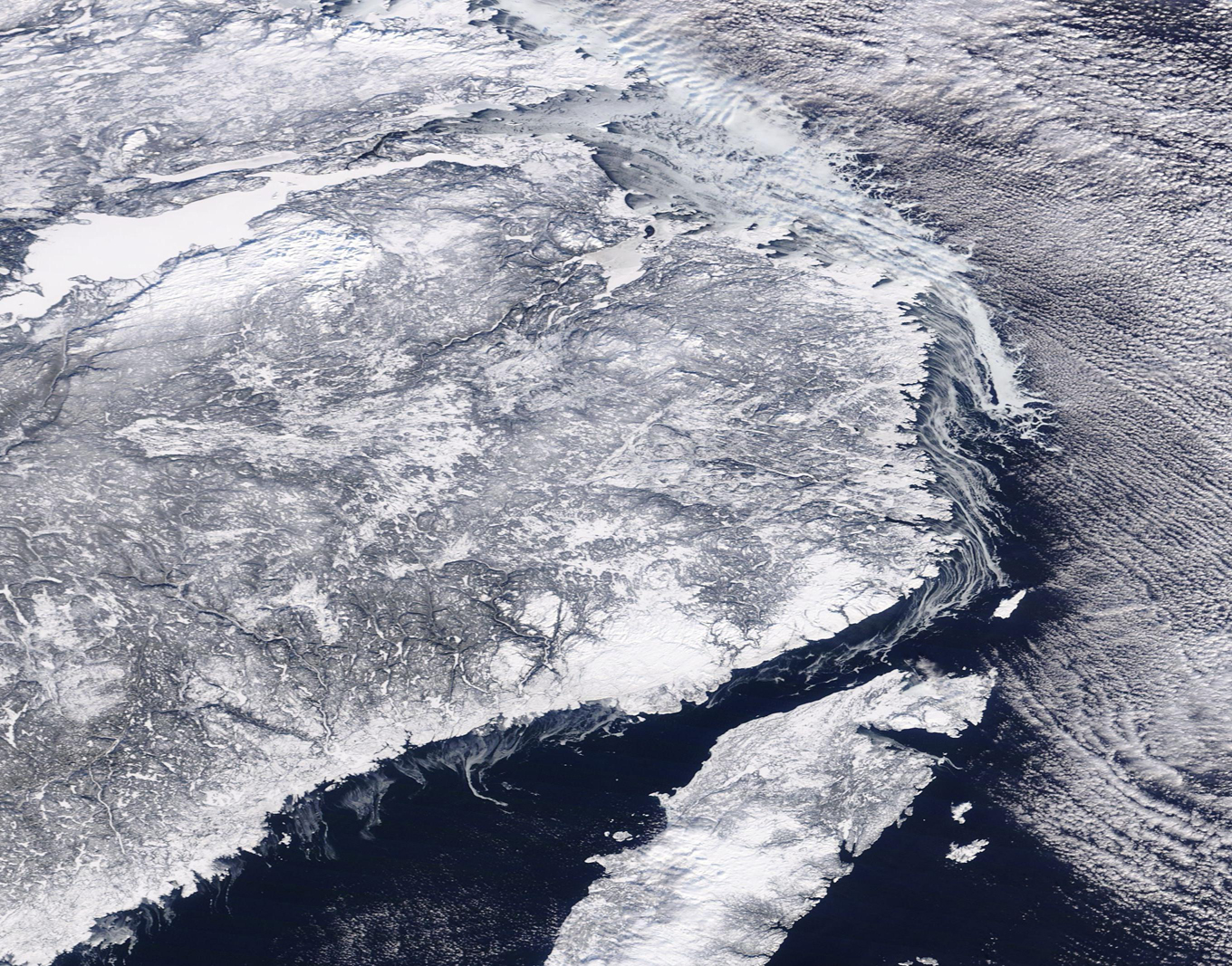
A relatively narrow shelf of sea ice clung to the coasts of Newfoundland and Labrador, Canada, as clouds covered the sky in mid-January, 2020. The Moderate Resolution Imaging Spectroradiometer (MODIS) on board NASA’s Terra satellite acquired a true-color image of the wintery scene on January 14.
The sea ice appears bright white, often with curving filigrees off the edge. These filigrees are created by the underlying currents in the Labrador Sea. Finer filigrees of forming sea ice curl off the coast along the Gulf of St. Lawrence, which separates the mainland and the island of Newfoundland. Environment Canada reports that on January 15, sea ice thicknesses in Newfoundland and Canada ranged from merely bergy water (floating chunks of ice) over the Belle Island Bank and the South Labrador Sea to consolidated first-year ice covering Lake Melville. Lake Melville appears as the large area of very bright white in the northwest section of this image.
Cloud cover also appears white, but the clouds are aligned in long, parallel rows which flow above the ice and water. These rows are called “cloud streets” and are formed through nature’s attempt to balance differences in energy. As frigid air moves over relatively warmer water, columns of warmer air, called thermals, rise into the atmosphere, moving warmth away from the sea surface. The air masses rise until they hit a warmer layer of air (temperature inversion). This layer acts like a lid, causing the rising thermals to roll and loop back on themselves, forming parallel cylinders of rotating air.
On the upper side of the cylinders (rising air), clouds form. Along the downward side (descending air), skies are clear.
Image Facts
Satellite:
Terra
Date Acquired: 1/14/2020
Resolutions:
1km (417.8 KB), 500m (1.2 MB), 250m (1.2 MB)
Bands Used: 1,4,3
Image Credit:
MODIS Land Rapid Response Team, NASA GSFC
