
Images


January 20, 2020 - Aegean Sea
 Tweet
Tweet
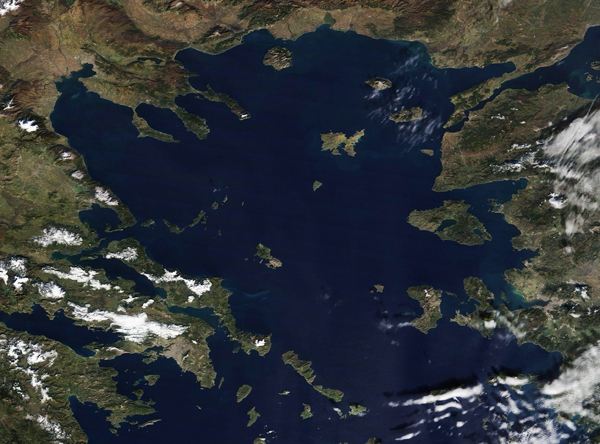
On January 4, 2020, the Moderate Resolution Imaging Spectroradiometer (MODIS) on board NASA’s Terra satellite acquired a glorious true-color image of the Aegean Sea, it’s multitude of islands, and the surrounding countryside.
Bounded by Greece on the north and west and Turkey on the east, the Aegean Sea is one of the four major basins of the Mediterranean Sea. More than 3,000 islands are scattered across the approximately 93,664 square mile- (240,000 square kilometer-) expanse of saltwater sea. Some of the islands are uninhabited, but many are home to residents and tourists, who enjoy spectacular scenery, mild temperatures, and sun-filled skies.
The islands of the Aegean Sea have long been popular with tourists, but in recent years the islands have a new type of visitor—refugees. The most recent report of the United Nations Refugee Agency (UNHCR) for Greece was dated January 6-12. During that time period, 508 people arrived on the Aegean Islands. This was a decrease from the previous week’s total of 1,091 arrivals but an increase from last year’s total of 198 arrivals during the same time period. About 41,300 refugees and asylum seekers reside on the islands, with most originating in Afghanistan (48%), Syria (20%) and Palestine (6%). Women account for 21% of the population, and children for 29% of whom more than 6 out of 10 are younger than 12 years old.
Image Facts
Satellite:
Terra
Date Acquired: 1/4/2020
Resolutions:
1km (239.8 KB), 500m (655.5 KB), 250m (482.3 KB)
Bands Used: 1,4,3
Image Credit:
MODIS Land Rapid Response Team, NASA GSFC
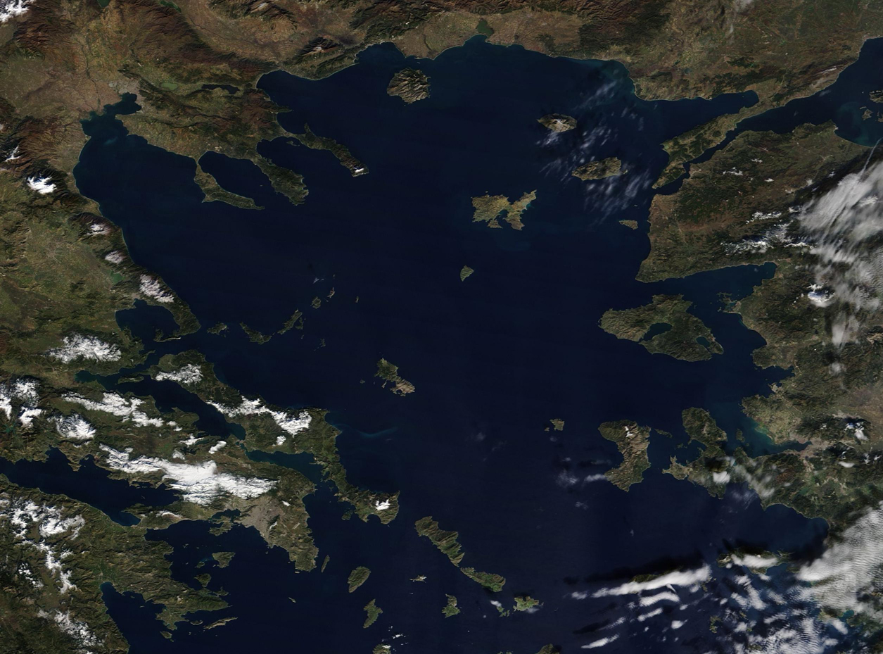
