
Images


March 28, 2020 - The Adrar Plateau
 Tweet
Tweet
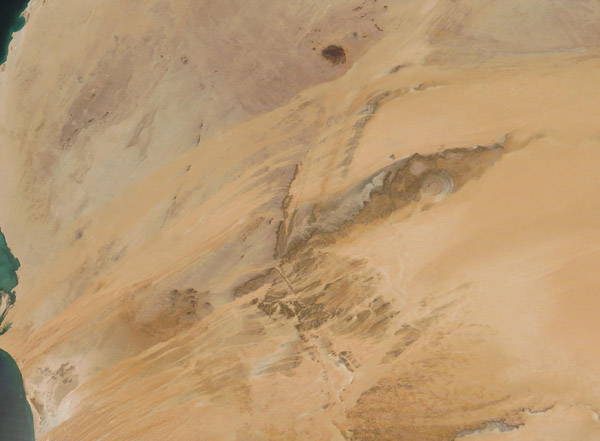
On March 25, 2020, the Moderate Resolution Imaging Spectroradiometer (MODIS) on board NASA’s Terra satellite acquired a stunning true-color image of Mauritania’s Adrar Plateau.
This sandy-and-sun section of Mauritania has been described as “epic Saharan country”, filled with rocky outcrops, vast plains filled with sand dunes, and gorges, sits along the North Atlantic Ocean. It is an extremely arid plateau, with only a few areas useful for agriculture and sparsely populated villages. Yet, when seen from space, the Adrar Plateau appears hauntingly beautiful, with swaths and streaks of salmon sands overlain on smaller areas of ochre and tan.
One unusual feature found on the Adrar Plateau is the circular formation known as the Richat Structure. Although its concentric rings bear resemblance to an impact crater, this structure is actually a well-eroded remnant of an ancient volcanic dome. Over time, the large dome hardened and then slowly eroded, exposing the onion-like layers of rock. This structure can be seen in the far eastern section of the ochre-colored gorge.
Image Facts
Satellite:
Terra
Date Acquired: 3/25/2020
Resolutions:
1km (104.6 KB), 500m (238.7 KB), 250m (406.3 KB)
Bands Used: 1,4,3
Image Credit:
MODIS Land Rapid Response Team, NASA GSFC
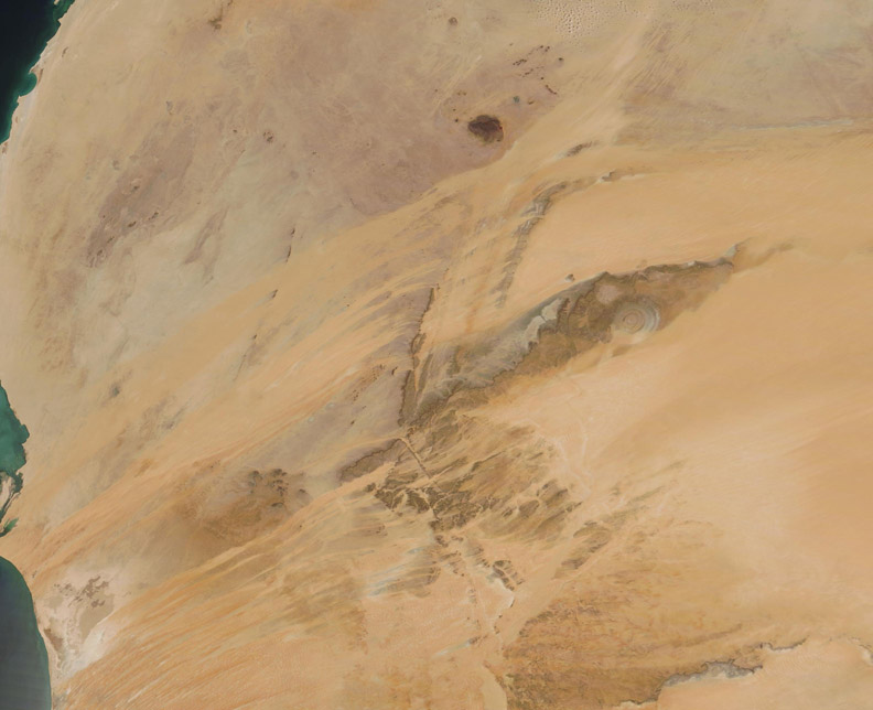
