
Images


March 30, 2020 - Springtime in Mississippi
 Tweet
Tweet
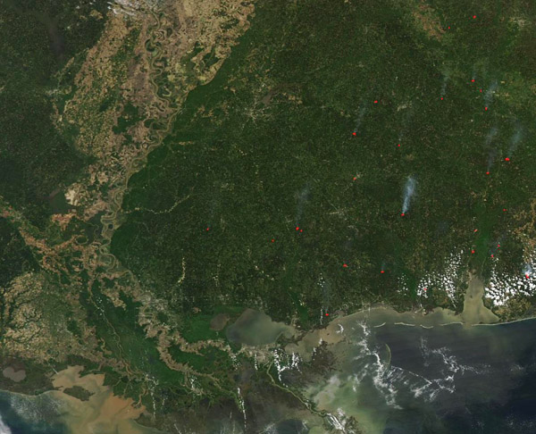
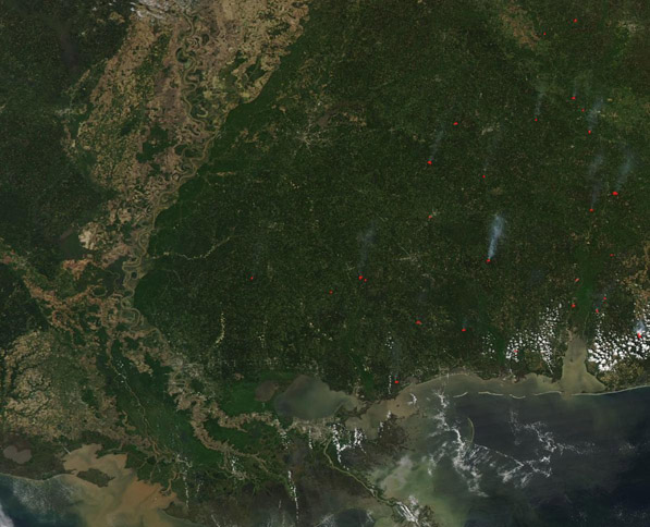
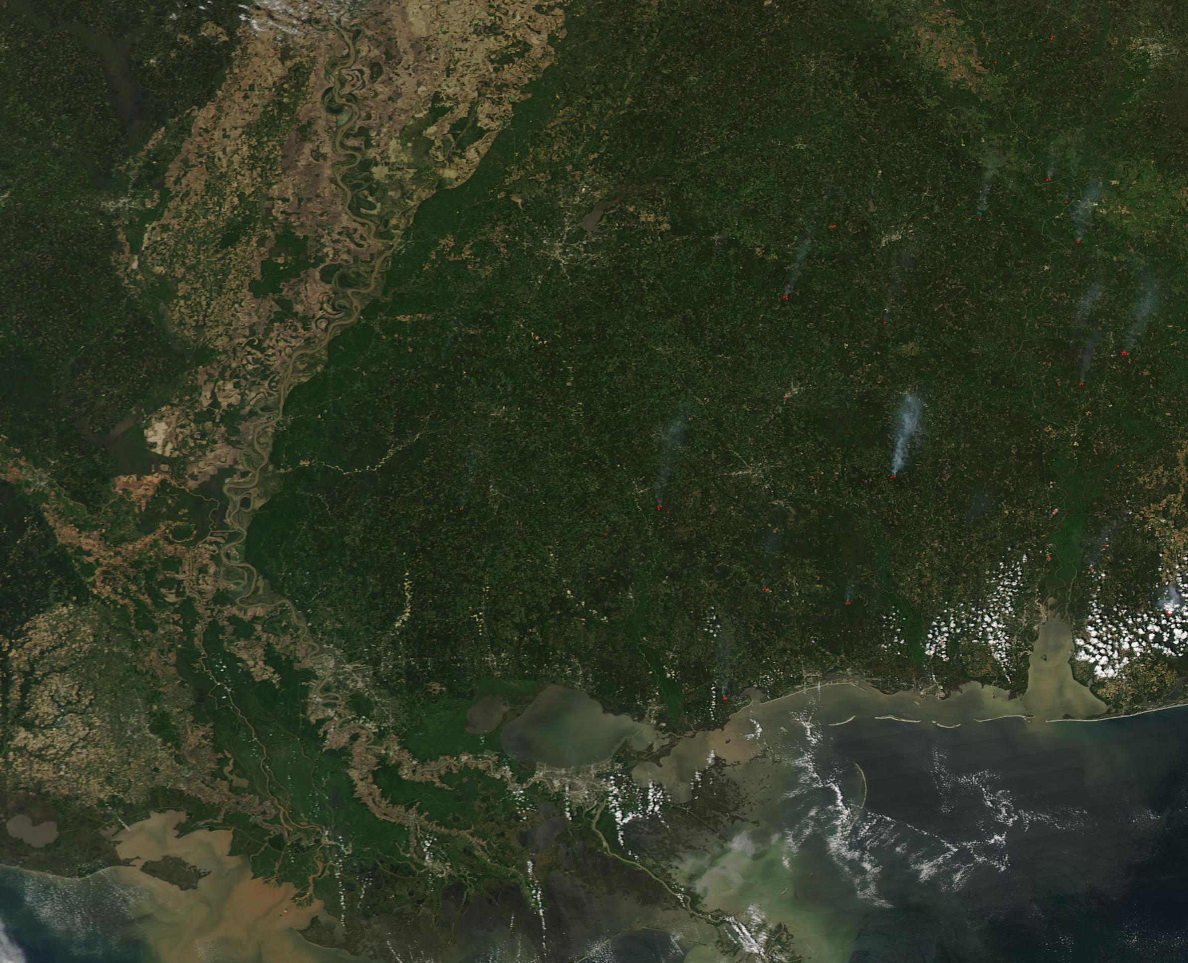
On March 26, 2020, the Moderate Resolution Imaging Spectroradiometer (MODIS) on board NASA’s Aqua satellite acquired a true-color image of a springtime day in Mississippi.
Each spring, snowmelt in the north and spring rains fill the Mississippi River with sediment washed from its more than 1,245,000 square mile (3,220,000 sq. km) drainage basin. As the mighty waters roll southward from Canada to the Gulf of Mexico, the collected sediment increases in density, turning the waters quite muddy by the time it rolls across Mississippi and Louisiana to pour into the Gulf of Mexico via the large Mississippi Delta. The sediment can easily be seen from space, highlighting the curving course of the Mississippi River through the wide, heavily agricultural Mississippi Valley. It then pours into the blue waters of the Gulf, edging the shores of Louisiana (west) and Mississippi (east).
Multiple fires burning in the cropland and forests of Mississippi are another sign of spring in this region. These fires are marked by red hot spots and plumes of gray smoke. According to the Mississippi Forestry Commission, March has one of the highest wildfire occurrence rates of the year due to dry vegetation, the transition from winter to spring, and windy conditions. On March 2, NewsMississippi reported that “In March 2019, the MFC responded to and suppressed 260 wildfires that burned approximately 5,293 acres. During the month, MFC Wildland Firefighters saved 602 homes, commercial buildings and other structures.” In February, Mississippi Governor Tate Reeves proclaimed March as “Wildfire Prevention Month” in the state.
Image Facts
Satellite:
Aqua
Date Acquired: 3/26/2020
Resolutions:
1km (105.6 KB), 500m (175 KB), 250m (594.9 KB)
Bands Used: 1,4,3
Image Credit:
MODIS Land Rapid Response Team, NASA GSFC
