Images
April 5, 2020 - Nile River Delta and the Persian Gulf
Tweet
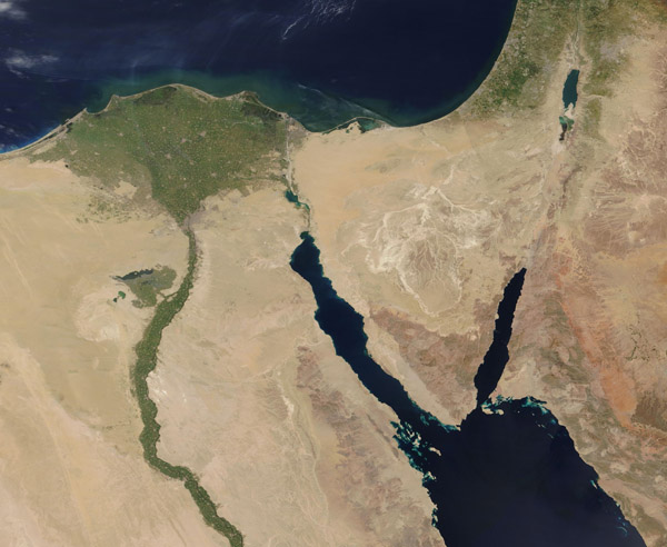
The gently curving course of Egypt’s Nile River and the broad fan of the Nile River Delta were colored by the rich greens of growing vegetation on April 3, 2020, when NASA’s Terra satellite passed overhead. On that day, the Moderate Resolution Imaging Spectroradiometer (MODIS) on board NASA’s Terra satellite acquired a stunning true-color image of the brilliantly green Nile contrasting against the surrounding tan desert sands.
The Nile River drains into the Mediterranean Sea through its fan-shaped and densely-populated Delta. Each population center appears as green or tan circles in the green Delta. The v-shaped Sinai Peninsula lies in the east, straddled by the Gulf of Suez (west) and the Gulf of Aqaba (east). Most of the Sinai Peninsula belongs to Egypt, with the Israel and Palestine also seen in the far east of this image. The body of water in the southeast is the Red Sea.
Image Facts
Satellite:
Terra
Date Acquired: 4/3/2020
Resolutions:
1km (155.5 KB), 500m (382.2 KB), 250m (757.3 KB)
Bands Used: 1,4,3
Image Credit:
MODIS Land Rapid Response Team, NASA GSFC


