
Images


August 4, 2020 - Typhoon Hagupit
 Tweet
Tweet
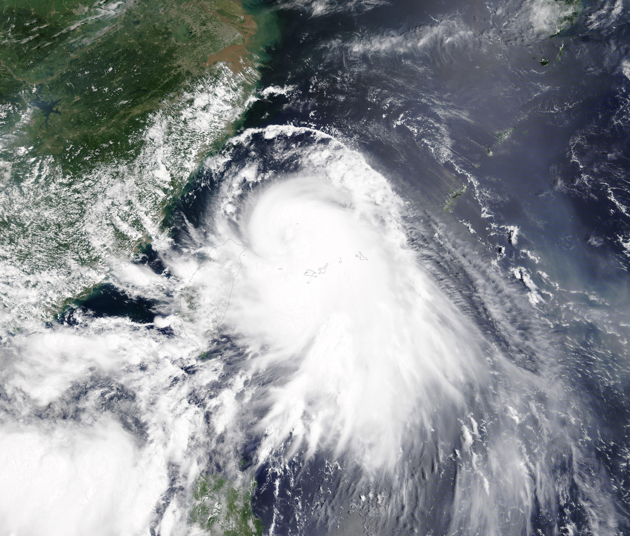
Typhoon Hagupit made landfall over eastern China’s Zhejiang Province at about 3:30 a.m. August 4 local time (1930 UTC/ 3:30 p.m. EDT on August 3). According to a report by Xinhua, the storm struck Yueqing City carrying maximum winds of 136.8 km/h (85 mph) early in the morning. This wind speed would place Typhoon Hagupit in Category 1 on the Saffir-Simpson Hurricane Wind Scale.
The storm formed as Tropical Depression 03W in the waters northeast of Luzon, Philippines on August 1 and was renamed Hagupit by the Joint Typhoon Warning Center (JTWC) when it strengthened to a tropical storm on August 2. By August 3, Hagupit quickly intensified into a typhoon and reached peak strength of 139 km/h (86.4 mph) as it headed towards China. It appeared to have started a weakening trend shortly before landfall. The Philippine Atmospheric, Geophysical, and Astronomical Services Administration (PAGASA)’s name for the storm is Dindo.
Typhoon Hagupit (Dindo) is forecast to move northward at 20-25 km/h (12.4-15.5 mph) as it weakens. It is expected to curve to the northwest and re-emerge over the South China Sea.
On August 3, 2020, the Moderate Resolution Imaging Spectroradiometer (MODIS) on board NASA’s Terra satellite acquired a true-color image of Typhoon Hagupit approaching China. The storm sported a large cloud-filled center and a “tail’ of convective bands on the southeast side of center. The elongation of the storm suggests it was facing wind shear as it moved towards the northwest.
Image Facts
Satellite:
Terra
Date Acquired: 8/3/2020
Resolutions:
1km (839.6 KB), 500m (2.5 MB), 250m (5.1 MB)
Bands Used: 1,4,3
Image Credit:
MODIS Land Rapid Response Team, NASA GSFC
