
Images


October 21, 2020 - Bullfrog Fire
 Tweet
Tweet
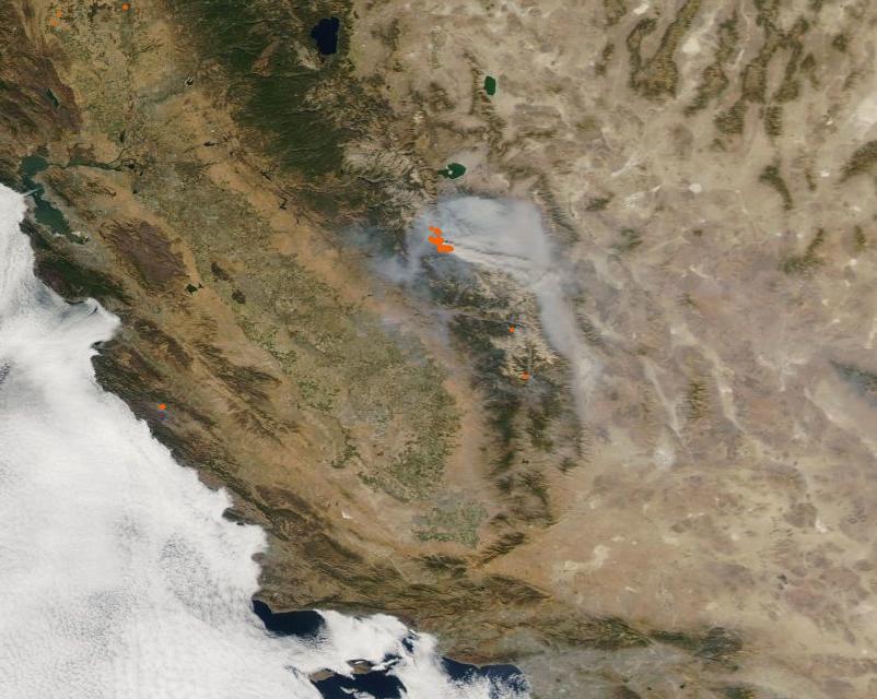
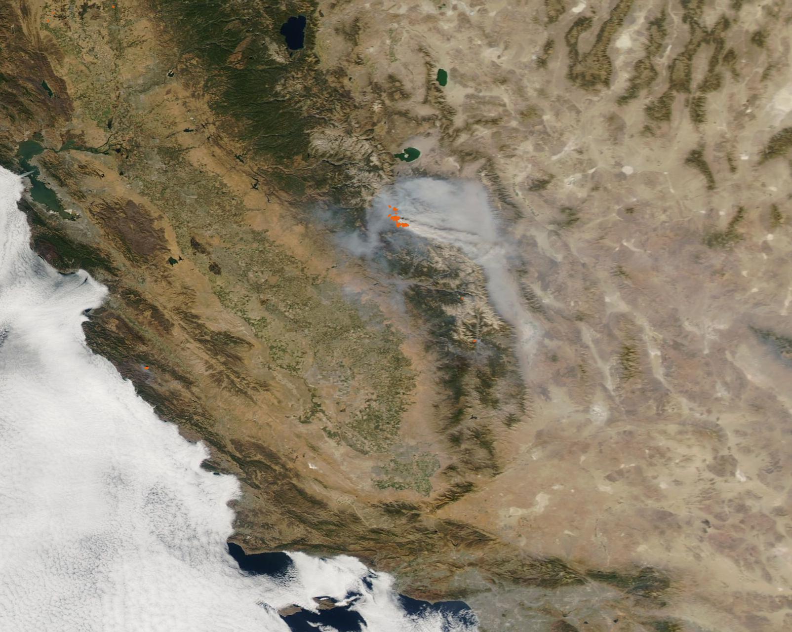
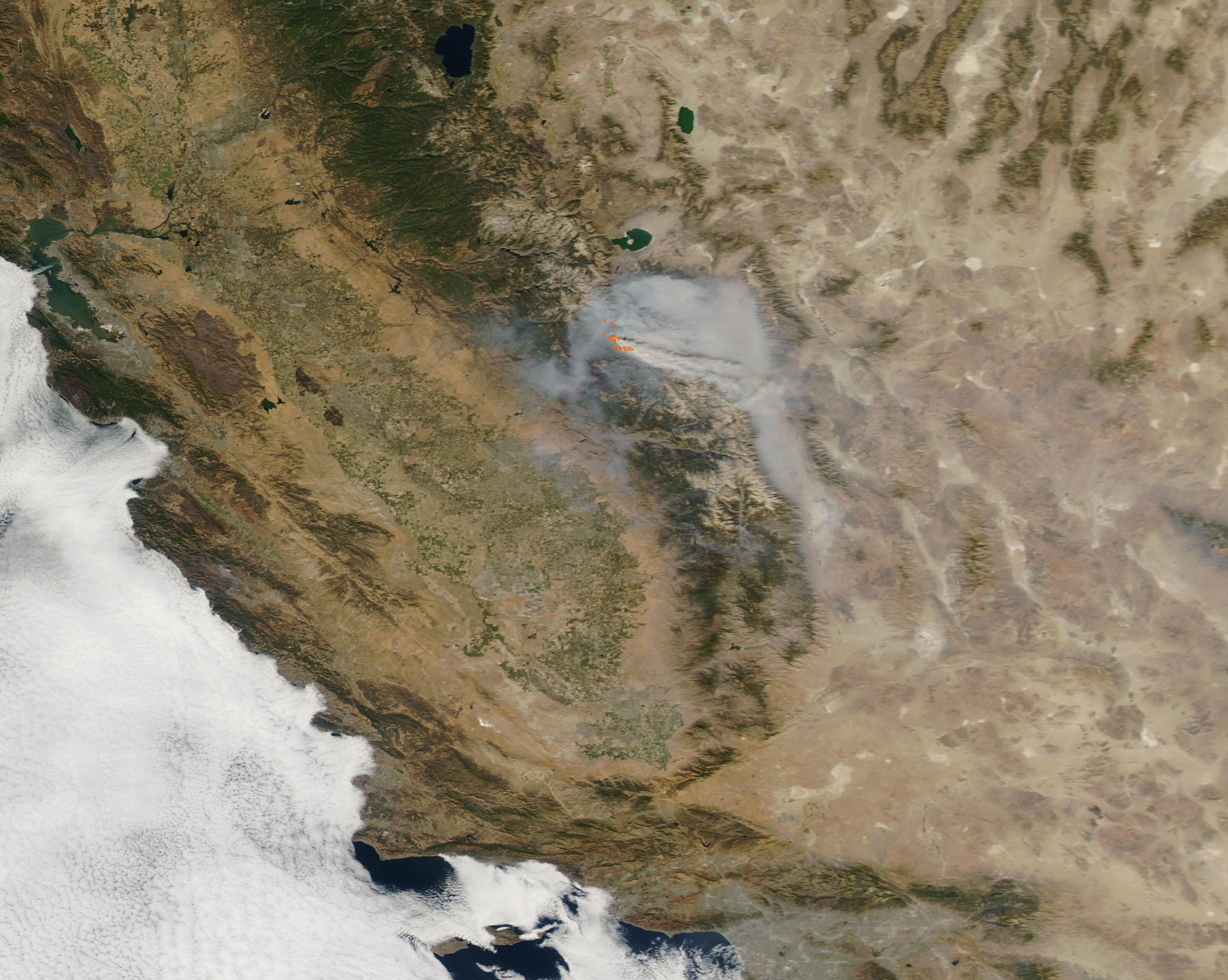
California’s long and difficult fire season continues, with 22 blazes active across the state as of October 20, 2020. Twelve of those are listed as major fires by CAL FIRE.
According to CAL FIRE, between January 1 and October 18 there were 8,685 fires handled by either CAL FIRE or the U.S. Forest Service, which has burned 4,129,924 acres. The 5-year average for the same period is 5,169 blazes and 53,034 acres burned.
On October 19, the Moderate Resolution Imaging Spectroradiometer (MODIS) on board NASA’s Aqua satellite acquired a true-color image of one of these many blazes, the Bullfrog Fire. Each red hot spot marks an area where the thermal bands on the MODIS instrument detected high temperatures. When combined with smoke, as in this image, such hot spots mark actively burning fire. Heavy gray smoke pours from the fire, primarily blowing southeast. Additional smoke fills the surrounding valleys.
The Bullfrog fire ignited on the afternoon of September 9 about forty-three miles northeast of Clovis, California on the eastern fringe of the Dinky Lakes Wilderness west of Courtright Reservoir. According to Inciweb Incident Information System, this fire is being managed by the Sierra National Forest using a confine-and-contain strategy, which takes advantage of trails, natural features and hand crews to fully suppress the fire. As of the report on October 20, the Bullfrog Fire had burned 1,185 Acres and was 60 percent contained.
Image Facts
Satellite:
Aqua
Date Acquired: 10/19/2020
Resolutions:
1km (81 KB), 500m (276.9 KB), 250m (843.4 KB)
Bands Used: 1,4,3
Image Credit:
MODIS Land Rapid Response Team, NASA GSFC
