
Images


October 26, 2020 - Snow in Tian Shan
 Tweet
Tweet
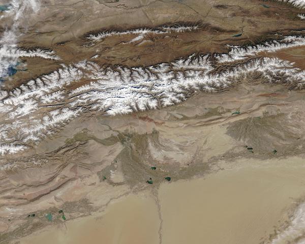
The Tian Shan Mountains form one of the longest continuous mountain ranges in the world, extending more than 1,500 miles (2,500 kilometers) across parts of Kyrgyzstan, Kazakhstan, and China. The snowpack that falls each winter provides fresh water to the surrounding area during the spring as summer as it slowly melts to replenish local rivers. The snow that tops the Tian Shan gives rise to the range’s nickname: “Central Asia’s Water Tower”.
On October 22, 2020, the Moderate Resolution Imaging Spectroradiometer (MODIS) on board NASA’s Terra satellite acquired a true-color image of the snow-covered Tian Shan peaks which rim the arid Taklimakan Desert in northwest China.
The Taklimakan, seen south of the mountains, is a low-lying basin enclosed by mountain ranges on three sides. Rain and snow will fall on the mountains, but have difficulty passing over the peaks, creating a rain shadow—an area that receives very little rain and becomes extremely dry most of the year. This large and persistent rain shadow has created the second-largest shifting sand desert on Earth. The green ribbon that runs south through the Taklimakan is formed by the Hotan River. It is fed primarily by snowmelt from the Kunlun Mountains in the south and runs northward through the Taklimakan to meet the Tarim River near the base of the Tian Shan mountains.
Image Facts
Satellite:
Terra
Date Acquired: 10/22/2020
Resolutions:
1km (65.2 KB), 500m (238.8 KB), 250m (809.9 KB)
Bands Used: 1,4,3
Image Credit:
MODIS Land Rapid Response Team, NASA GSFC
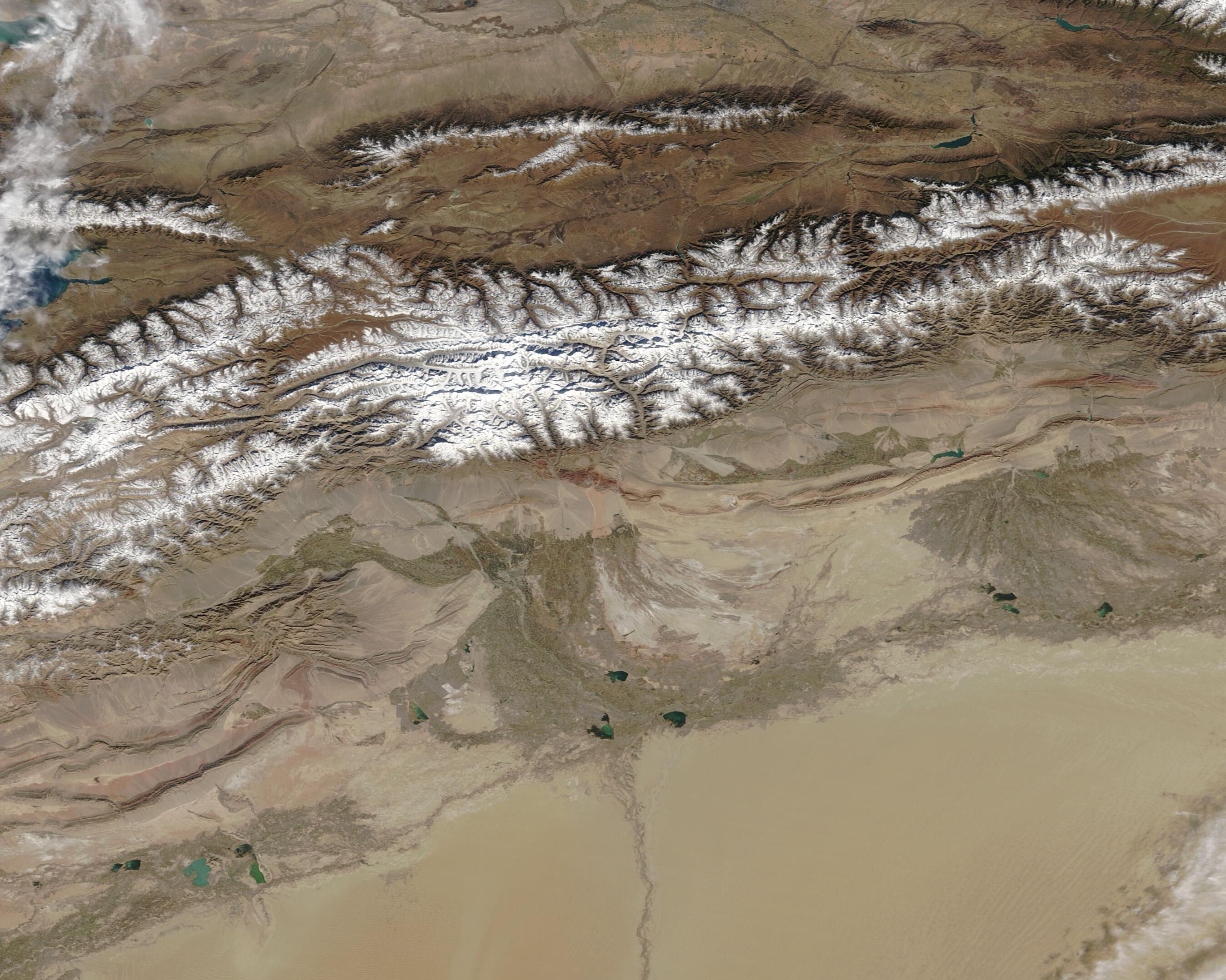
