
Images


January 13, 2021 - Wintery Quebec
 Tweet
Tweet
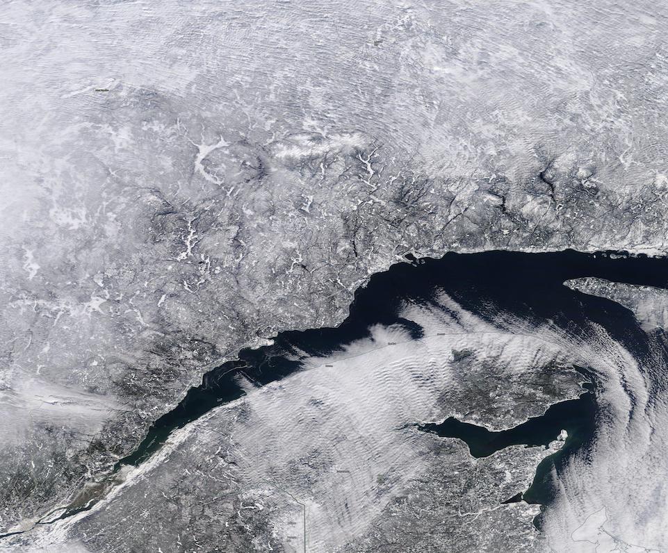
Snow shrouded southeastern Quebec, Canada, creating a chilly winter scene in early January 2021. The Moderate Resolution Imaging Spectroradiometer (MODIS) on board NASA’s Terra satellite acquired a true-color image of the chilly winter’s day on January 10.
The broad St. Lawrence River cuts through the snow-coated landscape, carrying fresh water from the Great Lakes to the North Atlantic Ocean. As it flows to the northeast from Lake Ontario, the river forms part of the boundary between New York State, USA, and Canada, and passes both Montreal and Quebec, Canada. The far northern reaches are saline and tidal compared to the fresh water south of Quebec, and as such they are slower to form sea ice in the frigid winters.
Quebec City and Île d'Orléans, seen in the lower left corner of the image, sit in the narrows of the St. Lawrence River. These are the heart of early French settlement in North America, although ancestors of First Nations peoples lived in the area for thousands of years. When Jacques Cartier explored the area in 1535, claiming the region for France, he described an Iroquois settlement of about 500 people in the area now known as Quebec City.
Image Facts
Satellite:
Terra
Date Acquired: 1/10/2021
Resolutions:
1km (197.9 KB), 500m (714.3 KB), 250m (2.1 MB)
Bands Used: 1,4,3
Image Credit:
MODIS Land Rapid Response Team, NASA GSFC
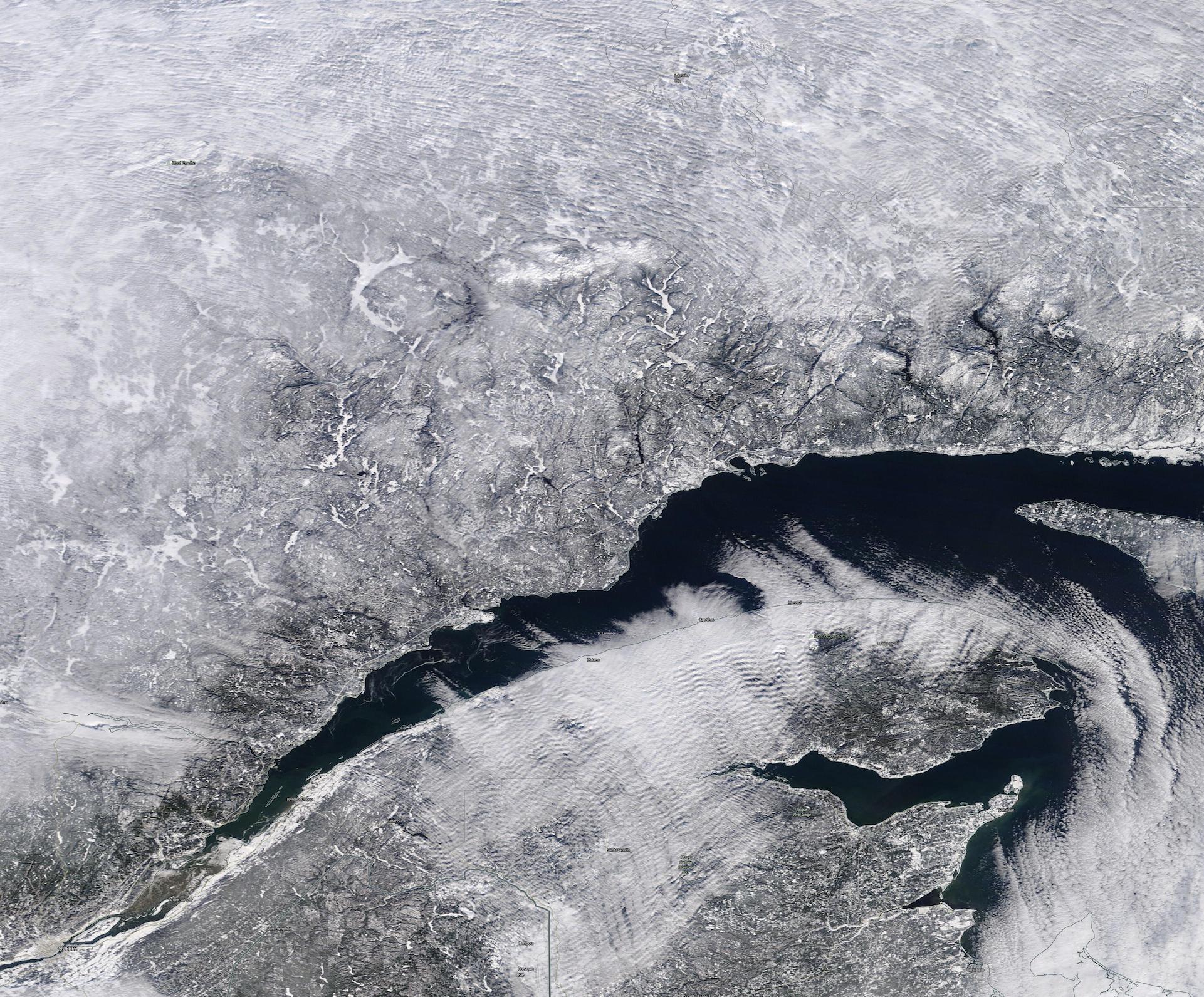
