
Images


April 10, 2021 - Northwestern Madagascar
 Tweet
Tweet
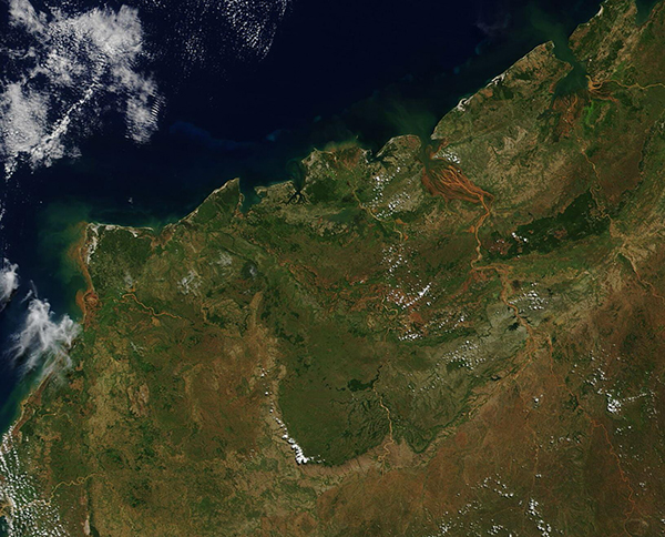
Green vegetation, red soils, and muddy rivers color northeastern Madagascar at the end of the rainy season in early April 2021. The Moderate Resolution Imaging Spectroradiometer (MODIS) on board NASA’s Terra satellite acquired this true-color image on April 4.
Northwestern Madagascar has been described as a mosaic of dry deciduous forest, degraded secondary forests, and grasslands. Roughly 2,000 years ago—before widespread human habitation and impacts affected the island—this region was thickly covered in forest. Over time, the forest was burned, primarily to make way for agriculture and pasturage, leaving secondary grasslands behind. While undisturbed dry deciduous forests teem with life, giving home to a high number of endemic plant and animal species, the grasslands are relatively sterile ecosystems with low diversity and a high number of non-native plant species. While remnant forests tend to be small and disconnected in a patchwork-like pattern with grasslands interspersed, the forests are still vitally important to biodiversity on the island.
Most of Madagascar’s rivers originate in the highlands in the island’s interior. They pick up large amounts of sediment there, often from the iron-rich red soils and rocks called laterites. Those colorful waters flow down toward one of several silty deltas along the coast. The largest river in this image (and in Madagascar) is the Betsiboka River. It appears muddy-red, with braided channels that pour into the Mozambique Channel. The color comes from iron-rich sediment that has been washed into the river in the high central plateau region and the mountains, then carried northwestward to the broad coastal delta.
Image Facts
Satellite:
Terra
Date Acquired: 4/4/2021
Resolutions:
1km (176.3 KB), 500m (482.5 KB), 250m (322.2 KB)
Bands Used: 1,4,3
Image Credit:
MODIS Land Rapid Response Team, NASA GSFC
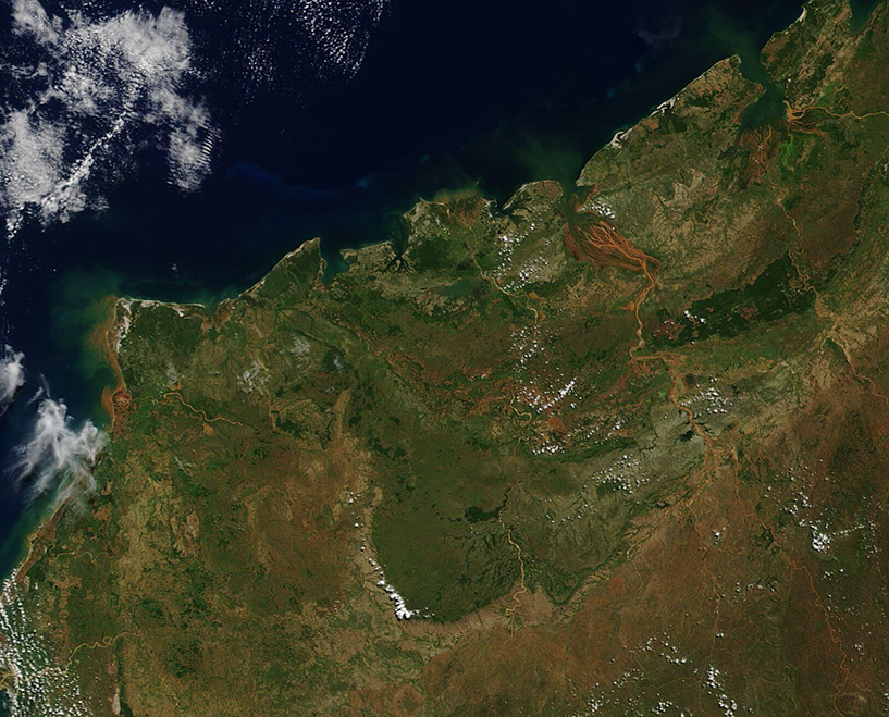
